
Takahagi
高萩市 | |
|---|---|
 Takahagi city hall | |
 Flag  Emblem | |
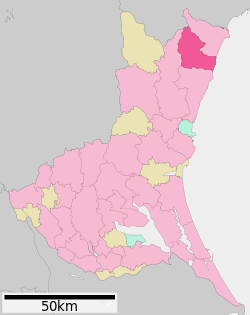 Location of Takahagi in Ibaraki Prefecture | |
 Takahagi | |
| Coordinates: 36°43′9″N 140°43′0.2″E / 36.71917°N 140.716722°E | |
| Country | Japan |
| Region | Kantō |
| Prefecture | Ibaraki |
| Area | |
| • Total | 193.58 km2 (74.74 sq mi) |
| Population (July 2020) | |
| • Total | 27,522 |
| • Density | 140/km2 (370/sq mi) |
| Time zone | UTC+9 (Japan Standard Time) |
| - Tree | Pine |
| - Flower | Lespedeza |
| - Bird | Green pheasant |
| Phone number | 0293-23-2111 |
| Address | 3-10-16 Kasuga-cho, Takahagi-shi, Ibaraki-ken 318-8511 |
| Website | Official website |


Takahagi (高萩市, Takahagi-shi) is a city located in Ibaraki Prefecture, Japan. As of 1 July 2020[update], the city had an estimated population of 27,522 in 11,651 households and a population density of 140 persons per km2. The percentage of the population aged over 65 was 36.2%.[1] The total area of the city is 193.58 square kilometres (74.74 sq mi).
YouTube Encyclopedic
-
1/3Views:1 6213 1351 318
-
高萩市-TAKAHAGI CITY- VISIT IBARAKI,JAPAN GUIDE
-
[V0254] いわき6:磯原跨線橋から太平洋を見おろし鵜の岬や川尻漁港へ
-
松岡中学校吹奏楽部(指揮:カール・ヤイトラー)赤浜音楽祭2014秋2014 autumn Akahama Music Festival(Conductor:Karl Jeitler)
Transcription
Geography
Located in northern Ibaraki Prefecture, Takahagi is bordered by the Pacific Ocean to the east, and by Fukushima Prefecture to the northwest.
Surrounding municipalities
Ibaraki Prefecture
Fukushima Prefecture
Climate
Takahagi has a Humid continental climate (Köppen Cfa) characterized by warm summers and cold winters with heavy snowfall. The average annual temperature in Takahagi is 13.9 °C. The average annual rainfall is 1429 mm with September as the wettest month. The temperatures are highest on average in August, at around 24.9 °C, and lowest in January, at around 3.8 °C.[2]
Demographics
Per Japanese census data,[3] the population of Takahagi has declined in recent decades.
| Year | Pop. | ±% |
|---|---|---|
| 1950 | 29,637 | — |
| 1960 | 32,816 | +10.7% |
| 1970 | 29,548 | −10.0% |
| 1980 | 32,436 | +9.8% |
| 1990 | 35,320 | +8.9% |
| 2000 | 32,602 | −7.7% |
| 2010 | 31,017 | −4.9% |
| 2020 | 27,699 | −10.7% |
History
During the Edo period, Takahagi was the jōkamachi of Matsuoka Domain, one of the feudal domains of the Tokugawa shogunate in Hitachi Province, ruled b the Nakamura clan, the hereditary karō of Mito Domain. With the creation of the modern municipalities system after the Meiji Restoration on April 1, 1889, the town of Matsubara, and the villages of Matsuoka, Takaoka, Kurosaki and Kushigata was established within Taga District, Ibaraki). Matsuoka was raised to town status on April 17, 1928. Matsubara was renamed Takahagi on October 1, 1937.
Takahagi merged with Matsubara, Takaoka and Kurosaki on November 23, 1954 and was raised to city status. The city suffered considerable damage in the 2011 Tōhoku earthquake and tsunami.
Government
Takahagi has a mayor-council form of government with a directly elected mayor and a unicameral city council of 14 members. Takahagi, together with neighboring Kitaibaraki, contributes two members to the Ibaraki Prefectural Assembly. In terms of national politics, the city is part of Ibaraki 5th district of the lower house of the Diet of Japan.
Economy
Takahagi was once part of the Jōban coal fields, but the mines were exhausted by the 1960s. Since that time, the economy had been oriented towards light manufacturing and food processing. Agriculture and commercial fishing also play subordinate roles.
Education
Takahagi has four public elementary schools and three public middle schools operated by the city government, and two public high schools operated by the Ibaraki Prefectural Board of Education. There is also one private high school
Transportation
Railway
Highway
 Jōban Expressway – Takahagi Interchange
 National Route 6
 National Route 461
Local attractions
- Matsuoka Castle ruins
- Hanazono-Hananuki Prefectural Nature Park
- Hananuki Dam
- Takado Beach
Noted people from Takahagi
- Jinzō Matsumura, botanist
References
- ^ "Ibaraki prefectural official statistics" (in Japanese). Japan.
- ^ Takahagi climate data
- ^ Takahagi population statistics
External links
![]() Media related to Takahagi, Ibaraki at Wikimedia Commons
Media related to Takahagi, Ibaraki at Wikimedia Commons
- Official Website (in Japanese)
| Core city | ||
|---|---|---|
| Special city | ||
| Cities | ||
| Districts | ||
| International | |
|---|---|
| National | |