
Taibus Banner
太仆寺旗 • ᠲᠠᠶᠢᠫᠤᠰᠧ ᠬᠣᠰᠢᠭᠤ Taipus, Taipusi | |
|---|---|
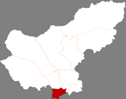 Taibus in Xilin Gol | |
 Xilin Gol in Inner Mongolia | |
 Taibus Location in Inner Mongolia  Taibus Taibus (China) | |
| Coordinates: 41°52′44″N 115°16′59″E / 41.87889°N 115.28306°E | |
| Country | China |
| Autonomous region | Inner Mongolia |
| League | Xilin Gol |
| Banner seat | Baochang |
| Area | |
| • Total | 3,426.14 km2 (1,322.84 sq mi) |
| Population (2020)[1] | |
| • Total | 109,370 |
| • Density | 32/km2 (83/sq mi) |
| Time zone | UTC+8 (China Standard) |
| Website | www |
| Taibus Banner | |||||||
|---|---|---|---|---|---|---|---|
| Chinese name | |||||||
| Simplified Chinese | 太仆寺旗 | ||||||
| Traditional Chinese | 太僕寺旗 | ||||||
| |||||||
| Mongolian name | |||||||
| Mongolian Cyrillic | Тайвас хошуу | ||||||
| Mongolian script | ᠲᠠᠶᠢᠫᠤᠰᠧ ᠬᠣᠰᠢᠭᠤ | ||||||
| |||||||
Taibus Banner[2] or Taipus Banner[3] (Mongolian: ᠲᠠᠶᠢᠫᠤᠰᠧ ᠬᠣᠰᠢᠭᠤ pronounced [ˈtʰɛːw̜əs χɞˈʃʊː]; Chinese: 太仆寺旗) is a banner of Inner Mongolia, China, bordering Hebei province to the southeast, south, and west. It is under the administration of Xilin Gol League and is its southernmost county-level division.
Demographics
Taibus Banner has a population of 109.370.[4]
Administrative divisions
Taibus Banner is divided into 5 towns, 1 township, and 1 sum.
| Name | Simplified Chinese | Hanyu Pinyin | Mongolian (Hudum Script) | Mongolian (Cyrillic) | Administrative division code |
|---|---|---|---|---|---|
| Towns | |||||
| Baochang Town | 宝昌镇 | Bǎochāng Zhèn | ᠪᠣᠣᠴᠠᠩ ᠪᠠᠯᠭᠠᠰᠤ | Бууцан балгас | 152527100 |
| Qianjingou Town | 千斤沟镇 | Qiānjīngōu Zhèn | ᠴᠢᠶᠠᠨ ᠵᠢᠨ ᠭᠧᠦ ᠪᠠᠯᠭᠠᠰᠤ | Чонгийн гүү балгас | 152527101 |
| Hongqi Town | 红旗镇 | Hóngqí Zhèn | ᠬᠤᠩ ᠴᠢ ᠪᠠᠯᠭᠠᠰᠤ | Хон чи балгас | 152527102 |
| Luotuoshan Town | 骆驼山镇 | Luòtuóshān Zhèn | ᠯᠦᠸᠧ ᠲᠦᠸᠧ ᠱᠠᠨ ᠪᠠᠯᠭᠠᠰᠤ | Лүве түве шин балгас | 152527103 |
| Yongfeng Town | 永丰镇 | Yǒngfēng Zhèn | ᠶᠦᠩ ᠹᠧᠩ ᠪᠠᠯᠭᠠᠰᠤ | Юн фен балгас | 152527104 |
| Township | |||||
| Xingfu Township | 幸福乡 | Xìngfú Xiāng | ᠰᠢᠩ ᠹᠦ᠋ ᠰᠢᠶᠠᠩ | Шин фү шиян | 152527200 |
| Township | |||||
| Gun Bulag Sum | 贡宝拉格苏木 | Gòngbǎolāgé Sūmù | ᠭᠦᠨᠪᠤᠯᠠᠭ ᠰᠤᠮᠤ | Хнбулаг сум | 152527201 |
Other: Wanshoutan Seed Farm (万寿滩良种场)(ᠸᠠᠨ ᠱᠧᠦ ᠲᠠᠨ ᠦᠷᠡ ᠶᠢᠨ ᠲᠠᠯᠠᠪᠠᠢ)
Climate
| Climate data for Taibus Banner (1991–2020 normals, extremes 1981–2010) | |||||||||||||
|---|---|---|---|---|---|---|---|---|---|---|---|---|---|
| Month | Jan | Feb | Mar | Apr | May | Jun | Jul | Aug | Sep | Oct | Nov | Dec | Year |
| Record high °C (°F) | 4.3 (39.7) |
10.8 (51.4) |
19.7 (67.5) |
27.6 (81.7) |
31.8 (89.2) |
33.5 (92.3) |
36.4 (97.5) |
32.0 (89.6) |
31.2 (88.2) |
23.2 (73.8) |
16.2 (61.2) |
9.6 (49.3) |
36.4 (97.5) |
| Average high °C (°F) | −10.0 (14.0) |
−5.0 (23.0) |
2.8 (37.0) |
11.6 (52.9) |
18.4 (65.1) |
22.9 (73.2) |
25.0 (77.0) |
23.6 (74.5) |
18.4 (65.1) |
10.2 (50.4) |
0.2 (32.4) |
−8.1 (17.4) |
9.2 (48.5) |
| Daily mean °C (°F) | −16.2 (2.8) |
−11.8 (10.8) |
−3.8 (25.2) |
4.7 (40.5) |
11.8 (53.2) |
16.6 (61.9) |
19.1 (66.4) |
17.5 (63.5) |
11.7 (53.1) |
3.6 (38.5) |
−6.1 (21.0) |
−14.0 (6.8) |
2.8 (37.0) |
| Average low °C (°F) | −21.0 (−5.8) |
−17.4 (0.7) |
−9.7 (14.5) |
−1.8 (28.8) |
5.0 (41.0) |
10.4 (50.7) |
13.6 (56.5) |
11.9 (53.4) |
5.7 (42.3) |
−2.0 (28.4) |
−11.3 (11.7) |
−18.7 (−1.7) |
−2.9 (26.7) |
| Record low °C (°F) | −34.2 (−29.6) |
−32.2 (−26.0) |
−26.6 (−15.9) |
−14.6 (5.7) |
−7.4 (18.7) |
−2.7 (27.1) |
5.6 (42.1) |
1.9 (35.4) |
−6.0 (21.2) |
−18.8 (−1.8) |
−27.7 (−17.9) |
−30.2 (−22.4) |
−34.2 (−29.6) |
| Average precipitation mm (inches) | 3.4 (0.13) |
4.6 (0.18) |
7.8 (0.31) |
20.0 (0.79) |
39.2 (1.54) |
63.8 (2.51) |
98.7 (3.89) |
73.5 (2.89) |
51.1 (2.01) |
21.1 (0.83) |
10.3 (0.41) |
4.5 (0.18) |
398 (15.67) |
| Average precipitation days (≥ 0.1 mm) | 5.8 | 5.7 | 5.4 | 6.4 | 8.3 | 12.1 | 13.5 | 10.7 | 9.6 | 6.6 | 6.2 | 6.6 | 96.9 |
| Average snowy days | 10.7 | 9.8 | 8.3 | 5.6 | 1.3 | 0 | 0 | 0 | 0.8 | 4.5 | 9.2 | 12.1 | 62.3 |
| Average relative humidity (%) | 69 | 62 | 50 | 42 | 44 | 56 | 67 | 67 | 60 | 57 | 62 | 68 | 59 |
| Mean monthly sunshine hours | 207.3 | 215.2 | 258.0 | 263.5 | 284.3 | 265.1 | 260.9 | 259.7 | 238.9 | 234.0 | 200.3 | 192.4 | 2,879.6 |
| Percent possible sunshine | 70 | 71 | 69 | 65 | 63 | 58 | 57 | 61 | 65 | 69 | 69 | 68 | 65 |
| Source: China Meteorological Administration[5][6] | |||||||||||||
References
- ^ Inner Mongolia: Prefectures, Cities, Districts and Counties
- ^ "Inner Mongolia music festival promises to be a natural success". China Daily. 2023-07-10.
Taibus Banner
- ^ Department of Commerce of Inner Mongolia Autonomous Region (内蒙古自治区商务厅). "Investment environment". Retrieved July 30, 2023.
Xilingol League ... The 13 banners, counties, cities (districts) are respectively Xilinhot City, Erenhot City, Sunid Left Banner, Sunid Right Banner, Abag Banner, East Ujimqin Banner, West Ujimqin Banner, Bordered Yellow Banner, Plain and Bordered White Banner, Taipus Banner, Plain Blue Banner, Duolun County and Wulagai Administrative Area.
- ^ a b 内蒙古自治区第七次全国人口普查领导小组办公室、内蒙古自治区统计局. "内蒙古人口普查年鉴-2020".
- ^ 1991-2020 normals "Climate averages from 1991 to 2020". China Meteorological Administration. Archived from the original on 2023-04-17.
- ^ 1981-2010 extremes 中国气象数据网 – WeatherBk Data (in Simplified Chinese). China Meteorological Administration. Retrieved 14 April 2023.
- www.xzqh.org (in Chinese)
This Inner Mongolia location article is a stub. You can help Wikipedia by expanding it. |