
Tai'an
泰安市 | |
|---|---|
 Mount Tai seen across Tai'an | |
 | |
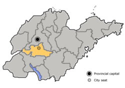 Location of Tai'an City jurisdiction in Shandong | |
 Tai'an Location on the North China Plain  Tai'an Tai'an (China) | |
| Coordinates (Tai'an municipal government): 36°12′07″N 117°05′13″E / 36.202°N 117.087°E | |
| Country | People's Republic of China |
| Province | Shandong |
| County-level divisions | 6 |
| Municipal seat | Taishan District |
| Government | |
| • CPC Secretary | Cui Honggang[1] |
| • Mayor | Li Xixin |
| Area | |
| • Prefecture-level city | 7,762 km2 (2,997 sq mi) |
| • Urban | 2,086.8 km2 (805.7 sq mi) |
| • Metro | 2,086.8 km2 (805.7 sq mi) |
| Elevation | 167 m (548 ft) |
| Highest elevation | 1,645 m (5,397 ft) |
| Population (2019 census)[2] | |
| • Prefecture-level city | 5,635,000 |
| • Density | 730/km2 (1,900/sq mi) |
| • Urban | 1,735,425 |
| • Urban density | 830/km2 (2,200/sq mi) |
| • Metro | 1,735,425 |
| • Metro density | 830/km2 (2,200/sq mi) |
| GDP[3] | |
| • Prefecture-level city | CN¥ 365 billion US$ 55.2 billion |
| • Per capita | CN¥ 64,714 US$ 9,779 |
| Time zone | UTC+8 (China Standard) |
| Area code | 538 |
| ISO 3166 code | CN-SD-09 |
| License Plate Prefix | 鲁J |
| Website | www |
Tai'an (Chinese: 泰安; pinyin: Tài'ān) is a prefecture-level city in Western Shandong Province of the People's Republic of China. Centered on Mount Tai, the city borders the provincial capital of Jinan to the north, Zibo to the east, Linyi to the southeast, Liaocheng to the extreme west and Jining to the south. To the west, Tai'an is separated from the province of Henan by the Yellow River.
Its population was 5,494,207 as of the 2010 census, of whom 1,735,425 lived in the built-up (or metro) area made of two urban districts (Taishan District and Daiyue District).
YouTube Encyclopedic
-
1/5Views:3 8921 94637 20621 82082 678
-
Visit the Chinese City of Taian
-
舊山線泰安車站 Old Mountain Line Tai'an Railway Station
-
Duelo de MCs - Oreia vs Taian (1ª Fase) - Batevolta - 10/05/15
-
Lễ kết đàn Dược sư - Cầu tiêu tai diên thọ quốc thái dân an | Chùa Ba Vàng
-
Duelo de MCs - Harley vs Taian (Semifinal) - Batevolta - 12/07/15
Transcription
Administration
The prefecture-level city of Tai'an administers six county-level divisions, including two districts, two county-level cities and two counties.
- Taishan District (泰山区)
- Daiyue District (岱岳区)
- Xintai City (新泰市)
- Feicheng City (肥城市)
- Ningyang County (宁阳县)
- Dongping County (东平县)
| Map |
|---|

History
Etymology
Tai'an is named after Mount Tai. In Chinese, Tai (泰) means "significant". Thus, the name Tai'an is derived from the ancient saying: "If Mount Tai is safe, then the four seas (the world) are safe (安; ān). "
Early history
Tai'an was home to the Dawenkou culture during the neolithic era. During the Spring and Autumn period and the Warring States period, the region belonged to the states of Qi and Lu. The site of major historical and cultural significance in the area is Mount Tai. It attracted multiple emperors throughout the dynasties to visit, offer sacrifice to the heaven gods and pray for harvest. Confucius, Sima Qian, Cao Zhi, Li Bai, Du Fu and other litterateurs visited here and many great works were produced.
Modern history
In 1909, German colonials built Tai'an-Fu Railway Station along with the construction of Tianjin–Pukou railway (Tientsin–Pukow railway). On 10 November of the following year, the first train service passed through the station.[4]
On 1 May 1928, Chiang Kai-shek, the leader of KMT and nationalist revolutionary army, commanded the attack of Tai'an and occupied it the next day.[5]
In October 1937, exiled students from Peking, Tianjin and other major cities arrived in Tai'an seeking asylum after the north of Yellow river was occupied by the Japanese forces. On 24 December 1937, Japanese troops crossed the Yellow River, occupied Jinan on the next day, and bombed Tai'an. On the night of 31 December, the Japanese occupied Tai'an.[6] Local resistants were assembled autonomously to fight against the occupation.[7]
Culture
Long ago, successive emperors would come to Tai'an to hold a Zen ceremony, and now the feudal society is over, but every year Tai'an will hold a large-scale live performance:"Chinese Taishan·Fengshan Grand Ceremony".[8]Tai'an is a tourist city, and the Tai'an government has also been trying to promote the development of tourism in Tai'an.[9]
Geography and climate
Tai'an is centered on the south side of Mount Tai. Dongping Lake is the biggest lake.
Tai'an lies in the northern temperate zone and has a continental, semi-humid monsoon climate. The average annual temperatures are −2.1 °C (28.2 °F) (January), 12.8 °C (55.0 °F) (annual average), and 26.0 °C (78.8 °F) (July). The average annual precipitation is 681 mm (26.8 in).
| Climate data for Tai'an (1991–2020 normals, extremes 1971–2010) | |||||||||||||
|---|---|---|---|---|---|---|---|---|---|---|---|---|---|
| Month | Jan | Feb | Mar | Apr | May | Jun | Jul | Aug | Sep | Oct | Nov | Dec | Year |
| Record high °C (°F) | 15.8 (60.4) |
21.8 (71.2) |
26.1 (79.0) |
33.8 (92.8) |
38.6 (101.5) |
40.7 (105.3) |
39.6 (103.3) |
40.0 (104.0) |
34.6 (94.3) |
31.6 (88.9) |
27.1 (80.8) |
17.4 (63.3) |
40.7 (105.3) |
| Mean daily maximum °C (°F) | 4.6 (40.3) |
8.2 (46.8) |
14.4 (57.9) |
21.1 (70.0) |
26.6 (79.9) |
31.0 (87.8) |
31.4 (88.5) |
30.3 (86.5) |
26.9 (80.4) |
21.0 (69.8) |
13.0 (55.4) |
6.1 (43.0) |
19.6 (67.2) |
| Daily mean °C (°F) | −1.3 (29.7) |
2.1 (35.8) |
8.2 (46.8) |
14.9 (58.8) |
20.5 (68.9) |
25.1 (77.2) |
26.7 (80.1) |
25.5 (77.9) |
20.9 (69.6) |
14.4 (57.9) |
6.9 (44.4) |
0.5 (32.9) |
13.7 (56.7) |
| Mean daily minimum °C (°F) | −5.9 (21.4) |
−2.9 (26.8) |
2.6 (36.7) |
8.9 (48.0) |
14.4 (57.9) |
19.5 (67.1) |
22.7 (72.9) |
21.6 (70.9) |
15.9 (60.6) |
9.1 (48.4) |
2.0 (35.6) |
−3.9 (25.0) |
8.7 (47.6) |
| Record low °C (°F) | −22.4 (−8.3) |
−19.3 (−2.7) |
−12.6 (9.3) |
−5.7 (21.7) |
0.7 (33.3) |
8.2 (46.8) |
13.1 (55.6) |
10.4 (50.7) |
1.8 (35.2) |
−3.3 (26.1) |
−12.6 (9.3) |
−20.3 (−4.5) |
−22.4 (−8.3) |
| Average precipitation mm (inches) | 5.2 (0.20) |
11.9 (0.47) |
13.8 (0.54) |
33.4 (1.31) |
55.8 (2.20) |
85.2 (3.35) |
201.3 (7.93) |
160.3 (6.31) |
64.2 (2.53) |
27.7 (1.09) |
25.3 (1.00) |
7.6 (0.30) |
691.7 (27.23) |
| Average precipitation days (≥ 0.1 mm) | 2.1 | 3.3 | 3.3 | 5.1 | 6.9 | 8.5 | 12.4 | 11.6 | 7.3 | 5.5 | 4.4 | 3.1 | 73.5 |
| Average snowy days | 2.8 | 2.9 | 1.2 | 0.2 | 0 | 0 | 0 | 0 | 0 | 0 | 1.0 | 2.2 | 10.3 |
| Average relative humidity (%) | 58 | 55 | 51 | 56 | 61 | 62 | 78 | 80 | 74 | 69 | 66 | 62 | 64 |
| Mean monthly sunshine hours | 163.6 | 166.4 | 213.5 | 235.3 | 261.5 | 228.5 | 190.8 | 200.2 | 194.6 | 198.7 | 170.6 | 162.1 | 2,385.8 |
| Percent possible sunshine | 53 | 54 | 57 | 60 | 60 | 52 | 43 | 48 | 53 | 58 | 56 | 54 | 54 |
| Source 1: China Meteorological Administration[10][11] | |||||||||||||
| Source 2: Weather China[12] | |||||||||||||
Education
- Shandong University of Science and Technology
- Shandong First Medical University
- Shandong Agricultural University
- Taishan University
- Tai'an Public Health School
- Tai'an Polytechnic College
- Shandong Foreign Trade Vocational College Taian Campus
Secondary schools
- Tai’an the first high school (泰安一中)
Transportation
Tai'an is served by Tai'an railway station on the Beijing–Shanghai high-speed railway and Taishan railway station on the Beijing–Shanghai railway.
Tai'an is served by the G2 Beijing–Shanghai Expressway and on the Tai-Lai Expressway (west-east from Tai'an to Laiwu). There is a four-lane highway from Tai'an to the Jinan Yaoqiang International Airport. Within Tai'an there are large tree lined avenues throughout the city.
The nearest major airport is Jinan Yaoqiang International Airport, about 120 km (75 mi) to the north.
See also
References
- ^ 全市领导干部会议召开 崔洪刚任中共泰安市委书记 (in Chinese). dzwww.com. 9 May 2018. Retrieved 1 May 2020.
- ^ a b 最新人口信息 www.hongheiku.com (in Chinese). hongheiku. Retrieved 12 January 2021.
- ^ "Shandong Statistical Yearbook-2016". www.stats-sd.gov.cn.
- ^ Daily Consular and Trade Reports, Issues 152-228, Department of Commerce and Labor, Bureau of Manufactures, 1913
- ^ Abbao [permanent dead link]
- ^ "第二节 徂徕山起义,四支队的建立与发展 - 泰安县地方史(1925—1949) - 泰山区地情库 - 泰安 - Shandong Chorography Archive".
- ^ "第一节 山东沦陷后泰安的抗战形势 - 泰安县地方史(1925—1949) - 泰山区地情库 - 泰安 - Shandong Chorography Archive".
- ^ Liu, Yi; Geng, Xin; Guan, Rui (1 October 2023). "Development of Experiential Live-action Performance Products in Tai'an City: A Case Study of"Chinese Taishan·Fengshan Grand Ceremony". | Journal of Landscape Research | EBSCOhost". openurl.ebsco.com. Retrieved 31 March 2024.
- ^ Weidong,
Shi; Xia, Liu; Ruyue
, Wang (20 November 2023). "Research on tourism industry development strategy of Tai'an City in post-epidemic era". Academic Journal of Humanities & Social Sciences. 6 (22). doi:10.25236/AJHSS.2023.062219. - ^ 中国气象数据网 – WeatherBk Data (in Simplified Chinese). China Meteorological Administration. Retrieved 7 October 2023.
- ^ 中国气象数据网 (in Simplified Chinese). China Meteorological Administration. Retrieved 7 October 2023.
- ^ 泰安 - 气象数据 -中国天气网. Weather China (in Chinese (China)). China Meteorological Administration. Retrieved 8 December 2021.
External links
 Tai'an travel guide from Wikivoyage
- Government website of Tai'an (in Simplified Chinese)
Major cities along the Yellow River | ||
|---|---|---|
| Province-level subdivisions | Cities (from upper reaches to lower reaches) | 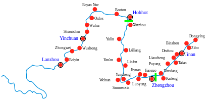 |
| Gansu | ||
| Ningxia | ||
| Inner Mongolia | ||
| Shanxi | ||
| Shaanxi | ||
| Henan | ||
| Shandong | ||
| International | |
|---|---|
| National | |
| Geographic | |
| Other | |