
Tai Wo Hau 大窩口 | |||||||||||||||||||||||||||||||||||||||||||||||||||||||||||||||
|---|---|---|---|---|---|---|---|---|---|---|---|---|---|---|---|---|---|---|---|---|---|---|---|---|---|---|---|---|---|---|---|---|---|---|---|---|---|---|---|---|---|---|---|---|---|---|---|---|---|---|---|---|---|---|---|---|---|---|---|---|---|---|---|
 Platform level of Tai Wo Hau station in July 2017 | |||||||||||||||||||||||||||||||||||||||||||||||||||||||||||||||
| Chinese name | |||||||||||||||||||||||||||||||||||||||||||||||||||||||||||||||
| Traditional Chinese | 大窩口 | ||||||||||||||||||||||||||||||||||||||||||||||||||||||||||||||
| Simplified Chinese | 大窝口 | ||||||||||||||||||||||||||||||||||||||||||||||||||||||||||||||
| Hanyu Pinyin | Dàwōkǒu | ||||||||||||||||||||||||||||||||||||||||||||||||||||||||||||||
| Cantonese Yale | Daaihwōháu | ||||||||||||||||||||||||||||||||||||||||||||||||||||||||||||||
| Literal meaning | Great Nest Mouth | ||||||||||||||||||||||||||||||||||||||||||||||||||||||||||||||
| |||||||||||||||||||||||||||||||||||||||||||||||||||||||||||||||
| General information | |||||||||||||||||||||||||||||||||||||||||||||||||||||||||||||||
| Location | Kwok Shui Road Park, Castle Peak Road — Kwai Chung, Tai Wo Hau Tsuen Wan District, Hong Kong | ||||||||||||||||||||||||||||||||||||||||||||||||||||||||||||||
| Coordinates | 22°22′15″N 114°07′30″E / 22.3708°N 114.1250°E | ||||||||||||||||||||||||||||||||||||||||||||||||||||||||||||||
| Operated by | MTR Corporation | ||||||||||||||||||||||||||||||||||||||||||||||||||||||||||||||
| Line(s) | Tsuen Wan line | ||||||||||||||||||||||||||||||||||||||||||||||||||||||||||||||
| Platforms | 2 (1 island platform) | ||||||||||||||||||||||||||||||||||||||||||||||||||||||||||||||
| Tracks | 2 | ||||||||||||||||||||||||||||||||||||||||||||||||||||||||||||||
| Connections | |||||||||||||||||||||||||||||||||||||||||||||||||||||||||||||||
| Construction | |||||||||||||||||||||||||||||||||||||||||||||||||||||||||||||||
| Structure type | Underground | ||||||||||||||||||||||||||||||||||||||||||||||||||||||||||||||
| Platform levels | 1 | ||||||||||||||||||||||||||||||||||||||||||||||||||||||||||||||
| Accessible | Yes | ||||||||||||||||||||||||||||||||||||||||||||||||||||||||||||||
| Other information | |||||||||||||||||||||||||||||||||||||||||||||||||||||||||||||||
| Station code | TWH | ||||||||||||||||||||||||||||||||||||||||||||||||||||||||||||||
| History | |||||||||||||||||||||||||||||||||||||||||||||||||||||||||||||||
| Opened | 17 May 1982 | ||||||||||||||||||||||||||||||||||||||||||||||||||||||||||||||
| Services | |||||||||||||||||||||||||||||||||||||||||||||||||||||||||||||||
| |||||||||||||||||||||||||||||||||||||||||||||||||||||||||||||||
| |||||||||||||||||||||||||||||||||||||||||||||||||||||||||||||||
| Location | |||||||||||||||||||||||||||||||||||||||||||||||||||||||||||||||
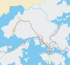 Tai Wo Hau Location within the MTR system | |||||||||||||||||||||||||||||||||||||||||||||||||||||||||||||||
Tai Wo Hau (Chinese: 大窩口; Cantonese Yale: Daaih wō háu) is an MTR station between Tsuen Wan and Kwai Hing stations on the Tsuen Wan line. It serves the areas of Kwai Yin Court and Tai Wo Hau Estate in the Kwai Tsing District, and some resited villages (such as Kwan Mun Hau Tsuen) in the Tsuen Wan District of Hong Kong. These villages were originally in Tsuen Wan town centre, being moved for new town development.
Tai Wo Hau station was one of the first railway stations in the New Territories; and the first underground one. All other New Territories stations on the Tsuen Wan line are either at surface level or on viaducts. Lai King station cuts through a hillside slope, and all other New Territories underground stations were opened some years later.
The station is relatively less busy in the system because of its distance to nearby bus stops and settlements.
YouTube Encyclopedic
-
1/1Views:322
-
太和市 - Tai Wo Town
Transcription
History
The station was built on the site of a park.[1] The 280-metre-long, 22-metre-wide, 15-metre-deep station box was built bottom-up within a sheetpile cofferdam.[2] The tunnel between Tai Wo Hau and Kwai Hing stations was completed in July 1980 using the drill-and-blast method.[3] Tai Wo Hau station opened on 10 May 1982, in sync with Tsuen Wan line. In 1984, the New Territories Development Department awarded a contract for the construction of a park above the station to replace the one which originally existed there.[4] This park is now called Kwok Shui Road Park.
Station layout
Platforms 1 and 2 share the same island platform.
| G | Ground level | Exits |
| L1 | Concourse | Customer Service, MTRShops |
| Vending machine, ATMs | ||
| L2 Platforms |
Platform 2 | Tsuen Wan line towards Central (Kwai Hing) → |
| Island platform, doors will open on the right | ||
| Platform 1 | ← Tsuen Wan line towards Tsuen Wan (Terminus) | |
Entrances/exits
- A: Hoi Pa San Tsuen, Ham Tin Tsuen, Ho Pui Tsuen, Kwok Shui Road, Primrose Hill
- B: Castle Peak Road, Kwai Yin Court, Kwai Chung Estate, Tai Wo Hau Estate
 [6]
[6]
References
- ^ Ngai, Yau-ki (19 June 1982). "Waiting for word on MTR's new park". South China Morning Post.
- ^ "How Tsun Wan Line stations were constructed". South China Morning Post. 10 May 1982.
- ^ "A boring achievement". South China Morning Post. 24 July 1980.
- ^ "New parks for Tsun Wan". South China Morning Post. 5 July 1984.
- ^ "Tai Wo Hau Station layout" (PDF). MTR Corporation. Retrieved 31 July 2014.
- ^ "Tai Wo Hau Station street map" (PDF). MTR Corporation. Retrieved 31 July 2014.