
| Tagoloan River | |
|---|---|
 Tagoloan River mouth  Tagoloan River (Philippines) | |
| Location | |
| Country | |
| Region | Northern Mindanao |
| Province | |
| Physical characteristics | |
| Source | |
| • location | Malaybalay City, Bukidnon |
| • elevation | 2,041 ft (622 m) |
| Mouth | Macajalar Bay |
• location | Tagoloan, Misamis Oriental |
• coordinates | 8°33′20″N 124°44′37″E / 8.55565°N 124.74359°E |
• elevation | 0 m (0 ft) |
| Length | 106 km (66 mi) |
| Basin size | 1,704 km2 (658 sq mi) |
| Discharge | |
| • location | Macajalar Bay |
| Basin features | |
| Tributaries | |
| • left |
|
| • right |
|
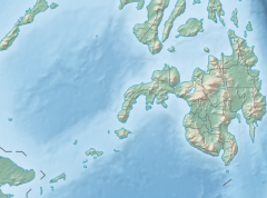
The Tagoloan River is the 13th largest river system in the Philippines in terms of watershed size, as classified by the National Water Resources Board.[1][2] It has an estimated drainage area of 1,704 square kilometres (658 sq mi) covering the provinces of Bukidnon and Misamis Oriental. It has a length of 106 kilometres (66 mi) from its source in Malaybalay City in Bukidnon province.[3]
YouTube Encyclopedic
-
1/2Views:1 21819 739
-
Lower Tagoloan River 1st descent by Kayak Domain
-
My unexpected shot, it's critical going to Tagoloan..
Transcription
References
- ^ Velasco, Luis Rey; Liborio Cabanilla (January 2003). "Assessment of Physical Resource Capability in Philippine Agriculture" (PDF). Philippine APEC Study Center Network. Archived from the original (PDF) on November 17, 2007. Retrieved September 19, 2008.
- ^ Suminguit, Vel J.; Erlinda Burton. "§ A Study on Ancestral Domain Recognition and Management Within and Around the Mt. Kitanglad Range National Park" (PDF). ICRAF Southeast Asia. Retrieved September 19, 2008.
- ^ Sumbalan, Antonio T. "The Bukidnon Experience on Natural Resource Management Decentralization". Archived from the original on July 19, 2011. Retrieved September 19, 2008.