
T'aechŏn County
태천군 | |
|---|---|
| Korean transcription(s) | |
| • Chosŏn'gŭl | 태천군 |
| • Hancha | 泰川郡 |
| • McCune-Reischauer | T'aech'ŏn-gun |
| • Revised Romanization | Taecheon-gun |
 | |
| Country | North Korea |
| Province | North P'yŏngan |
| Administrative divisions | 1 ŭp, 1 workers' district, 21 ri |
| Area | |
| • Total | 720.9 km2 (278.3 sq mi) |
| Population (2008[1]) | |
| • Total | 108,894 |
| • Density | 150/km2 (390/sq mi) |
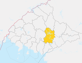
T'aechŏn County or Thaechŏn County (in North Korean romanization) is a kun, or county, in central North P'yŏngan province, North Korea. It borders Taegwan and Tongch'ang to the north, Unsan and Nyŏngbyŏn to the east, Pakch'ŏn and Unjŏn to the south, and Kusŏng to the west.
Geography
Mountains are scattered across the county, with the Pinandŏk mountains rising in the east. The tallest of these is Paegundŏksan (백운덕산, 868 m), but the county's highest point is in the north, at Samgaksan (삼각산, 936 m). The county is drained by the Taeryŏng River and its tributaries, which include the Ch'ŏnbang and Ch'angsŏng. Some 64% of the county's area is forestland, while 30% is cultivated.
Administrative divisions
T'aech'ŏn county is divided into 1 ŭp (town), 1 rodongjagu (workers' district) and 21 ri (villages):
|
|
Climate
The year-round annual temperature is 8.5 °C, with a January mean of -10 °C and an August mean of 23.8 °C. The annual rainfall is 1,338 mm (53 in). On average, there are 40 foggy days per year.
Economy
Crops raised on the cultivated land include maize, rice, tobacco and vegetables; Taechon leads the province in maize production. In addition, various animals are raised including silkworms, rabbits, cattle and hogs. There are numerous deposits of gold and graphite.
Transportation
The Ch'ŏngnyŏn P'arwŏn Line of the Korean State Railway passes through the county, on its way between Kusŏng and Kujang.
There are two airfields in the county - T'aech'ŏn Airport and T'aech'ŏn Northwest Airport.
Places of interest
The Silla-era temple Yanghwasa still stands in T'aech'ŏn.
Educational institutions in T'aech'ŏn include T'aech'ŏn Technical School (태천전문학교).
The construction of the Taechon nuclear power plant (39°55′41″N 125°34′08″E / 39.928°N 125.569°E) was halted in 1994 in accordance with the U.S.-North Korea Agreed Framework.
See also
References
- International Information Research Institute (국제정보연구소) (1999). "태천군". 北韓情報總覽 2000 [Bukhan jeongbo chong-ram 2000]. Seoul: Author. pp. 840–841.
External links
- In Korean language online encyclopedias:
39°55′16″N 125°29′38″E / 39.921°N 125.494°E
