
Szentendre District
Szentendrei járás | |
|---|---|
 Coat of arms | |
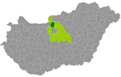 Szentendre District within Hungary and Pest County. | |
| Country | |
| County | Pest |
| District seat | Szentendre |
| Area | |
| • Total | 326.58 km2 (126.09 sq mi) |
| • Rank | 10th in Pest |
| Population (2011 census) | |
| • Total | 77,802 |
| • Rank | 7th in Pest |
| • Density | 238/km2 (620/sq mi) |
Szentendre (Hungarian: Szentendrei járás) is a district in north-western part of Pest County. Szentendre is also the name of the town where the district seat is found. The district is located in the Central Hungary Statistical Region.
Geography
Szentendre District borders with Szob District to the north, Vác District and Dunakeszi District to the east, Budapest to the south, Pilisvörösvár District to the southwest, Esztergom District (Komárom-Esztergom County) to the west. The district includes the whole of Szentendre Island in the Danube. The number of the inhabited places in Szentendre District is 13.
Municipalities
The district has 4 towns, 1 large village and 8 villages. (ordered by population, as of 1 January 2013)[1]
- Budakalász (10,450)
- Csobánka (3,178)
- Dunabogdány (3,113)
- Kisoroszi (946)
- Leányfalu (3,483)
- Pilisszentkereszt (2,193)
- Pilisszentlászló (1,193)
- Pócsmegyer (1,919)
- Pomáz (16,445)
- Szentendre (25,274) – district seat
- Szigetmonostor (2,235)
- Tahitótfalu (5,496)
- Visegrád (1,795)
The bolded municipalities are cities, italics municipality is large village.
Demographics
Religion in Szentendre District (2011 census)
In 2011, it had a population of 77,802 and the population density was 238/km2.
| Year | County population[2] | Change |
|---|---|---|
| 2011 | 77,802 | n/a |
Ethnicity
Besides the Hungarian majority, the main minorities are the German (approx. 2,500), Slovak (1,100), Roma (1,000), Serb (450), Romanian (300), Russian and Polish (150), Croat (100).
Total population (2011 census): 77,802
Ethnic groups (2011 census):[3] Identified themselves: 75,440 persons:
- Hungarians: 68,057 (90.21%)
- Germans: 2,585 (3.43%)
- Slovaks: 1,093 (1.45%)
- Gypsies: 1,030 (1.36%)
- Others and indefinable: 2,675 (3.55%)
Approx. 2,500 persons in Szentendre District did not declare their ethnic group at the 2011 census.
Religion
Religious adherence in the county according to 2011 census:[4]
- Catholic – 29,034 (Roman Catholic – 28,351; Greek Catholic – 665);
- Reformed – 9,305;
- Evangelical – 959;
- Orthodox – 354;
- Judaism – 128;
- other religions – 1,744;
- Non-religious – 12,811;
- Atheism – 1,607;
- Undeclared – 21,860.
Gallery
-
 Downtown of Szentendre
 -

-
 Teleki–Wattay Mansion in Pomáz
 -
 Panorama of Csobánka
See also
References
- ^ A KSH 2013. évi helységnévkönyve
- ^ népesség.com, "Szentendrei járás népessége"
- ^ 4.1.6.1 A népesség nemzetiség szerint, 2011, (in Hungarian) [1]
- ^ 4.1.7.1 A népesség vallás, felekezet szerint, 2011, (in Hungarian) [2]
External links
| Towns (4) |
| |
|---|---|---|
| Large village (1) | ||
| Villages (8) | ||
47°40′00″N 19°05′00″E / 47.6667°N 19.0833°E
This Pest County location article is a stub. You can help Wikipedia by expanding it. |