
Sutrapur Thana
সূত্রাপুর থানা | |
|---|---|
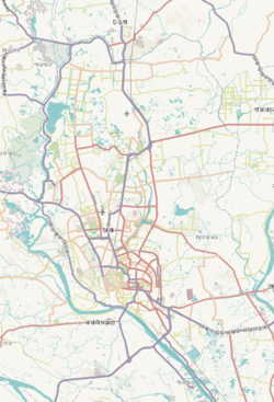
 Expandable map of vicinity of Sutrapur Thana | |
 Sutrapur Thana Location of Sutrapur Thana within Dhaka  Sutrapur Thana Location of Sutrapur Thana within Dhaka Division  Sutrapur Thana Location of Sutrapur Thana within Bangladesh | |
| Coordinates: 23°42′23″N 90°24′59″E / 23.70638°N 90.41650°E | |
| Country | |
| Division | Dhaka Division |
| District | Dhaka District |
| Established as a thana | 1976 |
| Area | |
| • Total | 2.08 km2 (0.80 sq mi) |
| Elevation | 23 m (75 ft) |
| Population (2011)[2] | |
| • Total | 211,210 |
| • Density | 101,543/km2 (263,000/sq mi) |
| Time zone | UTC+6 (BST) |
Sutrapur (Bengali: সূত্রাপুর) is a Thana of Dhaka District in the Division of Dhaka, Bangladesh.
YouTube Encyclopedic
-
1/1Views:9 210
-
ঢাকার মানচিত্র - Dhaka Maps-dhaka map by road-map of dhaka city-dhaka city map
Transcription
Geography
Sutrapur is bounded by Paltan Thana, Motijheel Thana and Sabujbagh Thana on the north, Keraniganj Upazila on the south, Sabujbagh Thana, Jatrabari Thana and Gendaria Thana on the east and Kotwali Thana and Bangshal Thana on the west. It has a total area of 2.08 square kilometres (0.80 sq mi).[3]
Demographics
According to 2011 census, Sutrapur Thana has a population of 211,210 with average household size of 4.9 members, and an average literacy rate of 79.9% vs national average of 51.8% literacy.[2]
Economy
Sutrapur houses some of the oldest businesses in the city. Call Ready began in 1948 as Arju Light House, a small business that rented out lights and phonographs for events. They soon branched out into microphones and loudspeakers, supplying them for many historic political meetings and rallies. As of 2017, they still have a storefront in Lakshmibazar.[4]
Points of interest
- Bhajahari Lodge is an early 20th century building on the Department of Archaeology's list of protected monuments.[5][6]
Education
Sutrapur is home to some of the old and renowned schools, like Government Shaheed Suhrawardy College, St Gregory's High School, Dhaka Collegiate School, Muslim Government High School, and Pogose School, Dhaka.
See also
References
- ^ "Geographic coordinates of Dhaka, Bangladesh". DATEANDTIME.INFO. Retrieved 7 July 2016.
- ^ a b Bangladesh Bureau of Statistics (2011). "Population & Housing Census" (PDF). Bangladesh Government. Archived from the original (PDF) on 3 September 2017. Retrieved 17 April 2015.
- ^ Marufuzzaman, S. (2012). "Sutrapur Thana". In Islam, Sirajul; Jamal, Ahmed A. (eds.). Banglapedia: National Encyclopedia of Bangladesh (Second ed.). Asiatic Society of Bangladesh.
- ^ Chowdhury, Moinul Hoque (17 March 2017). "The Call Ready microphone that witnessed history". bdnews24.com.
- ^ Rahman, Mahbubur (August 2009). "An Architect's Dhaka". Star Campus. The Daily Star. Retrieved July 1, 2017.
- ^ "List of Monuments". Department of Archaeology. Retrieved July 1, 2017.
This Dhaka Division location article is a stub. You can help Wikipedia by expanding it. |