
| Sun in the Sands | |
|---|---|
 The pub in 2007 | |
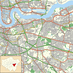 Sun in the Sands Location in London  Sun in the Sands Sun in the Sands (Greater London) | |
| General information | |
| Type | Public house |
| Location | Blackheath, London, England |
| Coordinates | 51°28′30″N 0°1′30″E / 51.47500°N 0.02500°E |
| Construction started | 1745 |
| Website | |
| www | |
The Sun in the Sands is a pub-restaurant between Blackheath and Shooter's Hill in London. It lends its name to the adjacent junction, where the A2 between central London and north Kent meets the A102, which notably, to the north, provides access to the Blackwall Tunnel. Several Transport for London (TfL) bus routes pass the former simple crossroads.[1]
YouTube Encyclopedic
-
1/5Views:1 755 96774 6131 800 46911 406166 017
-
Missouri S&T: How to survive an active shooter
-
Phoenix Serial Shooters
-
Can I BEAT The *NEW* FINAL BOSS? Bloons First Person Shooter! (Bloons FPS)
-
THE WORLD'S (UN)LUCKIEST SIDE ORDER PLAYER
-
Pilgrammed- Infinite Six Shooter Build (Op Gun Build)
Transcription
History
![The site in about 1880.[2] Click for broader map and to enable varied magnification.](/wikipedia/commons/thumb/9/91/Map_of_Kent_Sheet_002%2C_Ordnance_Survey%2C_1869-1882.jpg/im4424-Map_of_Kent_Sheet_002%2C_Ordnance_Survey%2C_1869-1882.jpg)
The upland heath, ridge, to the east was a meeting point since the Middle Ages, and was, in widespread recountings, a stopover of King Henry VIII when riding from Greenwich to Shooter's Hill with his first Queen and several Lords.[3] The present pub dates from around 1745[4][5] and its name comes from the sight of the setting sun amidst dust, kicked up by sheep herded by drovers from Kent headed to London.[6] It was soon an isolated inn on heathland, frequented by highwaymen in one period known as "the Trojans", who regularly pickpocketed.[7] William Hazlitt was known to visit the inn.[3]
The junction was built in stages, due to various 20th-century projects to bypass the old Roman Road between Blackheath and Dartford. The modern A2, parallel to this, forms the Shooters Hill By-Pass[8] which took most of the 1920s to complete.[9] The modern roundabout with side sliproad dates from the late 1960s.[10]
As well as the junction, the pub inspired the name of Sunfields Methodist Church[11] and the adjacent Sun Lane, a former caravan repair site which now hosts a garage;[12] it was previously a tiny passage, Sun-in-the-Sands Lane.[13]
Since 1995,[5] Greenwich Council has protected the appearance of a zone east of the junction, including the pub, as a Conservation Area,[14] defined as an area "of special architectural or historic interest, the character or appearance of which it is desirable to preserve or enhance."[5]
References
- ^ "Buses from Blackheath (Sun-in-the-Sands)" (PDF). Transport for London. Retrieved 7 August 2013.
- ^ Map of Kent Sheet 2, Ordnance Survey, 1869-1882
- ^ a b Blanchard, Edward Litt L (1860). Bradshaw's guide through London and its environs. Corrected and revised. Oxford University. p. 189. Retrieved 7 August 2013.
- ^ "Sun In The Sands". Retrieved 7 August 2013.
- ^ a b c "Sun in the Sands character appraisal". Royal borough of Greenwich. October 2007. Retrieved 7 August 2013.
- ^ Rothwell, David (2006). Dictionary of Pub Names. Wordsworth Editions. p. 378. ISBN 9781840222661.
- ^ The London and Paris Observer: Or Chronicle of Literature, Science, and the Fine Arts, Volume 13. Galignani. 1837. p. 589. Retrieved 7 August 2013.
- ^ Neal, Arthur (29 May 1922). "Arterial Roads". Parliamentary Debates (Hansard). Retrieved 8 August 2013.
- ^ Morrison, Herbert (2 December 1930). "Shooter's Hill By-Pass". Parliamentary Debates (Hansard). Retrieved 8 August 2013.
- ^ Hamling, William (23 July 1969). "Motorways (Eltham)". Parliamentary Debates (Hansard). Retrieved 8 August 2013.
- ^ "History of Sunfields Church". Sunfields Methodist Church. Retrieved 7 August 2013.
- ^ Watts, Derek (2008). Country Boy: A Biography of Albert Lee. McFarland. p. 10. ISBN 9780786482955.
- ^ London (Edition of 1894-96) CVI, Revised: 1893, Published: 1897, National Library of Scotland Maps. Retrieved: 2 July 2021.
- ^ "3.28 Map 28 - Sun in the Sands Conservation Area". Royal borough of Greenwich. October 2007. Retrieved 7 August 2013.