
Sullah শাল্লা | |
|---|---|
 | |
| Country | |
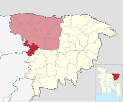
| Division | Sylhet |
| District | Sunamganj |
| 1919 | Naval outpost |
| 1941 | Thana |
| 1983 | Upazila |
| Government | |
| • MP (Sunamganj-2) | Joya Sengupta (Awami League) |
| • Upazila Chairman | Chowdhury Abdullah Al-Mahmud |
| Area | |
| • Total | 256.03 km2 (98.85 sq mi) |
| Population (2011) | |
| • Total | 113,743 |
| • Density | 440/km2 (1,200/sq mi) |
| Demonym(s) | Sullawi, Shallawi |
| Time zone | UTC+6 (BST) |
| Postal code | 3000 |
Sullah (Bengali: শাল্লা, romanized: Shalla), also spelt Sulla, is an upazila (sub-district) of the Sunamganj District, located in Bangladesh's Sylhet Division.[1] Its headquarters is located in Ghungiargaon.
History
It is generally thought that the area presently comprising Sullah Upazila was formerly inhabited by the Khasi people, which can be understood from the Khalisha Hati, Bara Hati, Kakura Hati and Godir Bak of Chobbisha village. The two mounds discovered in the village of Khalli and other mounds also provides evidence for thousand-year old tribal settlement.[2] Among the 120 mosques in Sullah, the Ghungiargaon-Sullah Jame Mosque, Srihail Saheb Bari Jame Mosque and Bahara Jame Mosque are of historical importance.[1]
Sullah Upazila is named after the village of Sullah which sits on the bank of the Kalni River. A small bazaar was established in the village and named Shahaganj Bazar, after Shah Nur, who was a prominent wali who lived in the village. However, the name of Shah Ullah was more prominent, and this later became corrupted to Sullah (pronounced Shalla).[2]
In 1919, a naval police headquarters was established in Sullah village. It was converted into an administrative thana in 1941. However, as a result of the breakage in the strong current of the Kalni river, the infrastructure of the thana was destroyed. The local chiefs then re-established the headquarters in the village of Ghungiargaon, located in the centre of Sullah Thana.[2] During the Bangladesh Liberation War of 1971, Sullah was a part of Sector 5 under Mir Shawkat Ali. Sullah was liberated on 7 December. Sullah Thana was upgraded to upazila (sub-district) in 1983 as part of the President of Bangladesh Hussain Muhammad Ershad's decentralisation programme. In 1987, the Hashimia Islami Madrasa was founded in Sullah which contributed to the educational development.[1]
Geography
Sullah is located at 24°37′35″N 91°15′00″E / 24.6264°N 91.2500°E. It has 20,299 households and total area 256.03 km2.
Demographics
According to the 2011 Bangladesh census, Sulla Upazila had 20,299 households and a population of 113,743. 33,217 (29.20%) were under 10 years of age. Sulla had a literacy rate (age 7 and over) of 34.29%, compared to the national average of 51.8%, and a sex ratio of 984 females per 1000 males. 3,914 (3.44%) lived in urban areas.[3][4] Sulla formerly had a Hindu majority, like many other upazilas in the Haor region, but after Partition the Hindus have gradually migrated to India.
As of the 1991 Bangladesh census, Sullah has a population of 89941. Males constitute 51.08% of the population, and females 48.92%. This Upazila's eighteen up population is 43247. Sullah has an average literacy rate of 21.8% (7+ years), and the national average of 32.4% literate.[5]
Administration
Sullah Upazila is divided into four union parishads: Atgaon, Bahara, Habibpur, and Shalla. The union parishads are subdivided into 65 mauzas and 116 villages.[3]
List of chairmen
| Number | Name | Term |
|---|---|---|
| 01 | Kalai Mia Chowdhury | |
| 02 | Muhammad Abdul Mannan Chowdhury | 1990 - 1991 |
| 03 | Adv. Abani Mohan Das | 22/2/2009 - 23/4/2014 |
| 04 | Ganesh Chandra Sarkar | 24/5/2014 - 13/5/2019 |
| 05 | Chowdhury Abdullah Al-Mahmud | 14/5/2019 - Present |
Notable people
- Akshay Kumar Das, member of the first Constituent Assembly of Pakistan
- Chowdhury Abdullah Al-Mamun, 31st Inspector General of Bangladesh Police
See also
References
- ^ a b c Jiban Kumar Chanda (2012). "Sulla Upazila". In Sirajul Islam; Miah, Sajahan; Khanam, Mahfuza; Ahmed, Sabbir (eds.). Banglapedia: the National Encyclopedia of Bangladesh (Online ed.). Dhaka, Bangladesh: Banglapedia Trust, Asiatic Society of Bangladesh. ISBN 984-32-0576-6. OCLC 52727562. OL 30677644M. Retrieved 1 February 2024.
- ^ a b c "শাল্লা উপজেলার পটভূমি". Bangladesh National Portal (in Bengali).
- ^ a b c "Bangladesh Population and Housing Census 2011 Zila Report – Sunamganj" (PDF). bbs.gov.bd. Bangladesh Bureau of Statistics.
- ^ "Community Tables: Sunamganj district" (PDF). bbs.gov.bd. Bangladesh Bureau of Statistics. 2011.
- ^ "Population Census Wing, BBS". Archived from the original on 2005-03-27. Retrieved November 10, 2006.
Capital: Sunamganj | ||
| Upazilas | ||
| Constituencies | ||
| Attractions and sites | ||
| Rivers | ||
| Inhabited areas | ||
| Educational institutions |
| |
| Transport | ||
| History | ||
Capital: Sylhet | ||
| Habiganj District |  | |
| Moulvibazar District | ||
| Sunamganj District | ||
| Sylhet District | ||
This Sylhet Division location article is a stub. You can help Wikipedia by expanding it. |