
Lebanon | |
|---|---|
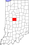 Boone County's location in Indiana | |
 Lebanon Location in Boone County | |
| Coordinates: 40°04′54″N 86°28′36″W / 40.08167°N 86.47667°W | |
| Country | United States |
| State | Indiana |
| County | Boone |
| Township | Center |
| Elevation | 938 ft (286 m) |
| Time zone | UTC-5 (Eastern (EST)) |
| • Summer (DST) | UTC-4 (EDT) |
| ZIP code | 46052 |
| Area code | 765 |
| FIPS code | 18-73700[2] |
| GNIS feature ID | 444272 |
Stringtown is an unincorporated community in Center Township, Boone County, in the U.S. state of Indiana.[3]
History
Stringtown was a name that was frequently applied in the United States to small, unincorporated settlements that consisted of only a small row (or a string) of buildings that lacked a town centre.[4] This village may have originally been named Keys Ferry after its founder.[5] This community is one of seven in Indiana named Stringtown.
Geography
Stringtown is located at 40°16′54″N 86°32′36″W / 40.28167°N 86.54333°W.
References
- ^ "US Board on Geographic Names". United States Geological Survey. 2007-10-25. Retrieved 2008-01-31.
- ^ "U.S. Census website". United States Census Bureau. Retrieved 2008-01-31.
- ^ "Lebanon Economic Development Corporation, Boone County, Indiana". Geographic Names Information System. United States Geological Survey. Retrieved March 6, 2020.
- ^ Baker, Ronald L. (October 1995). From Needmore to Prosperity: Hoosier Place Names in Folklore and History. Indiana University Press. p. 315. ISBN 978-0-253-32866-3.
...a row of houses or buildings strung along a road without a real center.
- ^ Baker, Ronald L. (1995). From Needmore to Prosperity : Hoosier place names in folklore and history. Internet Archive. Bloomington : Indiana University Press. ISBN 978-0-253-32866-3.
Municipalities and communities of Boone County, Indiana, United States | ||
|---|---|---|
| City |  | |
| Towns | ||
| Townships | ||
| CDP | ||
| Other communities | ||
| Footnotes | ‡This populated place also has portions in an adjacent county or counties | |
This Boone County, Indiana location article is a stub. You can help Wikipedia by expanding it. |