
Steinway Street | ||||||||||||||||||||||||||||||||||||||||||||||||||||||||||||||||||||
|---|---|---|---|---|---|---|---|---|---|---|---|---|---|---|---|---|---|---|---|---|---|---|---|---|---|---|---|---|---|---|---|---|---|---|---|---|---|---|---|---|---|---|---|---|---|---|---|---|---|---|---|---|---|---|---|---|---|---|---|---|---|---|---|---|---|---|---|---|
 34th Avenue exit stairs on northbound platform | ||||||||||||||||||||||||||||||||||||||||||||||||||||||||||||||||||||
| Station statistics | ||||||||||||||||||||||||||||||||||||||||||||||||||||||||||||||||||||
| Address | Steinway Street & Broadway Queens, NY 11103 | |||||||||||||||||||||||||||||||||||||||||||||||||||||||||||||||||||
| Borough | Queens | |||||||||||||||||||||||||||||||||||||||||||||||||||||||||||||||||||
| Locale | Astoria | |||||||||||||||||||||||||||||||||||||||||||||||||||||||||||||||||||
| Coordinates | 40°45′31″N 73°55′08″W / 40.758668°N 73.918934°W | |||||||||||||||||||||||||||||||||||||||||||||||||||||||||||||||||||
| Division | B (IND)[1] | |||||||||||||||||||||||||||||||||||||||||||||||||||||||||||||||||||
| Line | IND Queens Boulevard Line | |||||||||||||||||||||||||||||||||||||||||||||||||||||||||||||||||||
| Services | E F R | |||||||||||||||||||||||||||||||||||||||||||||||||||||||||||||||||||
| Transit | ||||||||||||||||||||||||||||||||||||||||||||||||||||||||||||||||||||
| Structure | Underground | |||||||||||||||||||||||||||||||||||||||||||||||||||||||||||||||||||
| Platforms | 2 side platforms | |||||||||||||||||||||||||||||||||||||||||||||||||||||||||||||||||||
| Tracks | 2 | |||||||||||||||||||||||||||||||||||||||||||||||||||||||||||||||||||
| Other information | ||||||||||||||||||||||||||||||||||||||||||||||||||||||||||||||||||||
| Opened | August 19, 1933 | |||||||||||||||||||||||||||||||||||||||||||||||||||||||||||||||||||
| Accessible | not ADA-accessible; accessibility planned | |||||||||||||||||||||||||||||||||||||||||||||||||||||||||||||||||||
| Opposite- direction transfer | Yes | |||||||||||||||||||||||||||||||||||||||||||||||||||||||||||||||||||
| Traffic | ||||||||||||||||||||||||||||||||||||||||||||||||||||||||||||||||||||
| 2022 | 2,629,433[3] | |||||||||||||||||||||||||||||||||||||||||||||||||||||||||||||||||||
| Rank | 112 out of 423[3] | |||||||||||||||||||||||||||||||||||||||||||||||||||||||||||||||||||
| ||||||||||||||||||||||||||||||||||||||||||||||||||||||||||||||||||||
| ||||||||||||||||||||||||||||||||||||||||||||||||||||||||||||||||||||
| ||||||||||||||||||||||||||||||||||||||||||||||||||||||||||||||||||||
| ||||||||||||||||||||||||||||||||||||||||||||||||||||||||||||||||||||
| ||||||||||||||||||||||||||||||||||||||||||||||||||||||||||||||||||||


The Steinway Street station is a local station on the IND Queens Boulevard Line of the New York City Subway. Located under Steinway Street between Broadway and 34th Avenue, it is served by the M train on weekdays, the R train at all times except nights, and the E and F trains at night.
YouTube Encyclopedic
-
1/5Views:22 21624 53765733 3977 978
-
Walking NYC : Steinway Street, Astoria, Queens (June 4, 2021)
-
⁴ᴷ⁶⁰ Walking NYC (Narrated) : Steinway Street, Astoria, Queens in its Entirety
-
Not In Service 4car (M) train passing Steinway Street station
-
⁴ᴷ⁶⁰ Walking NYC (Narrated) : Astoria, Queens at Late Night from Steinway Street to Crescent Street
-
⁴ᴷ⁶⁰ Walking NYC : Broadway, Astoria, Queens from Steinway Street to Crescent Street (Late Night)
Transcription
History

The Queens Boulevard Line was one of the first lines built by the city-owned Independent Subway System (IND),[4][5][6] and stretches between the IND Eighth Avenue Line in Manhattan and 179th Street and Hillside Avenue in Jamaica, Queens.[4][6][7] The Queens Boulevard Line was in part financed by a Public Works Administration (PWA) loan and grant of $25 million.[8] One of the proposed stations would have been located at Steinway Street.
The first section of the line, west from Roosevelt Avenue to 50th Street, opened on August 19, 1933. E trains ran local to Hudson Terminal (today's World Trade Center) in Manhattan, while the GG (predecessor to current G service) ran as a shuttle service between Queens Plaza and Nassau Avenue on the IND Crosstown Line.[9][10][11][12][13][14]
In 2019, as part of an initiative to increase the accessibility of the New York City Subway system, the MTA announced that it would install elevators at the Steinway Street station as part of the MTA's 2020–2024 Capital Program.[15] In November 2022, the MTA announced that it would award a $965 million contract for the installation of 21 elevators across eight stations,[16] including Steinway Street.[17][18]: 81 A joint venture of ASTM and Halmar International would construct the elevators under a public-private partnership.[17][18]: 80
Station layout
| Ground | Street level | Exit/entrance |
| Mezzanine | Mezzanine | Fare control, station agent |
| Platform level | Side platform | |
| Southbound local | ← ← ← | |
| Northbound local | | |
| Side platform | ||

This underground station has two tracks and two side platforms. The E and F trains serve the station at night,[19][20] the M train serves the station on weekdays during the day,[21] and the R train serves the station at all times except late nights.[22] The station is between 36th Street to the west and 46th Street to the east.[23]
Both platform walls have a purple tile band with a black border and mosaic name tablets reading "STEINWAY ST." in white sans-serif lettering on a black background and purple border. Small tile captions reading "STEINWAY" in white on black run below the tile band, and directional signs in the same style are present under some of the name tablets.[citation needed] The tile band was part of a color-coded tile system used throughout the IND.[24] The tile colors were designed to facilitate navigation for travelers going away from Lower Manhattan. As such, the purple tiles used at the Steinway Street station were originally also used at Queens Plaza, the next express station to the west, while a different tile color is used at Jackson Heights–Roosevelt Avenue, the next express station to the east. Purple tiles are similarly used at the other local stations between Queens Plaza and Roosevelt Avenue.[25][26]
Royal purple I-beam columns run along both platforms at regular intervals, alternating ones having the standard black station name plate with white lettering.[citation needed] The I-beam piers are located every 15 feet (4.6 m) and support girders above the platforms. The roof girders are also connected to columns in the platform walls.[27]: 3 The tunnel is covered by a U-shaped trough that contains utility pipes and wires. The outer walls of this trough are composed of columns, spaced approximately every 5 feet (1.5 m) with concrete infill between them. There is a 1-inch (25 mm) gap between the tunnel wall and the platform wall, which is made of 4-inch (100 mm)-thick brick covered over by a tiled finish. The columns between the tracks are also spaced every 5 feet (1.5 m), with no infill.[27]: 3
South of this station, the express tracks rejoin the local tracks and the line becomes four tracks again.
Exits

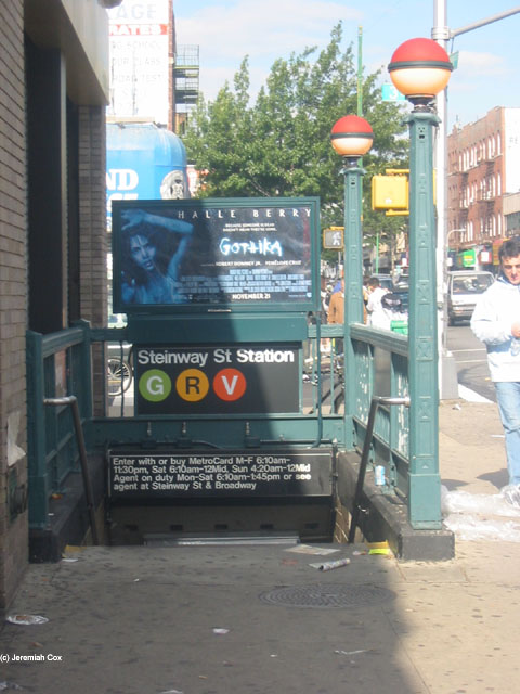
There are two separate mezzanines, one at each end of the station, and crossover is allowed on both of them. The side on Steinway Street near Broadway has two street stairs and has a token booth, and used to be the full-time side to the station. This side has two small staircases to the southbound side and a single platform-wide staircase on the northbound side. The part-time side at 34th Avenue and Steinway Street currently has no booth (it had been completely dismantled for asbestos abatement), and is HEET turnstile access at all times. This side has two stairs to the street to the northeast and southwest corners, and one to each platform.[28]
In 2003, the hours for this token booth were 6:10 a.m. to 1:45 p.m. Mondays through Saturdays. The entrances on this side, at the time, were only open 6:10 a.m. to 11:30 a.m. Mondays through Fridays, 6:10 a.m. to 12:00 a.m. Saturdays, and 4:20 a.m. to 12:00 a.m. Sundays.[29] In 2009, the MTA proposed closing the part-time booth, which was then open 6:10 a.m. to 1:30 p.m. Mondays through Saturdays. Access to this entrance has been added through HEET access between 2003 and 2009.[30]
References
- ^ "Glossary". Second Avenue Subway Supplemental Draft Environmental Impact Statement (SDEIS) (PDF). Vol. 1. Metropolitan Transportation Authority. March 4, 2003. pp. 1–2. Archived from the original (PDF) on February 26, 2021. Retrieved January 1, 2021.
- ^ "Annual Subway Ridership (2017–2022)". Metropolitan Transportation Authority. 2022. Retrieved November 8, 2023.
- ^ a b "Annual Subway Ridership (2017–2022)". Metropolitan Transportation Authority. 2022. Retrieved November 8, 2023.
- ^ a b Duffus, R.L. (September 22, 1929). "OUR GREAT SUBWAY NETWORK SPREADS WIDER; New Plans of Board of Transportation Involve the Building of More Than One Hundred Miles of Additional Rapid Transit Routes for New York". The New York Times. Retrieved August 19, 2015.
- ^ "QUEENS SUBWAY WORK AHEAD OF SCHEDULE: Completion Will Lead to Big Apartrnent Building, Says William C. Speers". The New York Times. April 7, 1929. Retrieved September 1, 2015.
- ^ a b "Queens Lauded as Best Boro By Chamber Chief". Brooklyn Daily Eagle. September 23, 1929. p. 40. Retrieved October 4, 2015 – via Newspapers.com.
- ^ New York Times, New Subway Routes in Hylan Program to Cost $186,046,000, March 21, 1925, page 1
- ^ "TEST TRAINS RUNNING IN QUEENS SUBWAY; Switch and Signal Equipment of New Independent Line Is Being Checked". The New York Times. December 20, 1936. ISSN 0362-4331. Retrieved April 26, 2016.
- ^ Kramer, Frederick A. (1990). Building the Independent Subway. Quadrant Press. ISBN 978-0-915276-50-9.
- ^ Raskin, Joseph B. (2013). The Routes Not Taken: A Trip Through New York City's Unbuilt Subway System. New York, New York: Fordham University Press. doi:10.5422/fordham/9780823253692.001.0001. ISBN 978-0-82325-369-2.
- ^ "Independent Subway Services Beginning in 1932". thejoekorner.com. August 21, 2013. Retrieved August 2, 2015.
- ^ "TWO SUBWAY UNITS OPEN AT MIDNIGHT; Links in City-Owned System in Queens and Brooklyn to Have 15 Stations" (PDF). The New York Times. August 18, 1933. Retrieved November 7, 2015.
- ^ "New Queens Subway Service Will Be Launched Tonight; Tunnel From Manhattan Open to Jackson Heights; Service Will Eventually Be Extended Through To Jamaica". Long Island Daily Press. Fultonhistory.com. August 18, 1933. p. 20. Retrieved July 27, 2016.
- ^ "New Queens Tube To Open Saturday: Brooklyn-Long Island City Link of City Line Also to Be Put in Operation". New York Evening Post. Fultonhistory.com. August 17, 1933. p. 18. Retrieved July 27, 2016.
- ^ "Press Release - MTA Headquarters - MTA Announces 20 Additional Subway Stations to Receive Accessibility Improvements Under Proposed 2020-2024 Capital Plan". mta.info. Metropolitan Transportation Authority. December 19, 2019. Retrieved December 20, 2019.
- ^ Nessen, Stephen (November 28, 2022). "MTA to spend more than $1B on accessibility upgrades". Gothamist. Retrieved December 1, 2022.
- ^ a b Brachfeld, Ben (November 29, 2022). "MTA to spend $1 billion on subway, commuter rail accessibility upgrades". amNewYork. Retrieved December 1, 2022.
- ^ a b "Capital Program Oversight Committee Meeting November 2022". mta.info. Metropolitan Transportation Authority. November 29, 2022. Retrieved July 14, 2022.
- ^ "E Subway Timetable, Effective December 4, 2022". Metropolitan Transportation Authority. Retrieved August 26, 2023.
- ^ "F Subway Timetable, Effective August 28, 2023". Metropolitan Transportation Authority. Retrieved August 26, 2023.
- ^ "M Subway Timetable, Effective August 28, 2023". Metropolitan Transportation Authority. Retrieved August 26, 2023.
- ^ "R Subway Timetable, Effective August 28, 2023". Metropolitan Transportation Authority. Retrieved August 26, 2023.
- ^ "Subway Map" (PDF). Metropolitan Transportation Authority. September 2021. Retrieved September 17, 2021.
- ^ "Tile Colors a Guide in the New Subway; Decoration Scheme Changes at Each Express Stop to Tell Riders Where They Are". The New York Times. August 22, 1932. ISSN 0362-4331. Archived from the original on July 1, 2022. Retrieved July 1, 2022.
- ^ Carlson, Jen (February 18, 2016). "Map: These Color Tiles In The Subway System Used To Mean Something". Gothamist. Retrieved May 10, 2023.
- ^ Gleason, Will (February 18, 2016). "The hidden meaning behind the New York subway's colored tiles". Time Out New York. Retrieved May 10, 2023.
- ^ a b "New York MPS Elmhurst Avenue Subway Station (IND)". Records of the National Park Service, 1785 - 2006, Series: National Register of Historic Places and National Historic Landmarks Program Records, 2013 - 2017, Box: National Register of Historic Places and National Historic Landmarks Program Records: New York, ID: 05000672. National Archives.
- ^ "Steinway Street Neighborhood Map". mta.info. Metropolitan Transportation Authority. April 2018. Retrieved February 9, 2020.
- ^ Cox, Jeremiah (October 5, 2003). "Approaching the part-time entrance with its red-half globes at 34 Avenue to Steinway Street". subwaynut.com. Retrieved August 20, 2019.
- ^ "Station Listing for Public Hearing" (PDF). mta.info. Metropolitan Transportation Authority. December 24, 2008. p. 147. Archived from the original (PDF) on March 5, 2009. Retrieved May 19, 2022.
External links
- nycsubway.org – IND Queens Boulevard Line: Steinway Street
- Station Reporter — R Train
- Station Reporter — M Train
- The Subway Nut — Steinway Street Pictures
- Broadway entrance from Google Maps Street View
- 34th Avenue entrance from Google Maps Street View
- Platforms from Google Maps Street View
| People | |
|---|---|
| Related places and things | |
| Eponymous places and things | |