
Starokostiantyniv
Старокостянтинів | |
|---|---|
   | |
 Flag  Seal | |
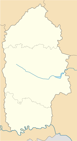 Starokostiantyniv Location of Starokostiantyniv in Ukraine  Starokostiantyniv Starokostiantyniv (Ukraine) | |
| Coordinates: 49°45′14″N 27°13′13″E / 49.75389°N 27.22028°E | |
| Country | |
| Oblast | Khmelnytskyi Oblast |
| Raion | Khmelnytskyi Raion |
| Hromada | Starokostiantyniv urban hromada |
| Founded | 1561 |
| Area | |
| • Total | 40 km2 (20 sq mi) |
| Elevation | 265 m (869 ft) |
| Population (2022) | |
| • Total | 33,921 |
| Website | http://starkon.km.ua/ |
Starokostiantyniv (Ukrainian: Старокостянтинів; Polish: Starokonstantynów, or Konstantynów; Yiddish: אלט-קאָנסטאַנטין Alt Konstantin) is a city in Khmelnytskyi Raion, Khmelnytskyi Oblast (province) of western Ukraine. It hosts the administration of Starokostiantyniv urban hromada, one of the hromadas of Ukraine.[1] Population: 33,921 (2022 estimate).[2]
YouTube Encyclopedic
-
1/2Views:2 283481
-
Старокостянтинів. Велика Волинь ч.12
-
Ми-8Т на Барнео
Transcription
History
Grand Duchy of Lithuania 1525–1569
Polish–Lithuanian Commonwealth 1569–1793
Russian Empire 1793–1917

Ukrainian People's Republic / Republic of Poland 1917-1920
Soviet Ukraine 1920–1922
Soviet Union 1922–1991
Nazi Germany 1941–1944 (occupation)
Ukraine 1991–present
Starokostiantyniv was founded in the 16th century when Konstanty Ostrogski built a fortress at the village of Kolishchentsi. The surviving Starokostiantyniv Castle was constructed by his son between 1561 and 1571. The village grew into a town which became known as "Old Constantine's Town" (Kostiantyniv Staryi) to prevent confusion with "New Constantine's Town" in the vicinity. It became a private town of Poland, owned by the Ostrogski family. It was part of Polish Volhynian Voivodeship in the Lesser Poland Province. 1648 saw the Battle of Starokostiantyniv. The 1st Infantry Regiment of the Polish Crown Army was stationed in the town in 1791 before it was relocated to Kalisz.[3] The town is home to an airfield.
In 1939, 6,743 Jews were living in the city, accounting for 31 percent of the total population. The Jewish community was murdered in mass executions perpetrated from August 1941 until November 1942. In the postwar period, the city grew significantly due to the development of industry (mechanical engineering and metalworking, food processing, etc.) and the deployment of a large garrison (including aviation units).
Until 18 July 2020, Starokostiantyniv was incorporated as a city of oblast significance and served as the administrative center of Starokostiantyniv Raion though it did not belong to the raion. In July 2020, as part of the administrative reform of Ukraine, which reduced the number of raions of Khmelnytskyi Oblast to three, the city of Starokostiantyniv was merged into Khmelnytskyi Raion.[4][5]
Notable people
- Abraham Goldfaden, poet and playwright, considered father of the modern Jewish theatre
- Ben-Zion (1897–1987), painter born in Starokostyantyniv[6]
- Avrom Ber Gotlober (1811–1899), writer, poet, and educator of the Haskala movement.
- Jakub Weinles, Polish painter
- Anatoliy Bondarchuk, hammer thrower who won the gold medal at the 1972 Summer Olympics
- Blank family, ancestors of Vladimir Lenin
- Chana Orloff (1888–1968), art deco and figurative art sculptor
Gallery
-
 Capuchin Monastery
 -
 Church of Holy Trinity
 -
 Basil Constantine Ostrozky Monument and Church of the Nativity of the Virgin Mary
 -
 Military officers' club
 -
 Tower of the former Dominican Monastery
References
- ^ "Староостропильская громада" (in Russian). Портал об'єднаних громад України.
- ^ Чисельність наявного населення України на 1 січня 2022 [Number of Present Population of Ukraine, as of January 1, 2022] (PDF) (in Ukrainian and English). Kyiv: State Statistics Service of Ukraine. Archived (PDF) from the original on 4 July 2022.
- ^ Gembarzewski, Bronisław (1925). Rodowody pułków polskich i oddziałów równorzędnych od r. 1717 do r. 1831 (in Polish). Warszawa: Towarzystwo Wiedzy Wojskowej. p. 26.
- ^ "Про утворення та ліквідацію районів. Постанова Верховної Ради України № 807-ІХ". Голос України (in Ukrainian). 2020-07-18. Retrieved 2020-10-03.
- ^ "Нові райони: карти + склад" (in Ukrainian). Міністерство розвитку громад та територій України.
- ^ "Ben-Zion". Smithsonian American Art Museum (SAAM). Retrieved 2021-07-27.
External links
- Weather in Starokostiantyniv.
- The murder of the Jews of Starokostiantyniv during World War II, at Yad Vashem website.
| International | |
|---|---|
| National | |
| Geographic | |
| Other | |
49°45′20″N 27°13′15″E / 49.75556°N 27.22083°E