
 St Hilary transmitting station (Vale of Glamorgan) | |
| Mast height | 229 metres (750 ft) |
|---|---|
| Coordinates | 51°27′26″N 3°24′11″W / 51.457222°N 3.402944°W |
| Grid reference | ST026741 |
| Built | 1957 |
| ITV region | TWW (1958-1968) HTV (1968-1985) |
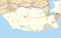
The St Hilary transmitting station is a facility for telecommunications situated close to the village of St Hilary, Glamorgan in the Vale of Glamorgan, Wales, in the UK. It comprises a 229-metre (750 ft) guyed mast with antennas attached at various heights. The site was established in 1958 for Independent Television transmission on VHF. Transmissions from the site include FM radio, DAB radio and mobile telephone signals.
It broadcasts Heart Wales on FM and DAB to the large parts of South Wales.[1]
Its broadcast areas include: St. Hilary, Cowbridge, Ystradowen, Miskin, Pontyclun, Bonvilston, St. Nicholas, Swansea, Llanelli, West of Barry, Pontypridd, Caerphilly, Mountain Ash, Llantrisant, Church Village and Talbot Green.
The studios of the regional radio station Nation Radio are located on the site and its DAB transmissions to south-east Wales are made from the mast. Nation Radio also transmits from other sites, including on FM from nearby Wenvoe and from Kilvey Hill near Swansea.[2][1][3]
YouTube Encyclopedic
-
1/5Views:9294821 626347561
-
175 - Internet Broadcasting 101
-
Hilary Hendershott on Her Profit Boss Podcast Generating $37M of New Assets in 10 Months!
-
Network Propaganda
-
Audio-Technica: Wireless Solutions Webinar - Dec 18, 2018
-
Amelia Earhart | Wikipedia audio article
Transcription
History
Construction
The plan by the Independent Television Authority (ITA) to build a mast at the site was controversial (prompting a House of Lords debate in May 1957[4]). This was due to its proximity to Rhoose Airport (now Cardiff International Airport), and ITA's initial plan for a 305 m (1,000 ft) mast on a site that itself is 125 m (410 ft) above sea level.
Objections were noted, the mast height was eventually limited to 229 m (750 ft) and it was built by BICC[5] in Summer 1957 to provide 405-line VHF television to south Wales and the West of England.
Transmission
Test transmissions commenced on 2 September 1957 on Band III channel 10 (199.75 MHz) from antennas at 340 m above sea level and the station entered television broadcast service on that frequency in January 1958. The programming was initially provided by TWW.
In 1965, Band III channel 7 (184.75 MHz) was added to the mast, transmitting from an antenna array sited about 20 m below the existing channel 10 array. This was to carry the programmes of the bilingual Teledu Cymru service that were already being provided by TWW in the rest of Wales, which in 1968 was replaced by Harlech Television (HTV Wales). From that point onwards, the channel 10 transmissions carried the English-language "General Service" (again, initially provided by TWW, and from 1968 by HTV). Channel 10's power output was decreased to 55 kW and the Wales-facing antennas were removed, though the power output towards the West of England remained about the same as it had been previously.
In 1985, when 405-line TV closed, the site was re-engineered to remove the VHF television antennas. St. Hilary became just a telecommunications mast and remained so until October 2000 when Real Radio commenced FM Radio broadcasting from the site. In late 2000, DAB Digital Radio was added to the radio broadcasting repertoire initially transmitting the Cardiff & Newport multiplex on channel 11C, but with Swansea SW Wales on channel 12A commencing in February 2004.[6]
In 2006 Ofcom received a proposal[7] for a new Rock-Orientated FM station to transmit from the site, but the licence was awarded to Xfm South Wales, now Nation Radio. Nation's studios are located at the foot of the St Hilary mast, but the station's Cardiff transmitter is a few miles away at Wenvoe.
Services
Analogue television
14 January 1958 - 15 February 1965
| Frequency | VHF | kW | Service |
|---|---|---|---|
| 199.75 MHz | 10 | 200 | TWW |
15 February 1965 - 3 January 1985
| Frequency | VHF | kW | Service |
|---|---|---|---|
| 184.75 MHz | 7 | 100 | HTV Wales (TWW Teledu Cymru until 1968) |
| 199.75 MHz | 10 | 55 | HTV West (TWW West until 1968) |
Analogue radio (VHF FM)
October 2000 - May 2014
| Frequency | kW | Service |
|---|---|---|
| 105.4 MHz | 5 | Real Radio |
May 2014 - present day
| Frequency | kW | Service |
|---|---|---|
| 105.4 MHz | 5 | Heart South Wales |
Digital Radio (DAB)
October 2000 - 31 January 2004
| Frequency | Block | kW | Operator |
|---|---|---|---|
| 220.352 MHz | 11C | 2 | NOW Cardiff & Newport |
February 2004 - Present
| Frequency | Block | kW | Operator |
|---|---|---|---|
| 227.360 MHz | 12C | 2 | South East Wales |
| 223.936 MHz | 12A | 1 | Swansea SW Wales |
See also
References
- ^ a b "St Hilary (The Vale of Glamorgan, Wales) DAB transmitter". UK Free TV. Retrieved 29 April 2018.
- ^ "Nation Radio". Retrieved 29 April 2018.
- ^ "Analogue Broadcast Radio Measured Coverage Area (MCA) Maps" (PDF). Ofcom.
- ^ "TELEVISION MAST NEAR RHOOSE AIRPORT (Hansard, 2 May 1957)". Parliamentary Debates (Hansard). 2 May 1957. Retrieved 28 May 2013.
- ^ Times Tuesday 27 October 1959, page 6
- ^ "Swansea dab - Page 6 - Radio - Digital Spy Forums". Forums.digitalspy.co.uk. Retrieved 28 May 2013.
- ^ "Archived copy" (PDF). Archived from the original (PDF) on 17 January 2012. Retrieved 27 October 2011.
{{cite web}}: CS1 maint: archived copy as title (link)
External links
- MB21's page on 405 TV to Wales and the West
- "405 Alive's list of transmitters"
- More details on 405-line ITV transmitters
| England |
| ||||||||||||||||||
|---|---|---|---|---|---|---|---|---|---|---|---|---|---|---|---|---|---|---|---|
| Scotland |
| ||||||||||||||||||
| Wales | |||||||||||||||||||
| Northern Ireland |
| ||||||||||||||||||
| Channel Islands | |||||||||||||||||||
| Isle of Man |
| ||||||||||||||||||
Italics denotes a transmitter no longer used for transmitting television signals | |||||||||||||||||||
