
St. Theresa Point | |
|---|---|
 | |
 St. Theresa Point Location of St. Theresa Point in Manitoba | |
| Coordinates: 53°48′45″N 94°55′05″W / 53.81250°N 94.91806°W | |
| Country | Canada |
| Province | Manitoba |
| Region | Northern |
| Government | |
| • Type | Band |
| • Chief | Marie A. Wood |
| • MLA | Ian Bushie (Keewatinook) |
| • MP | Niki Ashton (Churchill—Keewatinook Aski) |
| Area | |
| • Land | 153.89 km2 (59.42 sq mi) |
| Elevation | 250 m (820 ft) |
| Population (2016[1]) | |
| • Total | 3,262 |
| • Density | 21.2/km2 (55/sq mi) |
| Time zone | UTC-6 (CST) |
| • Summer (DST) | UTC-5 (CDT) |
| St. Theresa Point First Nation Band No. 298[2] | |
| Treaty | Treaty 5 |
| Province | Manitoba |
| Land | |
| Main reserve | St. Theresa Point |
| Other reserve(s) |
|
| Land area | 28.85 km2 |
| Government | |
| Chief | Marie A. Wood |
| Council size | 9 |
| Tribal Council | |
| Island Lake Tribal Council | |
| Website | |
| stpfirstnation | |
St. Theresa Point First Nation (Oji-Cree: Minithayinikam) is a First Nations community in northern Manitoba. It has 3 reserves in total, the largest and most populated of which is St. Theresa Point, which is bordered by the unorganized portion of Division No. 22, Manitoba, and by the Wasagamack First Nation.
The reserve is only accessible by airplane or winter ice roads (which continue north towards Garden Hill, and southwest towards Manigotagan, with a branch leading towards Berens River). The community is served by the nearby St. Theresa Point Airport. It has a local educational institution, St Theresa Point Regional Centre, with courses offered by the University College of the North and Assiniboine Community College.
YouTube Encyclopedic
-
1/5Views:3 6602 2993 8562 3813 985
-
St. Theresa Point First Nation - Client Profile
-
St Theresa Point First Nation
-
St. Theresa Point First Nation part 1
-
St. Theresa Point First Nation part 2
-
St. Theresa Point First Nation Community - H1N1 Vaccination Clinic
Transcription
Demographics
The community had a population of 2,871 in the Canada census of 2011 an increase of 9.1% from a 2006 population of 2,632. The median age was 20.1. The population density was 18.7 per km2 and the land area was 153.38 km2. There are 478 housing units within the community.[3]
St. Theresa Point First Nation
St. Theresa Point First Nation is the First Nations located at the center of St. Theresa Point.[4]
St. Theresa Point First Nation once belonged to the Island Lake band,[4] who, on 13 August 1909, became a signatory of Treaty 5. In 1969, Island Lake split into four separate communities with their own separate administrations: Garden Hill, Wasagamack, Red Sucker Lake, and St. Theresa Point First Nations.[5] Today, the 4 communities have a Tribal Council, called Island Lake Tribal Council, to collaborate on common interests.[5][6]
In 2011, the Island Lake communities (including St. Theresa Point FN) had a combined population of 7,120.[3]
As of December 2014, the First Nation had a registered population of 4,069, out of which 3,795 lived on their own reserve. The First Nation has a Custom Electoral System and is governed by an elected Chief and eight councillors. Along with Island Lake Tribal Council, the First Nation is affiliated with Manitoba Keewatinohk Okimahkanak (MKO), Assembly of Manitoba Chiefs (AMC), and Crown–Indigenous Relations and Northern Affairs Canada.[4]
Territory
St. Theresa Point First Nation has three reserves:[6]
- Cantin Lake (53°25′30″N 95°9′0″W / 53.42500°N 95.15000°W) — located on the south shore and east shore of Cantin Lake; total size of 1,912.10 ha (4,724.9 acres)[7]
- Mukwa Narrows (53°2′11″N 94°57′44″W / 53.03639°N 94.96222°W) — 140 km east of Negginan and northwest of Elliot Lake 890.30 ha (2,200.0 acres)[8]
- St. Theresa Point — on the west shore of Island Lake; total size of 2,885 hectares (7,130 acres) (53°48′45″N 94°55′5″W / 53.81250°N 94.91806°W)[9]
and meengwun
Notable people
- Judy Klassen - former MLA for Kewatinook and interim leader of the Manitoba Liberal Party.
References
- ^ "God's Lake Census Canada data". Census Canada. Retrieved 2018-06-20.
- ^ "About Us".
- ^ a b "Canada Census 2011". 8 February 2012. Retrieved 2015-01-14.
- ^ a b c "About Us". stpfn. Retrieved 2021-08-14.
- ^ a b "First Nation History". stpfn. Retrieved August 14, 2021.
- ^ a b "AANDC (Registered Population)". Crown–Indigenous Relations and Northern Affairs Canada. Government of Canada. Retrieved 2015-01-14.
- ^ "Natural Resources Canada-Canadian Geographical Names (Cantin Lake )". Retrieved 2015-01-07.
- ^ "Natural Resources Canada-Canadian Geographical Names (Mukwa Narrows)". Retrieved 2015-01-07.
- ^ "Natural Resources Canada-Canadian Geographical Names (St. Theresa Point)". Retrieved 2015-01-07.
External links
| Cities | 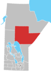 | |
|---|---|---|
| Local government districts | ||
| First Nations | ||
| Indian reserves | ||
| Indian settlements | ||
| Unorganized areas | ||
| Unincorporated communities | ||