
Special Area No. 4 | |
|---|---|
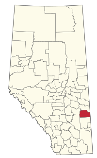 Location within Alberta | |
| Country | Canada |
| Province | Alberta |
| Planning region | Red Deer |
| Incorporated | January 1, 1969[1] |
| Government | |
| • Governing body | Special Areas Board |
| • Municipal office | Hanna |
| • District office | Consort |
| Area (2021)[2] | |
| • Land | 4,299.8 km2 (1,660.2 sq mi) |
| Population (2021)[2] | |
| • Total | 1,236 |
| • Density | 0.3/km2 (0.8/sq mi) |
| Time zone | UTC-7 (MST) |
| • Summer (DST) | UTC-6 (MDT) |
| Postal Code Prefix | |
| Area code | +1-403 |
| Website | specialareas.ab.ca |

Special Area No. 4 is a special area in central Alberta, Canada. It is a rural municipality similar to a municipal district; however, the elected council is overseen by four representatives appointed by the province, the Special Areas Board.
Special Area 4 has one provincial park, Gooseberry Lake Provincial Park. Lakes include Grassy Island Lake and Sounding Lake.
YouTube Encyclopedic
-
1/1Views:4 165
-
2011 SQA Higher Maths: paper 2 no.4 Area between curves
Transcription
Geography
Communities and localities
|
The following urban municipalities are surrounded by Special Area No. 4.[3]
|
The following hamlets are located within Special Area No. 4.[3]
|
The following localities are located within Special Area No. 4.[4]
- Localities
|
|
Demographics
In the 2021 Census of Population conducted by Statistics Canada, Special Area No. 4 had a population of 1,236 living in 421 of its 489 total private dwellings, a change of -0.1% from its 2016 population of 1,237. With a land area of 4,299.8 km2 (1,660.2 sq mi), it had a population density of 0.3/km2 (0.7/sq mi) in 2021.[2]
In the 2016 Census of Population conducted by Statistics Canada, Special Area No. 4 had a population of 1,237 living in 429 of its 471 total private dwellings, a change of -8.5% from its 2011 population of 1,352. With a land area of 4,402.64 km2 (1,699.87 sq mi), it had a population density of 0.3/km2 (0.7/sq mi) in 2016.[5]
See also
- List of communities in Alberta
- List of improvement districts in Alberta
- List of municipal districts in Alberta
- List of municipalities in Alberta
References
- ^ "Municipal Profile: Special Areas Board" (PDF) (PDF). Alberta Municipal Affairs. October 24, 2014. p. 1. Retrieved November 3, 2014.
- ^ a b c "Population and dwelling counts: Canada, provinces and territories, and census subdivisions (municipalities)". Statistics Canada. February 9, 2022. Retrieved February 9, 2022.
- ^ a b "Specialized and Rural Municipalities and Their Communities" (PDF). Alberta Municipal Affairs. March 1, 2012. Retrieved August 12, 2012.
- ^ "Standard Geographical Classification (SGC) 2006, Economic Regions: 4804020 - Special Area No. 4, geographical codes and localities, 2006". Statistics Canada. March 5, 2010. Retrieved August 12, 2012.
- ^ "Population and dwelling counts, for Canada, provinces and territories, and census subdivisions (municipalities), 2016 and 2011 censuses – 100% data (Alberta)". Statistics Canada. February 8, 2017. Retrieved February 8, 2017.
External links
Places adjacent to Special Area No. 4 | |
|---|---|
| Cities | |
|---|---|
| Towns | |
| Villages | |
| Hamlets |
|
| Summer villages | |
| Municipal districts | |
| Special areas | |
| Indian reserves | |
| Provincial parks | |
| Other topics | |