
South Whittier, California | |
|---|---|
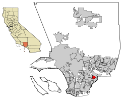 Location of South Whittier in Los Angeles County, California. | |
 South Whittier, California Location in the United States | |
| Coordinates: 33°56′5″N 118°1′51″W / 33.93472°N 118.03083°W | |
| Country | |
| State | |
| County | |
| Area | |
| • Total | 5.346 sq mi (13.846 km2) |
| • Land | 5.337 sq mi (13.823 km2) |
| • Water | 0.009 sq mi (0.022 km2) 0.16% |
| Elevation | 177 ft (54 m) |
| Population | |
| • Total | 56,415 |
| • Density | 11,000/sq mi (4,100/km2) |
| Time zone | UTC-8 (Pacific) |
| • Summer (DST) | UTC-7 (PDT) |
| ZIP code | 90602 |
| Area code | 562 |
| FIPS code | 06-73430 |
| GNIS feature ID | 1661484 |
South Whittier (ⓘ) is an unincorporated community and census-designated place in Los Angeles County, California just south of the city of Whittier. As of the 2020 census, the CDP had a total population of 56,415,[3] down from 57,156 at the 2010 census.
YouTube Encyclopedic
-
1/4Views:7032 1739566 357
-
Solatube On the Scene: South Whittier Library
-
south whittier middle school graduation 1990
-
south whittier middle school 1990 part 2
-
Whittier, California: City of Homes
Transcription
Geography
South Whittier is located at 33°56′5″N 118°1′51″W / 33.93472°N 118.03083°W (33.934724, -118.030800).[4][5]
According to the United States Census Bureau, the CDP has a total area of 5.3 square miles (13.8 km2), over 99% of it land.
Climate
According to the Köppen Climate Classification system, South Whittier has a warm-summer Mediterranean climate, abbreviated "Csa" on climate maps.[6]
Demographics
| Census | Pop. | Note | %± |
|---|---|---|---|
| 1970 | 46,461 | — | |
| 1980 | 43,815 | −5.7% | |
| 1990 | 49,514 | 13.0% | |
| 2000 | 55,193 | 11.5% | |
| 2010 | 57,156 | 3.6% | |
| 2020 | 56,415 | −1.3% | |
| [7] | |||
2010
At the 2010 census South Whittier had a population of 57,156. The population density was 10,691.8 inhabitants per square mile (4,128.1/km2). The racial makeup of South Whittier was 33,663 (58.9%) White (16.7% Non-Hispanic White),[8] 859 (1.5%) African American, 743 (1.3%) Native American, 2,305 (4.0%) Asian, 147 (0.3%) Pacific Islander, 17,085 (29.9%) from other races, and 2,354 (4.1%) from two or more races. Hispanic or Latino of any race were 44,094 persons (77.1%).[9]
The census reported that 56,859 people (99.5% of the population) lived in households, 282 (0.5%) lived in non-institutionalized group quarters, and 15 (0%) were institutionalized.
There were 15,067 households, 7,647 (50.8%) had children under the age of 18 living in them, 8,500 (56.4%) were opposite-sex married couples living together, 2,678 (17.8%) had a female householder with no husband present, 1,276 (8.5%) had a male householder with no wife present. There were 979 (6.5%) unmarried opposite-sex partnerships, and 110 (0.7%) same-sex married couples or partnerships. 1,943 households (12.9%) were one person and 810 (5.4%) had someone living alone who was 65 or older. The average household size was 3.77. There were 12,454 families (82.7% of households); the average family size was 4.05.
The age distribution was 16,274 people (28.5%) under the age of 18, 6,637 people (11.6%) aged 18 to 24, 16,369 people (28.6%) aged 25 to 44, 12,891 people (22.6%) aged 45 to 64, and 4,985 people (8.7%) who were 65 or older. The median age was 32.0 years. For every 100 females, there were 98.5 males. For every 100 females age 18 and over, there were 97.0 males.
There were 15,600 housing units at an average density of 2,918.2 per square mile, of the occupied units 9,563 (63.5%) were owner-occupied and 5,504 (36.5%) were rented. The homeowner vacancy rate was 1.1%; the rental vacancy rate was 3.7%. 36,050 people (63.1% of the population) lived in owner-occupied housing units and 20,809 people (36.4%) lived in rental housing units.
According to the 2010 United States Census, South Whittier had a median household income of $65,815, with 11.4% of the population living below the federal poverty line.[8]
2000
At the 2000 census there were 55,193 people, 14,673 households, and 12,266 families in the CDP. The population density was 10,257.7 inhabitants per square mile (3,960.5/km2). There were 15,008 housing units at an average density of 2,789.3 per square mile (1,077.0/km2). The racial makeup of the CDP was 52.47% White, 1.47% African American, 1.23% Native American, 3.02% Asian, 0.26% Pacific Islander, 36.37% from other races, and 5.18% from two or more races. Hispanic or Latino of any race were 69.31%.[10]
Of the 14,673 households 48.0% had children under the age of 18 living with them, 60.5% were married couples living together, 15.5% had a female householder with no husband present, and 16.4% were non-families. 12.2% of households were one person and 5.1% were one person aged 65 or older. The average household size was 3.74 and the average family size was 3.99.
The age distribution was 33.1% under the age of 18, 10.5% from 18 to 24, 31.5% from 25 to 44, 16.7% from 45 to 64, and 8.2% 65 or older. The median age was 29 years. For every 100 females, there were 100.8 males. For every 100 females age 18 and over, there were 97.8 males.
The median household income was $47,378 and the median family income was $49,756. Males had a median income of $32,314 versus $25,605 for females. The per capita income for the CDP was $15,080. About 9.2% of families and 12.4% of the population were below the poverty line, including 15.0% of those under age 18 and 7.5% of those age 65 or over.
Government
In the California State Legislature, South Whittier is in the 32nd Senate District, represented by Republican Kelly Seyarto, and in the 57th Assembly District, represented by Democrat Reggie Jones-Sawyer.[11]
In the United States House of Representatives, South Whittier is in California's 38th congressional district, represented by Democrat Linda Sánchez.[12]
The Los Angeles County Sheriff's Department (LASD) operates the Norwalk Station in Norwalk, serving South Whittier.[13] In addition the department operates the Whittier Substation in South Whittier.[14]
See also
References
- ^ "2010 Census U.S. Gazetteer Files – Places – California". United States Census Bureau.
- ^ "South Whittier". Geographic Names Information System. United States Geological Survey, United States Department of the Interior. Retrieved April 18, 2015.
- ^ "US Census Bureau Quickfacts". United States Census Bureau. August 12, 2021. Retrieved August 18, 2011.
- ^ "US Gazetteer files: 2010, 2000, and 1990". United States Census Bureau. February 12, 2011. Retrieved April 23, 2011.
- ^ http://www.city-data.com/city/South-Whittier-California.html city.data.com
- ^ "South Whittier, California Köppen Climate Classification (Weatherbase)". Weatherbase.
- ^ "Historical Population Data for California". Archived from the original on March 11, 2007. Retrieved March 11, 2007.
- ^ a b "QuickFacts". United States Census Bureau. Archived from the original on April 18, 2012. Retrieved July 5, 2023.
{{cite web}}: CS1 maint: unfit URL (link) - ^ "2010 Census Interactive Population Search: CA - South Whittier CDP". U.S. Census Bureau. Archived from the original on July 15, 2014. Retrieved July 12, 2014.
- ^ "U.S. Census website". United States Census Bureau. Retrieved January 31, 2008.
- ^ "Statewide Database". Regents of the University of California. Archived from the original on February 1, 2015. Retrieved April 18, 2015.
- ^ "California's 38th Congressional District - Representatives & District Map". Civic Impulse, LLC.
- ^ "Norwalk Station Archived 2010-01-23 at the Wayback Machine." Los Angeles County Sheriff's Department. Retrieved on January 21, 2010.
- ^ "Whittier Substation Archived 2010-01-31 at the Wayback Machine." Los Angeles County Sheriff's Department. Retrieved on January 21, 2010.

