
South Weldon, North Carolina | |
|---|---|
 Location of SouthWeldon, North Carolina | |
| Coordinates: 36°24′49″N 77°36′09″W / 36.41361°N 77.60250°W | |
| Country | United States |
| State | North Carolina |
| County | Halifax |
| Area | |
| • Total | 0.43 sq mi (1.13 km2) |
| • Land | 0.43 sq mi (1.13 km2) |
| • Water | 0.00 sq mi (0.00 km2) |
| Elevation | 75 ft (23 m) |
| Population (2020) | |
| • Total | 550 |
| • Density | 1,264.37/sq mi (487.68/km2) |
| Time zone | UTC-5 (Eastern (EST)) |
| • Summer (DST) | UTC-4 (EDT) |
| ZIP code | 27890[3] |
| Area code | 252 |
| FIPS code | 37-63560[4] |
| GNIS feature ID | 2402882[2] |
South Weldon is an unincorporated community and census-designated place (CDP) in Halifax County, North Carolina, United States. As of the 2010 census, the CDP population was 705.[5] It is part of the Roanoke Rapids, North Carolina Micropolitan Statistical Area.
YouTube Encyclopedic
-
1/2Views:382368
-
Weldon NC - Aqueduct - 10/24/09 Short Version
-
Amtrak P090 at Weldon Trestle
Transcription
Geography
South Weldon is located in northern Halifax County and is bordered to the north and west by the town of Weldon. U.S. Route 301 forms the eastern border of South Weldon; the highway runs north into Weldon and south 6 miles (10 km) to Halifax, the county seat.
According to the United States Census Bureau, the South Weldon CDP has a total area of 0.44 square miles (1.13 km2), all land.[5]
Demographics
| Census | Pop. | Note | %± |
|---|---|---|---|
| 2020 | 550 | — | |
| U.S. Decennial Census[6] | |||
As of the census[4] of 2000, there were 1,414 people, 497 households, and 375 families residing in the CDP. The population density was 505.9 people per square mile (195.3 people/km2). There were 587 housing units at an average density of 210.0 per square mile (81.1/km2). The racial makeup of the CDP was 13.44% White, 84.79% African American, 0.28% Native American, 0.07% Asian, 0.07% from other races, and 1.34% from two or more races. Hispanic or Latino of any race were 0.35% of the population.
There were 497 households, out of which 36.2% had children under the age of 18 living with them, 35.8% were married couples living together, 35.0% had a female householder with no husband present, and 24.5% were non-families. 22.7% of all households were made up of individuals, and 11.5% had someone living alone who was 65 years of age or older. The average household size was 2.85 and the average family size was 3.32.
In the CDP, the population was spread out, with 31.9% under the age of 18, 9.4% from 18 to 24, 25.5% from 25 to 44, 20.5% from 45 to 64, and 12.7% who were 65 years of age or older. The median age was 33 years. For every 100 females, there were 79.0 males. For every 100 females age 18 and over, there were 72.3 males.
The median income for a household in the CDP was $16,000, and the median income for a family was $21,033. Males had a median income of $27,176 versus $18,594 for females. The per capita income for the CDP was $8,845. About 38.5% of families and 42.8% of the population were below the poverty line, including 55.5% of those under age 18 and 21.6% of those age 65 or over.
References
- ^ "ArcGIS REST Services Directory". United States Census Bureau. Retrieved September 20, 2022.
- ^ a b U.S. Geological Survey Geographic Names Information System: South Weldon, North Carolina
- ^ "South Weldon ZIP Code". zipdatamaps.com. 2023. Retrieved January 12, 2023.
- ^ a b "U.S. Census website". United States Census Bureau. Retrieved January 31, 2008.
- ^ a b "Geographic Identifiers: 2010 Census Summary File 1 (G001): South Weldon CDP, North Carolina". American Factfinder. U.S. Census Bureau. Archived from the original on February 13, 2020. Retrieved December 7, 2017.
- ^ "Census of Population and Housing". Census.gov. Retrieved June 4, 2016.
Municipalities and communities of Halifax County, North Carolina, United States | ||
|---|---|---|
| City | 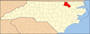 | |
| Towns | ||
| CDPs | ||
| Unincorporated communities | ||