
| South Burnett Region Queensland | |||||||||||||||
|---|---|---|---|---|---|---|---|---|---|---|---|---|---|---|---|
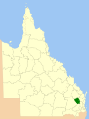 Location within Queensland | |||||||||||||||
| Population | 32,555 (2018)[1] | ||||||||||||||
| • Density | 3.88392/km2 (10.0593/sq mi) | ||||||||||||||
| Established | 2008 | ||||||||||||||
| Area | 8,382 km2 (3,236.3 sq mi)[1] | ||||||||||||||
| Mayor | Brett Wayne Otto | ||||||||||||||
| Council seat | Kingaroy | ||||||||||||||
| State electorate(s) | Nanango | ||||||||||||||
| Federal division(s) | |||||||||||||||
| Website | South Burnett Region | ||||||||||||||
| |||||||||||||||
The South Burnett Region is a local government area in the South Burnett district of Queensland, Australia.
YouTube Encyclopedic
-
1/3Views:1 1628 677563
-
Bike Overnight - South Burnett Rail Trail, Queensland, Australia
-
Follow the South Burnett wine trail with Hayden Quinn
-
Scenic Scenes: Blackbutt & South Burnett
Transcription
Origins
This Local Government was created in March 2008 as a result of the report of the Local Government Reform Commission released in July 2007.
Prior to the 2008 amalgamation, the South Burnett Region, located in the southern catchment of the Burnett River, existed as four distinct local government areas:
- the Shire of Kingaroy;
- the Shire of Nanango;
- the Shire of Murgon;
- and the Shire of Wondai.
The report recommended the new local government area should not be divided into wards and should elect six councilors and a mayor however the Interim Steering Committee applied to the State Government for four wards based on the old shire boundaries. As the total population is just a few hundred short of the level set in the report for eight councilors and a mayor, application for this was also made.
Area and size
The South Burnett Region covers an area 8,382 square kilometres (3,236 sq mi),[1] containing a population of 32,555[1] in June 2018 and has an estimated operating budget of A$42 m (as at 2008).
The Aboriginal community of Cherbourg has been excluded from the amalgamated area and continues to have its own local government.
Towns and localities
The South Burnett Region includes the following settlements:
|
Kingaroy area: |
Nanango area: |
Murgon area: |
Wondai area: |
Others areas:
|
Libraries
The South Burnett Regional Council operate public libraries at Blackbutt, Kingaroy, Murgon, Nanango, Proston, and Wondai.[2]
Council
Current composition
The current council, elected in 2020, is:
| Ward | Councillor | Party | |
|---|---|---|---|
| Mayor | Brett Otto | Independent | |
| Division 1 | Roz Frohloff | Independent | |
| Division 2 | Gavin Jones | Independent | |
| Division 3 | Danita Potter | Independent | |
| Division 4 | Kirstie Schumacher | Independent | |
| Division 5 | Kathy Duff | Independent LNP | |
| Division 6 | Scott Henschen | Independent | |
Mayors
2008–present
| No. | Portrait | Mayor | Party | Term start | Term end | Council control (term) | ||
|---|---|---|---|---|---|---|---|---|
| 1 | 
|
David Carter | Independent | 15 March 2008 | 28 April 2012 | Independents majority (2008–present) | ||
| 2 |
|
Wayne Kratzmann | Independent | 28 April 2012 | 19 March 2016 | |||
| 3 |
|
Keith Campbell | Independent | 19 March 2016 | 29 March 2020 | |||
| 4 |
|
Brett Olds | Independent | 29 March 2020 | incumbent | |||
Past councillors
2008−present
| Year | Division 1 | Division 2 | Division 3 | Division 4 | Division 5 | Division 6 | ||||||||||||
|---|---|---|---|---|---|---|---|---|---|---|---|---|---|---|---|---|---|---|
| Councillor | Party | Councillor | Party | Councillor | Party | Councillor | Party | Councillor | Party | Councillor | Party | |||||||
| 2008 | Barry Green | Independent | Debra Palmer | Independent | Damien Tessmann | Independent | Keith Campbell | Independent | Kathy Duff | Independent LNP | Cheryl Dalton | Independent | ||||||
| 2012 | ||||||||||||||||||
| 2016 | Roz Frohloff | Independent | Gavin Jones | Independent | Danita Potter | Independent | Terry Fleischfresser | Independent | Ros Heit | Independent | ||||||||
| 2020 | Kirstie Schumacher | Independent | Scott Henschen | Independent | ||||||||||||||
References
- ^ a b c d "3218.0 – Regional Population Growth, Australia, 2017-18: Population Estimates by Local Government Area (ASGS 2018), 2017 to 2018". Australian Bureau of Statistics. Australian Bureau of Statistics. 27 March 2019. Retrieved 25 October 2019. Estimated resident population, 30 June 2018.
- ^ "Locate a library". South Burnett Regional Council. Archived from the original on 31 January 2018. Retrieved 31 January 2018.
External links
- South Burnett Regional Council
- Interactive Map of the South Burnett Region (Electoral Commission Queensland web site) Retrieved 18 April 2008
26°32′25.6″S 151°50′20.3″E / 26.540444°S 151.838972°E