
Soper, Oklahoma | |
|---|---|
 Location of Soper, Oklahoma | |
| Coordinates: 34°01′55″N 95°41′48″W / 34.03194°N 95.69667°W | |
| Country | United States |
| State | Oklahoma |
| County | Choctaw |
| Area | |
| • Total | 0.25 sq mi (0.65 km2) |
| • Land | 0.25 sq mi (0.65 km2) |
| • Water | 0.00 sq mi (0.00 km2) |
| Elevation | 532 ft (162 m) |
| Population (2020) | |
| • Total | 225 |
| • Density | 896.41/sq mi (346.40/km2) |
| Time zone | UTC-6 (Central (CST)) |
| • Summer (DST) | UTC-5 (CDT) |
| ZIP code | 74759 |
| Area code | 580 |
| FIPS code | 40-68500[3] |
| GNIS feature ID | 2413304[2] |
Soper is a town in Choctaw County, Oklahoma, United States. The population was 261 at the 2010 census.[4] The town was named for Pliny L. Soper, who was an attorney for the Arkansas and Choctaw Railway.[5]
YouTube Encyclopedic
-
1/3Views:15 768 0741 227 85161 441 165
-
Restoration of a mini remote control high Speed Boat
-
A Stranger's Following Me | Kids Outdoor Safety Cartoon | Sheriff Labrador | BabyBus
-
I Like To Ride My Bicycle | Songs from Caitie's Classroom
Transcription
History
At the time of its founding, Soper was located in Kiamitia County, one of the constituent counties comprising the Apukshunnubbee District of the Choctaw Nation.[6]
Geography
Soper is located in west-central Choctaw County. The town is located approximately 12 miles (19 km) west of Hugo, the county seat, and approximately 10 miles (16 km) east of Boswell.
Soper has a volunteer fire department, local gas station and market, and several prominent families who have been in the area for many years.
According to the United States Census Bureau, the town of Soper has a total area of 0.27 square miles (0.7 km2), all land.[4]
Demographics
| Census | Pop. | Note | %± |
|---|---|---|---|
| 1910 | 233 | — | |
| 1920 | 538 | 130.9% | |
| 1930 | 417 | −22.5% | |
| 1940 | 481 | 15.3% | |
| 1950 | 337 | −29.9% | |
| 1960 | 309 | −8.3% | |
| 1970 | 322 | 4.2% | |
| 1980 | 465 | 44.4% | |
| 1990 | 305 | −34.4% | |
| 2000 | 300 | −1.6% | |
| 2010 | 261 | −13.0% | |
| 2020 | 225 | −13.8% | |
| U.S. Decennial Census[7] | |||
As of the census[3] of 2000, there were 600 people, 432 households, and 74 families residing in the town. The population density was 1,191.8 inhabitants per square mile (460.2/km2). There were 159 housing units at an average density of 631.7 per square mile (243.9/km2). The racial makeup of the town was 74.33% White, 19.33% Native American, and 6.33% from two or more races. Hispanic or Latino of any race were 0.67% of the population.
There were 132 households, out of which 29.5% had children under the age of 18, 40.2% were married couples living together, 15.2% had a female householder with no husband present, and 43.2% were nonfamilies. Of all households 41.7% were made up of individuals, and 25.0% had someone living alone who was 65 years of age or older. The average household size was 2.27, and the average family size was 3.13.
In the town, the population was spread out, with 28.3% under the age of 18, 8.3% from 18 to 24, 24.0% from 25 to 44, 20.3% from 45 to 64, and 19.0% 65 years of age or older. The median age was 36 years. For every 100 females age 18 and over, there were 73.4 males.
The median income for a household in the town was $13,875, and the median income for a family was $18,333. Males had a median income of $16,875 versus $16,000 for females. The per capita income for the town was $7,814. About 35.1% of families and 44.4% of the population were below the poverty line, including 41.5% of those under the age of 18 and 50.8% of those 65 or over.
Education
Surrounding smaller communities in the area include Buckhorn, Bluff, Gay, Nelson, and Sugar Creek, most of which were small school districts, many of which still stand today, before they were closed and the students began using the Soper public school system.[citation needed]
The Soper High School baseball team has been in the state tournament many times, since debuting and placing runner-up in the fall of 1992, and finally winning the state championship in the spring of 2009.[citation needed]
Notable people
- Ray Wylie Hubbard, Texas country singer and songwriter
- Freckles Brown, born Warren Granger Brown, rodeo performer known for riding the "unrideable" bull Tornado in 1967, owned and lived on a ranch near Soper.[8]
References
- ^ "ArcGIS REST Services Directory". United States Census Bureau. Retrieved September 20, 2022.
- ^ a b U.S. Geological Survey Geographic Names Information System: Soper, Oklahoma
- ^ a b "U.S. Census website". United States Census Bureau. Retrieved January 31, 2008.
- ^ a b "Geographic Identifiers: 2010 Demographic Profile Data (G001): Soper town, Oklahoma". U.S. Census Bureau, American Factfinder. Archived from the original on February 20, 2015. Retrieved February 20, 2015.
- ^ Alder, Altha. "Soper," Encyclopedia of Oklahoma History and Culture, Oklahoma Historical Society, Accessed May 23, 2015.
- ^ Morris, John W. Historical Atlas of Oklahoma (Norman: University of Oklahoma Press, 1986), plate 38.
- ^ "Census of Population and Housing". Census.gov. Retrieved June 4, 2015.
- ^ Jackson Jr., Ron. "Eight Seconds In Rodeo History," NewsOK (online edition of The Oklahoman,) Accessed May 23, 2015. Harrisonentertainment.com. (2019). John Harrison Rodeo Clown | Soper, OK 74759. [online] Available at: http://www.harrisonentertainment.com [Accessed 18 Jun. 2019].
Municipalities and communities of Choctaw County, Oklahoma, United States | ||
|---|---|---|
| City | 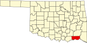 | |
| Towns | ||
| CDPs | ||
| Other unincorporated communities | ||
| Indian reservation | ||
| Footnotes | ‡This populated place also has portions in another county or counties | |
| Authority control databases: Geographic |
|---|