
Soltaniyeh County
Persian: شهرستان سلطانیه | |
|---|---|
 Location of Soltaniyeh County in Zanjan province (right, yellow) | |
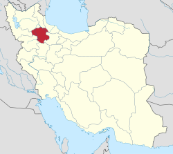 Location of Zanjan province in Iran | |
| Coordinates: 36°27′N 48°49′E / 36.450°N 48.817°E[1] | |
| Country | |
| Province | Zanjan |
| Capital | Soltaniyeh |
| Districts | Central, Bagh Helli |
| Area | |
| • Total | 1,358.8 km2 (524.6 sq mi) |
| Population (2016)[2] | |
| • Total | 29,480 |
| • Density | 22/km2 (56/sq mi) |
| Time zone | UTC+3:30 (IRST) |
Soltaniyeh County (Persian: شهرستان سلطانیه) is in Zanjan province, Iran. Its capital is the city of Soltaniyeh.[3] There is a large cave called Katale Khor near the capital city.[4]
History
After the 2011 National Census, Soltaniyeh District was separated from Abhar County in the establishment of Soltaniyeh County, which was divided into two districts of two rural districts each, with Soltaniyeh as its capital and only city.[3]
Demographics
Population
At the time of the 2016 National Census, the county's population was 29,480 in 9,130 households.[2]
Administrative divisions
Soltaniyeh County's population and administrative structure are shown in the following table.
| Administrative Divisions | 2016[2] |
|---|---|
| Central District | 17,987 |
| Soltaniyeh RD | 2,031 |
| Sonbolabad RD | 8,318 |
| Soltaniyeh (city) | 7,638 |
| Bagh Helli District | 11,493 |
| Guzal Darreh RD | 4,794 |
| Qarah Bolagh RD | 6,699 |
| Total | 29,480 |
| RD = Rural District | |
See also
![]() Media related to Soltaniyeh County at Wikimedia Commons
Media related to Soltaniyeh County at Wikimedia Commons
References
- ^ OpenStreetMap contributors (1 March 2024). "Soltaniyeh County" (Map). OpenStreetMap. Retrieved 1 March 2024.
- ^ a b c "Census of the Islamic Republic of Iran, 1395 (2016)". AMAR (in Persian). The Statistical Center of Iran. p. 19. Archived from the original (Excel) on 27 April 2022. Retrieved 19 December 2022.
- ^ a b "Zanjan became the owner of two cities and a new county". Islamic Republic News Agency (in Persian). Archived from the original on 14 October 2013. Retrieved 25 February 2023.
- ^ "Katale Khnor (English)". Hamyar Zangan Company. Archived from the original on 2 April 2015. Retrieved 26 April 2017.
Zanjan Province, Iran | ||||||||||||||||
|---|---|---|---|---|---|---|---|---|---|---|---|---|---|---|---|---|
Capital: Zanjan | ||||||||||||||||
| Counties and cities |
|  | ||||||||||||||
| Sights |
| |||||||||||||||
| populated places | ||||||||||||||||
| Capital | |||||||||||||||||||||
|---|---|---|---|---|---|---|---|---|---|---|---|---|---|---|---|---|---|---|---|---|---|
| Districts |
| ||||||||||||||||||||
This Zanjan province location article is a stub. You can help Wikipedia by expanding it. |