
Smirnykh
Смирных | |
|---|---|
 View of Smirnykh | |
Location of Smirnykh  | |
 Smirnykh Location of Smirnykh 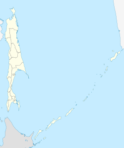 Smirnykh Smirnykh (Sakhalin Oblast) | |
| Coordinates: 49°45′N 142°50′E / 49.750°N 142.833°E | |
| Country | Russia |
| Federal subject | Sakhalin Oblast[1] |
| Administrative district | Smirnykhovsky District[1] |
| Population | |
| • Total | 7,399 |
| • Estimate (2018)[3] | 7,814 (+5.6%) |
| • Capital of | Smirnykhovsky District[1] |
| • Urban okrug | Smirnykhovsky Urban Okrug[4] |
| • Capital of | Smirnykhovsky Urban Okrug[4] |
| Time zone | UTC+11 (MSK+8 |
| Postal code(s)[6] | 694350 |
| Dialing code(s) | +7 42452[7] |
| OKTMO ID | 64746000051 |
Smirnykh (Russian: Смирных) is an urban locality (an urban-type settlement) and the administrative center of Smirnykhovsky District of Sakhalin Oblast, Russia, located in the central part of the Sakhalin Island. Population: 7,399 (2010 Census);[2] 7,561 (2002 Census);[8] 9,693 (1989 Census).[9]
History
During the period of Japanese rule over the southern half of Sakhalin from 1905-1945, its name was Keton (気屯). During fighting between Soviet and Japanese forces on the island during World War II, Battalion Commander Leonid Smirnykh and Sergeant Anton Buyukly were killed; the localities of Smyrnikh, Leonidovo, and Buyukly are named in their honor.
Administrative and municipal status
Within the framework of administrative divisions, Smirnykh serves as the administrative center of Smirnykhovsky District and is subordinated to it.[1] As a municipal division, the urban-type settlement of Smirnykh and thirteen rural localities of Smirnykhovsky District are incorporated as Smirnykhovsky Urban Okrug.[4]
Military
It was home to Smirnykh air base during the Cold War.
References
Notes
- ^ a b c d e Law #25-ZO
- ^ a b Russian Federal State Statistics Service (2011). Всероссийская перепись населения 2010 года. Том 1 [2010 All-Russian Population Census, vol. 1]. Всероссийская перепись населения 2010 года [2010 All-Russia Population Census] (in Russian). Federal State Statistics Service.
- ^ "26. Численность постоянного населения Российской Федерации по муниципальным образованиям на 1 января 2018 года". Federal State Statistics Service. Archived from the original on July 26, 2018. Retrieved January 23, 2019.
- ^ a b c Law #524
- ^ "Об исчислении времени". Официальный интернет-портал правовой информации (in Russian). June 3, 2011. Retrieved January 19, 2019.
- ^ Почта России. Информационно-вычислительный центр ОАСУ РПО. (Russian Post). Поиск объектов почтовой связи (Postal Objects Search) (in Russian)
- ^ Телефонные коды Сахалина - Dialing codes of Sakhalin (in Russian)
- ^ Russian Federal State Statistics Service (May 21, 2004). Численность населения России, субъектов Российской Федерации в составе федеральных округов, районов, городских поселений, сельских населённых пунктов – районных центров и сельских населённых пунктов с населением 3 тысячи и более человек [Population of Russia, Its Federal Districts, Federal Subjects, Districts, Urban Localities, Rural Localities—Administrative Centers, and Rural Localities with Population of Over 3,000] (XLS). Всероссийская перепись населения 2002 года [All-Russia Population Census of 2002] (in Russian).
- ^ Всесоюзная перепись населения 1989 г. Численность наличного населения союзных и автономных республик, автономных областей и округов, краёв, областей, районов, городских поселений и сёл-райцентров [All Union Population Census of 1989: Present Population of Union and Autonomous Republics, Autonomous Oblasts and Okrugs, Krais, Oblasts, Districts, Urban Settlements, and Villages Serving as District Administrative Centers]. Всесоюзная перепись населения 1989 года [All-Union Population Census of 1989] (in Russian). Институт демографии Национального исследовательского университета: Высшая школа экономики [Institute of Demography at the National Research University: Higher School of Economics]. 1989 – via Demoscope Weekly.
Sources
- Сахалинская областная Дума. Закон №25-ЗО от 23 марта 2011 г. «Об административно-территориальном устройстве Сахалинской области», в ред. Закона №62-ЗО от 27 июня 2013 г. «О внесении изменения в статью 10 Закона Сахалинской области "Об административно-территориальном устройстве Сахалинской области"». Вступил в силу 9 апреля 2011 г.. Опубликован: "Губернские ведомости", №55(3742), 29 марта 2011 г. (Sakhalin Oblast Duma. Law #25-ZO of March 23, 2011 On the Administrative-Territorial Structure of Sakhalin Oblast, as amended by the Law #62-ZO of June 27, 2013 On Amending Article 10 of the Law of Sakhalin Oblast "On the Administrative-Territorial Structure of Sakhalin Oblast". Effective as of April 9, 2011.).
- Сахалинская областная Дума. Закон №524 от 21 июля 2004 г. «О границах и статусе муниципальных образований в Сахалинской области», в ред. Закона №45-ЗО от 27 мая 2013 г. «О внесении изменения в Закон Сахалинской области "О границах и статусе муниципальных образований в Сахалинской области"». Вступил в силу 1 января 2005 г. Опубликован: "Губернские ведомости", №175–176(2111–2112), 31 июля 2004 г. (Sakhalin Oblast Duma. Law #524 of July 21, 2004 On the Borders and Status of the Municipal Formations in Sakhalin Oblast, as amended by the Law #45-ZO of May 27, 2013 On Amending the Law of Sakhalin Oblast "On the Borders and Status of the Municipal Formations in Sakhalin Oblast". Effective as of January 1, 2005.).
External links
| International | |
|---|---|
| National | |