
Slobodskoy
Слободской | |
|---|---|
 View of Slobodskoy | |
 Flag  Coat of arms | |
Location of Slobodskoy  | |
 Slobodskoy Location of Slobodskoy 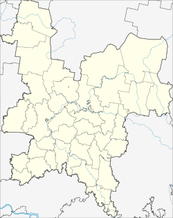 Slobodskoy Slobodskoy (Kirov Oblast) | |
| Coordinates: 58°43′15″N 50°11′06″E / 58.72083°N 50.18500°E | |
| Country | Russia |
| Federal subject | Kirov Oblast[1] |
| First mentioned | 1505 |
| Town status since | 1780 |
| Elevation | 140 m (460 ft) |
| Population | |
| • Total | 33,981 |
| • Estimate (2018)[3] | 32,793 (−3.5%) |
| • Subordinated to | Town of Slobodskoy[1] |
| • Capital of | Slobodskoy District,[1] Town of Slobodskoy[1] |
| • Urban okrug | Slobodskoy Urban Okrug[4] |
| • Capital of | Slobodskoy Urban Okrug,[4] Slobodskoy Municipal District[4] |
| Time zone | UTC+3 (MSK |
| Postal code(s)[6] | 613150 |
| OKTMO ID | 33713000001 |
| Website | www |
Slobodskoy (Russian: Слободско́й) is a town in Kirov Oblast, Russia, located on the right bank of the Vyatka River, 35 kilometers (22 mi) northeast of Kirov. Population: 33,981 (2010 Census);[2] 33,477 (2002 Census);[7] 39,249 (1989 Census).[8]
YouTube Encyclopedic
-
1/3Views:1 098907427
-
Mission 1:27 - Slobodskoy Smiles
-
Russia through a train window / Россия через окно поезда
-
Путешественник Илья Фролов.Слободской.Пеший марш бросок Выборг Владивосток
Transcription
History
It was first mentioned in 1505 as a fortified settlement.[citation needed] From 1562 it was known as Slobodskoy posad (Слободско́й поса́д). It has had town status since 1780.[citation needed]
Slobodskoy is one of the oldest towns in Kirov Oblast. It appeared after joining Vyatka region to Moscow in 1489. For the first time Slobodskoy was mentioned in the charter of Ivan the Terrible in 1505. This year is considered to be the year of its foundation. In Slobodskoy there was the Kremlin castle, from the south it was defended by a large moat, from the east by the bank of the Vyatka and from the north by a large ravine. In the Kremlin there were three churches made of wood. At that time there were 154 houses and nearly 600 people lived here. The site of the town was chosen rather well. It was a place of forests and endless grasslands. In the forests there were a lot of animals and the rivers were full of fish.
Russians arrived in the 12th century. They were peasants who built the villages on the bank of the Vyatka River. They were from Novgorod, Ustyug, and Suzdal. The peasants were occupied with agriculture; they fed cattle, grew vegetables, and liked fishing and hunting. Slobodskoy province was connected with other provinces by highways and a river system. Natives used those routes for trading. The highway on which Slobodskoy was situated was also the way of the Russian sovereign from Moscow to far Siberia. That highway played a great role in the fate of the town. It had become an outpost and a trade center in the north of Vyatka by the beginning of the 17th century.
In the 17th century Slobodskoy became an uyezd seat with its own government. Since 1784, Slobodskoy began to be built according to the plan of Catherine the Great. In the 18th and 19th centuries, brick houses in the spirit of provincial classic appeared in the main street.
Administrative and municipal status
Within the framework of administrative divisions, Slobodskoy serves as the administrative center of Slobodskoy District, even though it is not a part of it.[1] As an administrative division, it is, together with four rural localities, incorporated separately as the Town of Slobodskoy—an administrative unit with the status equal to that of the districts.[1] As a municipal division, the Town of Slobodskoy is incorporated as Slobodskoy Urban Okrug.[4]
References
Notes
- ^ a b c d e f g Law #387-ZO
- ^ a b Russian Federal State Statistics Service (2011). Всероссийская перепись населения 2010 года. Том 1 [2010 All-Russian Population Census, vol. 1]. Всероссийская перепись населения 2010 года [2010 All-Russia Population Census] (in Russian). Federal State Statistics Service.
- ^ "26. Численность постоянного населения Российской Федерации по муниципальным образованиям на 1 января 2018 года". Federal State Statistics Service. Retrieved January 23, 2019.
- ^ a b c d Law #284-ZO
- ^ "Об исчислении времени". Официальный интернет-портал правовой информации (in Russian). June 3, 2011. Retrieved January 19, 2019.
- ^ Почта России. Информационно-вычислительный центр ОАСУ РПО. (Russian Post). Поиск объектов почтовой связи (Postal Objects Search) (in Russian)
- ^ Russian Federal State Statistics Service (May 21, 2004). Численность населения России, субъектов Российской Федерации в составе федеральных округов, районов, городских поселений, сельских населённых пунктов – районных центров и сельских населённых пунктов с населением 3 тысячи и более человек [Population of Russia, Its Federal Districts, Federal Subjects, Districts, Urban Localities, Rural Localities—Administrative Centers, and Rural Localities with Population of Over 3,000] (XLS). Всероссийская перепись населения 2002 года [All-Russia Population Census of 2002] (in Russian).
- ^ Всесоюзная перепись населения 1989 г. Численность наличного населения союзных и автономных республик, автономных областей и округов, краёв, областей, районов, городских поселений и сёл-райцентров [All Union Population Census of 1989: Present Population of Union and Autonomous Republics, Autonomous Oblasts and Okrugs, Krais, Oblasts, Districts, Urban Settlements, and Villages Serving as District Administrative Centers]. Всесоюзная перепись населения 1989 года [All-Union Population Census of 1989] (in Russian). Институт демографии Национального исследовательского университета: Высшая школа экономики [Institute of Demography at the National Research University: Higher School of Economics]. 1989 – via Demoscope Weekly.
Sources
- Законодательное Собрание Кировской области. Закон №387-ЗО от 2 декабря 2005 г. «Об административно-территориальном устройстве Кировской области», в ред. Закона №249-ЗО от 29 декабря 2012 г. «О внесении изменений в Закон Кировской области "Об административно-территориальном устройстве Кировской области"». Вступил в силу со дня официального опубликования. Опубликован: "Вятский край", №228–228 (3635–3636), 13 декабря 2005 г. (Legislative Assembly of Kirov Oblast. Law #387-ZO of December 2, 2005 On the Administrative-Territorial Structure of Kirov Oblast, as amended by the Law #249-ZO of December 29, 2012 On Amending the Law of Kirov Oblast "On the Administrative-Territorial Structure of Kirov Oblast". Effective as of the day of the official publication.).
- Законодательное Собрание Кировской области. Закон №284-ЗО от 7 декабря 2004 г. «Об установлении границ муниципальных образований Кировской области и наделении их статусом муниципального района, городского округа, городского поселения, сельского поселения», в ред. Закона №350-ЗО от 11 ноября 2013 г. «О внесении изменений в отдельные Законы Кировской области». Вступил в силу по истечении 10 дней со дня официального опубликования. Опубликован: "Вятский край", №233–234 (3401–3402), 21 декабря 2004 г. (Legislative Assembly of Kirov Oblast. Law #284-ZO of December 7, 2004 On Establishing the Borders of the Municipal Formations of Kirov Oblast and on Granting Them the Municipal District, Urban Okrug, Urban Settlement, Rural Settlement Status, as amended by the Law #350-ZO of November 11, 2013 On Amending Various Laws of Kirov Oblast. Effective as of after 10 days from the day of the official publication.).
| International | |
|---|---|
| National | |