
Skyline View, Pennsylvania | |
|---|---|
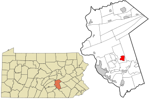 Location in Dauphin County and state of Pennsylvania. | |
| Coordinates: 40°20′11″N 76°43′22″W / 40.33639°N 76.72278°W | |
| Country | United States |
| State | Pennsylvania |
| County | Dauphin |
| Township | West Hanover |
| Area | |
| • Total | 2.67 sq mi (6.92 km2) |
| • Land | 2.67 sq mi (6.92 km2) |
| • Water | 0.00 sq mi (0.00 km2) |
| Elevation | 503 ft (153 m) |
| Population | |
| • Total | 4,410 |
| • Density | 1,649.83/sq mi (637.07/km2) |
| Time zone | UTC-5 (Eastern (EST)) |
| • Summer (DST) | UTC-4 (EDT) |
| ZIP code | 17112[3] |
| Area code | 717 |
| FIPS code | 42-71032 |
| GNIS feature ID | 1187769 |
Skyline View is an unincorporated community and census-designated place (CDP) in West Hanover Township, Dauphin County, Pennsylvania, United States. The population was 4,003 at the 2010 census,[4] up from 2,307 at the 2000 census. It is part of the Harrisburg–Carlisle Metropolitan Statistical Area.
YouTube Encyclopedic
-
1/5Views:18 7835 83911 1076 3682 307
-
Downtown Pittsburgh - 4K AERIAL DRONE SKYLINE TOUR
-
Awesome Philadelphia Skyline Views in 5k (2022)
-
Philadelphia Skyline My Drone Footage | Pennsylvania🇺🇸 |4K| Aerial Footage | Downtown| Diary Of TK
-
Philadelphia Skyline at Night Screensaver | City Drone Footage 4K
-
PHILADELPHIA - 4K AERIAL DRONE SKYLINE TOUR
Transcription
Geography
Skyline View is located in southern West Hanover Township at 40°20′11″N 76°43′22″W / 40.33639°N 76.72278°W (40.336439, -76.722848).[5] Its northern border follows Interstate 81, and its eastern border follows Pennsylvania Route 39. U.S. Route 22 (Allentown Boulevard) runs through the center of the community, leading east 70 miles (110 km) to Allentown and west 10 miles (16 km) to downtown Harrisburg. PA 39 leads south 6 miles (10 km) to Hershey.
According to the United States Census Bureau, the Skyline View CDP has a total area of 2.7 square miles (6.9 km2), all land.[4]
Demographics
As of the census[6] of 2000, there were 2,307 people, 865 households, and 703 families residing in the CDP. The population density was 867.7 inhabitants per square mile (335.0/km2). There were 890 housing units at an average density of 334.8 per square mile (129.3/km2). The racial makeup of the CDP was 97.01% White, 1.08% African American, 1.30% Asian, 0.04% Pacific Islander, 0.09% from other races, and 0.48% from two or more races. Hispanic or Latino of any race were 0.61% of the population.
There were 865 households, out of which 28.9% had children under the age of 18 living with them, 72.0% were married couples living together, 6.7% had a female householder with no husband present, and 18.7% were non-families. 15.8% of all households were made up of individuals, and 6.9% had someone living alone who was 65 years of age or older. The average household size was 2.67 and the average family size was 2.95.
In the CDP, the population was spread out, with 22.6% under the age of 18, 5.5% from 18 to 24, 27.2% from 25 to 44, 30.8% from 45 to 64, and 13.9% who were 65 years of age or older. The median age was 42 years. For every 100 females, there were 100.1 males. For every 100 females age 18 and over, there were 94.7 males.
The median income for a household in the CDP was $54,853, and the median income for a family was $61,439. Males had a median income of $40,216 versus $35,708 for females. The per capita income for the CDP was $23,418. About 1.2% of families and 2.4% of the population were below the poverty line, including none of those under age 18 and 6.5% of those age 65 or over.
| Census | Pop. | Note | %± |
|---|---|---|---|
| 2000 | 2,307 | — | |
| 2010 | 4,003 | 73.5% | |
| 2020 | 4,410 | 10.2% | |
| U.S. Decennial Census[7] | |||
References
- ^ "ArcGIS REST Services Directory". United States Census Bureau. Retrieved October 16, 2022.
- ^ "Census Population API". United States Census Bureau. Retrieved October 12, 2022.
- ^ "Skyline View PA ZIP Code". zipdatamaps.com. 2023. Retrieved May 13, 2023.
- ^ a b "Geographic Identifiers: 2010 Demographic Profile Data (G001): Skyline View CDP, Pennsylvania". U.S. Census Bureau, American Factfinder. Archived from the original on February 13, 2020. Retrieved December 23, 2015.
- ^ "US Gazetteer files: 2010, 2000, and 1990". United States Census Bureau. February 12, 2011. Retrieved April 23, 2011.
- ^ "U.S. Census website". United States Census Bureau. Retrieved January 31, 2008.
- ^ "Census of Population and Housing". Census.gov. Retrieved June 4, 2016.
