
Sinagoga | |
|---|---|
Settlement | |
 Sinagoga | |
| Coordinates: 17°10′41″N 25°01′55″W / 17.178°N 25.032°W | |
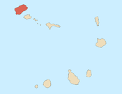
| Country | Cape Verde |
| Island | Santo Antão |
| Municipality | Ribeira Grande |
| Civil parish | Nossa Senhora do Rosário |
| Elevation | 16 m (52 ft) |
| Population (2010)[1] | |
| • Total | 603 |
| ID | 11106 |
Sinagoga is a settlement in the northeastern part of the island of Santo Antão, Cape Verde. It is situated on the coast, 4 kilometers east of Ribeira Grande and 18 km north-northeast of the island capital Porto Novo. It is situated on the national road connecting Ribeira Grande and Pombas (EN1-SA02).
Its name means "synagogue" in Portuguese. The village was founded by Jewish Miguelist immigrants from the Azores who came to Santa Antao in aftermath of the Liberal Wars in Portugal.[2] Surnames of Jewish origin can still be found in the area.[3]
YouTube Encyclopedic
-
1/3Views:30 3793 72120 016
-
¿CÓMO ES UNA SINAGOGA?
-
Torah reading at the Synagogue - Lectura de la Torá en la Sinagoga
-
Qué esperar dentro de una sinagoga
Transcription
Climate
Sinagoga has a hot desert climate. The annual rainfall is 291 millimeters. The average annual temperature is 23.4 °C (74.1 °F).[4]
| Climate data for Sinagoga, 0 metres ASL | |||||||||||||
|---|---|---|---|---|---|---|---|---|---|---|---|---|---|
| Month | Jan | Feb | Mar | Apr | May | Jun | Jul | Aug | Sep | Oct | Nov | Dec | Year |
| Mean daily maximum °C (°F) | 23.3 (73.9) |
23.1 (73.6) |
23.6 (74.5) |
24.1 (75.4) |
24.9 (76.8) |
25.6 (78.1) |
26.4 (79.5) |
27.4 (81.3) |
27.6 (81.7) |
27.4 (81.3) |
26.4 (79.5) |
24.3 (75.7) |
25.3 (77.5) |
| Daily mean °C (°F) | 21.4 (70.5) |
21.2 (70.2) |
21.5 (70.7) |
21.9 (71.4) |
22.7 (72.9) |
23.6 (74.5) |
24.3 (75.7) |
25.4 (77.7) |
25.8 (78.4) |
25.5 (77.9) |
24.4 (75.9) |
22.6 (72.7) |
23.4 (74.1) |
| Mean daily minimum °C (°F) | 19.6 (67.3) |
19.3 (66.7) |
19.5 (67.1) |
19.8 (67.6) |
20.6 (69.1) |
21.7 (71.1) |
22.3 (72.1) |
23.5 (74.3) |
24.1 (75.4) |
23.7 (74.7) |
22.5 (72.5) |
21.0 (69.8) |
21.5 (70.7) |
| Average rainfall mm (inches) | 14 (0.6) |
5 (0.2) |
1 (0.0) |
0 (0) |
0 (0) |
0 (0) |
11 (0.4) |
44 (1.7) |
128 (5.0) |
44 (1.7) |
26 (1.0) |
18 (0.7) |
291 (11.3) |
| Source: [4] | |||||||||||||
See also
References
- ^ "2010 Census results". Instituto Nacional de Estatística Cabo Verde (in Portuguese). 24 November 2016.
- ^ Brooks, George E. (2006). "Cabo Verde: Gulag of the South Atlantic: Racism, Fishing Prohibitions, and Famines". History in Africa. 33: 131. Retrieved 28 December 2023.
- ^ Aldeia de Sinagoga em Santo Antão, Isa Lima Fernandes, 2005, p. 20-21
- ^ a b Climate-Data.ORG
Subdivisions of the island of Santo Antão | |||||||||
|---|---|---|---|---|---|---|---|---|---|
| Paul |
|  | |||||||
| Porto Novo |
| ||||||||
| Ribeira Grande |
| ||||||||