
 Location of Simonszand | |
| Geography | |
|---|---|
| Coordinates | 53°31′N 6°24′E / 53.517°N 6.400°E |
| Archipelago | (West) Frisian Islands |
| Adjacent to | North Sea Wadden Sea |
| Administration | |
Netherlands | |
| Province | Groningen |
| Municipality | Het Hogeland |
| Demographics | |
| Population | Uninhabited |
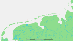
Simonszand (Dutch pronunciation: [ˈsimɔn(s)ˌsɑnt]) is a sandbank between the West Frisian Islands of Schiermonnikoog and Rottumerplaat in the Netherlands. It is located in the municipality of Het Hogeland in the province of Groningen.
The sandbank was originally mapped as being an Intertidal zone in approximately 1811, but changed in later mappings to be shown as a Supratidal zone after it became larger and migrated seaward.[1]
YouTube Encyclopedic
-
1/3Views:1 8315332 397
-
Schiermonnikoog - Last sunlight at schiermonnikoog - Impressions of a waddeneiland in the north sea.
-
Broederschool Sint-Niklaas : Saeftinghe 2017
-
Hollandia's Glorie: Zeehonden op Simonszand
Transcription
References
- ^ van der Velde, L. (1995). "Geologica Ultraiectina". Geologica Ultraiectina. 125–126. ISBN 9789071577796.
External links
 Media related to Simonszand at Wikimedia Commons
| West Frisian Islands (Netherlands) |
|  | |||||
|---|---|---|---|---|---|---|---|
| East Frisian Islands (Germany) |
| ||||||
| Heligoland Bight (Germany) | |||||||
| North Frisian Islands (Germany) |
| ||||||
| Danish Wadden Sea Islands (Denmark) |
| ||||||
This Groningen location article is a stub. You can help Wikipedia by expanding it. |