
| Silot Lagoon | |
|---|---|
 | |
 Silot Lagoon 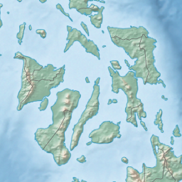 Silot Lagoon | |
| Coordinates | 10°23′30″N 123°59′40″E / 10.39167°N 123.99444°E |
| Type | Lagoon |
| Primary outflows | Camotes Sea |
| Basin countries | Philippines |
| Max. length | 1.4 km (0.87 mi) |
| Max. width | 1.2 km (0.75 mi) |
| Settlements | Liloan, Cebu |
Silot Lagoon (more widely and erroneously known as Silot Bay) is a shallow body of water located in the municipality of Liloan, Cebu in the Philippines. It is a lagoon surrounded by mangroves that is connected to the Camotes Sea by a narrow channel called the Liloan River.[1] The lagoon has depths of between 1–2 feet (0.30–0.61 m) and is situated just south of Liloan's poblacion. It is bounded to the east by the village of Catarman, to the west by Yati, and to the south by Tayud. It has sandbars near its outlet at Liloan River.[1]
Geography

Silot Lagoon is roughly circular in shape and measures around 1.4 kilometers (0.87 mi) long and 1.2 kilometers (0.75 mi) wide.[2] Its waters flows to the Camotes Sea[2] through a short channel known as the Liloan River.[1] The waters in the river's mouth is prone to swirling current. The lagoon is surrounded by a ridge around 25 meters (82 ft) high above sea level.[2] It separates two of the town's barangays which are connected through a bridge. The name of Liloan town, reportedly came from the lagoon's current; from lilo or the Cebuano word for whirlpool.[3]
In 2000, the Department of Environment and Natural Resources' (DENR) Environmental Management Bureau gave Silot Lagoon an "SB" classification,[4] which meant that the lagoon host "fishery water suitable for commercial propagation of shellfish and intended as spawning areas for milkfish and similar species"[5]
Use

The lagoon is traditional fishing grounds for tilapia, groupers (Lapu-Lapu) and shrimps. It is also frequented by bathers. Several resorts can be found along Silot Lagoon's coastline;[3] including Silot Beach Resort, commonly known as Pilapil Park, and Papa Kit's Marina and Fishing Lagoon. The latter is owned by Democrito Mendoza.[6]
Property dispute
The 92 hectares (230 acres) property of trade union leader Democrito Mendoza in Silot Lagoon has been a subject of a local dispute.[7] Mendoza's first commercial involvement in the Silot Lagoon was in 1954 when he secured a fishpond permit. Taking advantage of President Ferdinand Marcos's order to the Bureau of Forestry to release all fish pond areas to the Bureau of Lands as "alienable and disposable" in 1967, he was able to acquire a property in the lagoon in 1974 with then-Liloan Mayor Cesar Bugtai opposing his bid. The Department of Environment and Natural Resources in 1990 attempted to retrieve Mendoza's property for the government through legal means but the Supreme Court ruled in 2007 in favor of Mendoza.[8]
In 2014, Mendoza erected fencing around his property in the lagoon which local fishers complained that this has bared them access from the lagoon's fishing grounds[9] and alleged that the fencing was made in preparation of developing the enclosed property into a water park.[3] The structure was shortly demolished following protests.[10]
References
- ^ a b c Department of Commerce U.S. Coast and Geodetic Survey (1919). United States Coast Pilot, Philippine Islands, Part 1. E. Lester Jones, Superintendent. Washington D.C.: U.S. Government Printing Office. p. 259. Retrieved October 7, 2020.
- ^ a b c "The Roadmap Study for Sustainable Urban Development in Metro Cebu - Supporting Report 2: Roadmap Plan" (PDF). Open JICA Report (Final Report). ALMEC Corporation, Oriental Consultants Global Co., Ltd.: 2–40 June 2015.
- ^ a b c Asutilla, Carine (February 4, 2014). "Locals protest fencing of Silot Bay". ABS-CBN News. Retrieved October 2, 2020.
- ^ "Region 7, List of Waterbodies". DENR Environmental Management Bureau - Water Quality Management Section. Retrieved October 2, 2020.
- ^ "DENR Classifies 35 more water bodies". Department of Environment and Natural Resources. April 9, 2019. Retrieved 2 October 2020.
- ^ Mayol, Ador Vincent; Asutilla, Carine (February 4, 2014). "Lilo-an folk protest fencing of Silot Bay by Mendozas". Cebu Daily News. Retrieved October 2, 2020.
- ^ Asutilla, Carine; Romanillos, Peter (February 7, 2014). "DENR checking if Silot Bay fence within property limits". Cebu Daily News. Retrieved 2 October 2020.
- ^ Mayol, Ador Vincent (February 4, 2014). "How Silot Bay ended up privately owned". Cebu Daily News. Retrieved October 2, 2020.
- ^ Gitgano, Flornisa (February 5, 2014). "Silot Bay case needs review". Sun Star. Retrieved 2 October 2020.
- ^ Gitgano, Flornisa (February 7, 2014). "Silot Bay cleared of fences, says Mendoza". Sun Star. Retrieved October 2, 2020.