
| Sibagat River | |
|---|---|
 Sibagat River in Sibagat, Agusan del Sur | |
 Sibagat River mouth  Sibagat River (Philippines) | |
| Native name | Ilog Sibagat (Tagalog) |
| Location | |
| Country | Philippines |
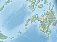
| Region | Caraga |
| Province | Agusan del Sur |
| Municipality | Sibagat |
| Physical characteristics | |
| Source | |
| • location | Sibagat, Agusan del Sur, Caraga Region |
| Mouth | Wawa River |
• location | Poblacion, Sibagat, Agusan del Sur |
• coordinates | 8°49′46.99″N 125°41′53.01″E / 8.8297194°N 125.6980583°E |
| Length | 24 km (15 mi) |
| Basin size | 12 km2 (4.6 sq mi) |
| Discharge | |
| • location | Wawa River |
| • average | 38 m3/s (1,300 cu ft/s) |
| Basin features | |
| Progression | Sibagat–Wawa–Agusan |
The Sibagat River (Tagalog: Ilog Sibagat; Cebuano: Suba sa Sibagat) is a stream located in Sibagat, Agusan del Sur, Caraga Region, Philippines.[1] It is a tributary of the larger Wawa River with headwaters located in the northeastern mountain boundaries of Sibagat and Butuan.
YouTube Encyclopedic
-
1/2Views:548970
-
List of Philippines-related topics | Wikipedia audio article
-
Outline of the Philippines | Wikipedia audio article
Transcription
Etymology
The Sibagat River is named after its town's name Sibagat that comes from the word bagat which means meet or meeting place. According to oral history, the Sibagat River is the place where warring tribes met and fought. The losing tribe would retreat downstream to the Wawa River and disappear.[2][3][4]
Geography
The Sibagat River headwaters originate from the hinterlands of Barangay Pianing in Butuan and traverses along the riverbank barangay of Bugsukan, also in Butuan, and the barangays of Tabontabon, Afga, El Rio, Mahayahay and Poblacion in Sibagat where its mouth located in Sitio Sabang met with the larger Wawa River. The Wawa River is the largest river in the town and a tributary river to the Agusan River.
Crossings
There are three permanent bridges that cross the Sibagat River
- Camponay Bridge – Brgy. Tabontabon, connecting the road linking NRJ-Tabontabon to Sta. Maria-Sta. Cruz-Banagbanag-Perez Road
- Mahayahay Bridge – Brgy. Mahayahay, connecting the road linking NRJ-Mahayahay to Del Rosario-San Isidro-Magsaysay-Banagbanag-New Tubigon-Tandag Road
- Sibagat Bridge – Brgy. Poblacion, a steel bridge connecting the road linking NRJ-Sibagat to Villangit-San Isidro-Magsaysay-Banagbanag-New Tubigon-Tandag Road
Tributaries
See also
- Agusan River
- Wawa River (Agusan del Sur)
- Tambagoko River
- Boguko River
- Andanan River
- Sibagat, Agusan del Sur
- Agusan del Sur Province
- List of rivers of the Philippines
References
- ^ "Sibagat River". geoview.info.
- ^ "Satellite map of Sibagat River".
- ^ James Barcelona on February 25, 2015. "Sibagat, Agusan del Sur, Philippines".
{{cite web}}: CS1 maint: numeric names: authors list (link) - ^ Agusan del Sur The Land of Golden Opportunities. "Municipality of Sibagat".