
Shortepa
شور تیپه | |
|---|---|
 Shortepa Location within Afghanistan[1] | |
| Coordinates: 37°15′36″N 66°51′00″E / 37.26000°N 66.85000°E | |
| Country | |
| Province | Balkh |
| Elevation | 274 m (899 ft) |
| Population (2012) | |
| • Total | 38,500 |
Shortepa also Shor Tappeh (Dari: شور تیپه) (population 38,500)[2] is one of the 15 districts of Balkh province. Shortepa, a small district in Balkh Province, Afghanistan. It is situated along the Amu Darya river, across the border with Termez, Uzbekistan, and to the east Kaldar. The main village is Shor Tappeh, A (37°20′10″N 66°49′12″E / 37.3361°N 66.8200°E) at 274 m altitude.
Economy
The vast majority of villagers work in agriculture on farms along the coast. In the village of Joi Wakil there is a clinic which serves the spars district.
Demographics
According to the 2023 census, there are 44357 people residing in the seven villages. 19,800 or 51.5% of villagers were males and 18,700 or 48.5% were females. With a multi-ethnic and mostly Persian-speaking society.[3] The major ethnic group is the Tajiks with the vast population belonging to them followed by Pashtoons, Uzbek, Hazaras, Turkman, Arab and Baluch. Shortepa also has a small but noticeable population of Kuchis or nomads whose numbers vary in different seasons with numbers going down in the winter and up in the summer.
Villages
- Tash Guzar
- Hazareh Toghay
- Boria Baf
- Tokhom Geldi
- Arigh Batur
- Joi Wakli
- Chub Bash
References
- ^ "District Names". National Democratic Institute. Retrieved 7 August 2015.
- ^ "Settled Population of Balkh Province" (PDF). Central Statistics Organisation. Retrieved 7 August 2015.
- ^ "Balkh Province". Program for Culture & Conflict Studies. Naval Postgraduate School. Archived from the original on May 29, 2012. Retrieved 2013-06-16.
- ^ "Archived copy" (PDF). Archived from the original (PDF) on 2019-01-06. Retrieved 2019-01-06.
{{cite web}}: CS1 maint: archived copy as title (link)
External links
- Map of Shortepa (PDF)
| Districts | 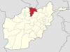 | |
|---|---|---|
| Landforms | ||
| Landmarks and culture | ||
This Balkh Province, Afghanistan location article is a stub. You can help Wikipedia by expanding it. |