
| Shire of Loddon Victoria | |||||||||||||||
|---|---|---|---|---|---|---|---|---|---|---|---|---|---|---|---|
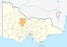 Location in Victoria | |||||||||||||||
| Population | 7,759 (2021)[1] | ||||||||||||||
| • Density | 1.15875/km2 (3.0012/sq mi) | ||||||||||||||
| Established | 1995 | ||||||||||||||
| Gazetted | 19 January 1995[2] | ||||||||||||||
| Area | 6,696 km2 (2,585.3 sq mi)[1] | ||||||||||||||
| Mayor | Cr Dan Straub | ||||||||||||||
| Council seat | Wedderburn | ||||||||||||||
| Region | Loddon Mallee | ||||||||||||||
| State electorate(s) | |||||||||||||||
| Federal division(s) | Mallee | ||||||||||||||
| Website | Shire of Loddon | ||||||||||||||
| |||||||||||||||
The Shire of Loddon is a local government area in Victoria, Australia, located in the northern part of the state. It covers an area of 6,696 square kilometres (2,585 sq mi) and in 2021 had a population of 7,759.[3]
It includes the towns of Inglewood, Boort, Serpentine, Pyramid Hill and Wedderburn. It was formed in 1995 from the amalgamation of the Shire of East Loddon, Shire of Gordon, Shire of Korong, and parts of the Rural City of Marong, Shire of Bet Bet, Shire of Maldon and Shire of Tullaroop.[2]
The Shire is governed and administered by the Loddon Shire Council; its seat of local government and administrative centre is located at the council headquarters in Wedderburn, it also has a service centre located in Serpentine. The Shire is named after the Loddon River, a major geographical feature that meanders through the LGA.
YouTube Encyclopedic
-
1/2Views:4181 177
-
Dr Khaled El-Shiekh on NBN4 Mildura Wentworth Loddon Mallee
-
Operation Next Gen: Simon & Kym Priest
Transcription
Council
Current composition
The council is composed of five wards and five councillors, with one councillor per ward elected to represent each ward.[4]
| Ward | Councillor | Notes | |
|---|---|---|---|
| Boort | Neil Beattie | ||
| Inglewood | Wendy Murphy | ||
| Tarnagulla | Linda Jungwirth | ||
| Terrick | Dan Straub | Mayor | |
| Wedderburn | Gavan Holt | ||
Administration and governance
The council meets in the council chambers at the Wedderburn Municipal Offices. It also provides customer services at both its administrative centre in Wedderburn, and its service centre in Serpentine.
Traditional owners
The Dja Dja Wurrung and Barababaraba are the traditional owners of this land.[5]
Townships and localities
The 2021 census recorded the shire's population of 7,759, compared to 7,516 in the 2016 census.[6]
| Population | ||
|---|---|---|
| Locality | 2016 | 2021 |
| Appin South^ | 29 | 38 |
| Arnold | 47 | 56 |
| Arnold West | 22 | 19 |
| Auchmore | 13 | 5 |
| Barraport | 37 | 45 |
| Barraport West | 10 | 5 |
| Bealiba^ | 206 | 213 |
| Bears Lagoon | 72 | 53 |
| Berrimal | 46 | 52 |
| Boort | 873 | 940 |
| Borung | 82 | 59 |
| Brenanah | 28 | 29 |
| Bridgewater | 142 | 133 |
| Bridgewater North | 57 | 54 |
| Bridgewater On Loddon | 326 | 341 |
| Buckrabanyule^ | 51 | 52 |
| Burkes Flat | 14 | 20 |
| Calivil | 178 | 178 |
| Campbells Forest | 45 | 50 |
| Canary Island | 10 | 4 |
| Catumnal | 18 | 14 |
| Cochranes Creek | 9 | 9 |
| Coonooer Bridge^ | 31 | 30 |
| Derby | 17 | 18 |
| Dingee | 206 | 195 |
| Dunolly^ | 893 | 899 |
| Durham Ox | 74 | 60 |
| Population | ||
|---|---|---|
| Locality | 2016 | 2021 |
| Eastville^ | 24 | 13 |
| Eddington^ | 96 | 113 |
| Emu^ | 32 | 37 |
| Fentons Creek | 24 | 27 |
| Fernihurst | 20 | 32 |
| Fiery Flat | 25 | 28 |
| Gladfield | 24 | 32 |
| Glenalbyn | 19 | 21 |
| Glenloth East^ | 13 | 14 |
| Goldsborough^ | 36 | 37 |
| Gowar East^ | 20 | 23 |
| Gredgwin^ | 15 | 13 |
| Horfield^ | 91 | 93 |
| Inglewood | 855 | 886 |
| Inkerman^ | * | # |
| Jarklin | 37 | 49 |
| Jungaburra | 0 | 0 |
| Kamarooka^ | 92 | 89 |
| Kamarooka North | 15 | 9 |
| Kingower | 32 | 46 |
| Kinypanial | 11 | 12 |
| Korong Vale | 168 | 143 |
| Kurraca | 7 | 5 |
| Kurraca West | 10 | 0 |
| Kurting | 53 | 61 |
| Laanecoorie | 177 | 179 |
| Lake Marmal^ | 21 | 21 |
| Population | ||
|---|---|---|
| Locality | 2016 | 2021 |
| Lake Meran^ | 23 | 22 |
| Leaghur | 19 | 20 |
| Leichardt^ | 125 | 167 |
| Leitchville^ | 558 | 576 |
| Llanelly | 38 | 62 |
| Loddon Vale | 31 | 24 |
| Logan^ | 53 | 59 |
| Macorna^ | 87 | 67 |
| Marong^ | 1,416 | 2,005 |
| McIntyre | 42 | 47 |
| Meering West^ | 13 | 12 |
| Milloo^ | 35 | 37 |
| Mincha | 50 | 62 |
| Minmindie | 21 | 13 |
| Mitiamo^ | 117 | 116 |
| Moliagul^ | 88 | 80 |
| Mologa | 29 | 20 |
| Murphys Creek | 37 | 46 |
| Mysia | 43 | 26 |
| Newbridge | 192 | 171 |
| Nine Mile^ | 22 | 19 |
| Painswick | 5 | 14 |
| Pompapiel | 50 | 38 |
| Powlett Plains | 42 | 38 |
| Prairie | 66 | 37 |
| Pyramid Hill | 558 | 598 |
| Raywood^ | 318 | 329 |
| Population | ||
|---|---|---|
| Locality | 2016 | 2021 |
| Rheola | 56 | 52 |
| Richmond Plains^ | 3 | 9 |
| Salisbury West | 21 | 38 |
| Sebastian^ | 217 | 251 |
| Serpentine | 192 | 222 |
| Shelbourne^ | 452 | 423 |
| Skinners Flat | 26 | 27 |
| Slaty Creek^ | 37 | 34 |
| Sylvaterre | 17 | 22 |
| Tandarra | 48 | 55 |
| Tarnagulla | 133 | 153 |
| Terrappee^ | 22 | 20 |
| Terrick Terrick | 11 | 8 |
| Waanyarra | 22 | 57 |
| Wedderburn | 941 | 951 |
| Wedderburn Junction | 20 | 20 |
| Wehla | 39 | 41 |
| Woodstock On Loddon | 28 | 36 |
| Woodstock West | 41 | 45 |
| Woolshed Flat | 3 | 13 |
| Woosang^ | 11 | 12 |
| Wychitella | 31 | 29 |
| Wychitella North | 9 | 18 |
| Yando | 40 | 45 |
| Yarraberb | 23 | 17 |
| Yarrawalla | 90 | 78 |
| Yeungroon East^ | 16 | 11 |
^ - Territory divided with another LGA
* - Not noted in 2016 Census
# - Not noted in 2021 Census


See also
References
- ^ a b "2021 Census All persons QuickStats - Loddon LGA". Australian Bureau of Statistics. 2021. Retrieved 12 August 2022. Estimated resident population, 2022.
- ^ a b Victoria Government Gazette – Online Archive (1837–1997). "S2 of 1995: Order estg (Part 7) the Shire of Loddon". State Library of Victoria. State Government of Victoria (published 19 January 1995). p. 3. Retrieved 10 January 2014.
- ^ "2021 Loddon, Census All persons QuickStats | Australian Bureau of Statistics". www.abs.gov.au. Retrieved 12 August 2022.
- ^ Local Government in Victoria. "Loddon Shire Council". Department of Transport, Planning and Local Infrastructure. State Government of Victoria. Retrieved 10 January 2014.
- ^ "Loddon Aboriginal Community Partnership Plan 2019-2022" (PDF). Shire of Loddon. 23 October 2022.
- ^ "Census | Australian Bureau of Statistics". www.abs.gov.au. 11 January 2023.
External links
- Loddon Shire Council official website
- Metlink local public transport map
- Link to Land Victoria interactive maps
- Loddon Shire Promotional, Events & Investment Website
Localities in the Shire of Loddon | ||
|---|---|---|
| Town |  | |
| Locality |
| |
^ - Territory divided with another LGA | ||
36°25′06″S 143°52′00″E / 36.41833°S 143.86667°E