
| Shire of Fitzroy Queensland | |||||||||||||||
|---|---|---|---|---|---|---|---|---|---|---|---|---|---|---|---|
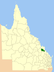 Location within Queensland | |||||||||||||||
| Population | 10,310 (2006 census)[1] | ||||||||||||||
| • Density | 1.7478/km2 (4.5269/sq mi) | ||||||||||||||
| Established | 1899 | ||||||||||||||
| Area | 5,898.7 km2 (2,277.5 sq mi) | ||||||||||||||
| Council seat | Gracemere | ||||||||||||||
| Region | Capricornia | ||||||||||||||
| Website | Shire of Fitzroy | ||||||||||||||
| |||||||||||||||
The Shire of Fitzroy was a local government area located in the Capricornia region of Central Queensland, Queensland, Australia, to the immediate west and south of the regional city of Rockhampton. The shire, administered from the town of Gracemere, covered an area of 5,898.7 square kilometres (2,277.5 sq mi), and existed as a local government entity from 1899 until 2008, when it amalgamated with several other councils to become the Rockhampton Region. It is named for the Fitzroy River, that passes along the northern boundary of the shire.
YouTube Encyclopedic
-
1/5Views:1 2321 86013 321464112 661
-
FITZROY CROSSING WESTERN AUSTRALIA
-
FITZROY CROSSING WA 1 WESTERN AUSTRALIA pt 1 of 2
-
HALLS CREEK WA WESTERN AUSTRALIA
-
HALLS CREEK WA WESTERN AUSTRALIA
-
IHHP Mornington Island Hit The Ground
Transcription
History

On 11 November 1879, the Gogango Division was established as one of 74 divisions around Queensland under the Divisional Boards Act 1879.[2] On 6 April 1899, the section of Gogango south of the Fitzroy River split away to form the Fitzroy Division.[3]
With the passage of the Local Authorities Act 1902, Fitzroy Division became the Shire of Fitzroy on 31 March 1903.[3][4]
On 15 March 2008, under the Local Government (Reform Implementation) Act 2007 passed by the Parliament of Queensland on 10 August 2007, the Shire of Fitzroy merged with the City of Rockhampton and the Shires of Mount Morgan and Livingstone to form the Rockhampton Region.[4][5]
At the time of amalgamation, the Shire of Fitzroy was the only local government area in Queensland without a library service.[6]
Towns and localities
The Shire of Fitzroy included the following settlements:
- Gracemere
- Alton Downs
- Bajool
- Bouldercombe
- Bushley
- Dalma
- Garnant
- Glenroy
- Gogango
- Kabra
- Kalapa
- Marmor
- Midgee
- Morinish
- Morinish South
- Nine Mile
- Pink Lily
- Port Alma
- Ridgelands
- Stanwell
- Westwood
- Wycarbah
Chairmen
- 1899: Thomas Richard Avalon Creed[7]
- 1903: William Wells[7][8]
- 1913: Michael Leahy[7]
- 1908; 1918; 1924 - 1930: John Walsh O'Shanesy[7][9][10]
- 1930 - 1933: Edward Walker Archer[7][11]
- 1933 - 1936: John Henry Salmon[7][12]
- 1936 - 1943: John Beck[7][13][14]
- 1943 - 1949: John Gay O'Shanesy[7][15]
- 1949 - 1975: Richard (Richie) Edward Pierce (died in office)[7][16]
- 1975 - 1982; 1988 - 1994; 1997 - 2000: Ian Besch[7]
- 1982 - 1985: Robert Cedric Mackenzie Archer[7]
- 1994 - 1997: Mary Lilliendal Seierup[7]
- 2000 - 2004: Donald Edward Close[7]
- 2004 - 2008: John Hopkins[17]
Population
| Year | Population |
|---|---|
| 1933 | 4,256 |
| 1947 | 3,773 |
| 1954 | 3,554 |
| 1961 | 3,576 |
| 1966 | 3,590 |
| 1971 | 3,434 |
| 1976 | 3,441 |
| 1981 | 4,645 |
| 1986 | 6,406 |
| 1991 | 8,047 |
| 1996 | 9,499 |
| 2001 | 9,553 |
| 2006 | 10,310 |
References
- ^ Australian Bureau of Statistics (25 October 2007). "Fitzroy (S) (Local Government Area)". 2006 Census QuickStats. Retrieved 18 March 2008.
- ^ "Agency ID 896, Gogango Divisional Board". Queensland State Archives. Retrieved 20 September 2013.
- ^ a b "Agency ID 243, Fitzroy Divisional Board". Queensland State Archives. Retrieved 20 September 2013.
- ^ a b "Agency ID 245, Fitzroy Shire Council". Queensland State Archives. Retrieved 20 September 2013.
- ^ "Agency ID 11047, Rockhampton Regional Council". Queensland State Archives. Retrieved 20 September 2013.
- ^ "Story time joy as new Gracemere library opens". Rockhampton Morning Bulletin. 27 August 2017. Archived from the original on 1 February 2018. Retrieved 1 February 2018.
- ^ a b c d e f g h i j k l m Johansen, Grace (2003). Pioneers to Prosperity: A History of Fitzroy Shire 1853 - 2003. Rockhampton, Queensland: CQU Press. ISBN 1876780282.
- ^ "Passing of pioneers regretted: Late Messrs Wells, Burns and Conachan". The Evening News. 11 July 1934. p. 10. Retrieved 5 March 2023.
- ^ Pugh, Theophilus Parsons (1927). Pugh's Almanac for 1927. Retrieved 13 June 2014.
- ^ "Death of Mr. J. W. O'Shanesy". The Morning Bulletin. 17 July 1946. p. 8. Retrieved 5 March 2023.
- ^ "Death of Mr. E. W. Archer - fine record of public service". The Morning Bulletin. 2 July 1940. p. 4. Retrieved 5 March 2023.
- ^ "Mr. J. H. Salmon". The Central Queensland Herald. 3 April 1947. p. 25. Retrieved 5 March 2023.
- ^ "Count completed: Livingstone and Fitzroy Shire elections". The Morning Bulletin. 21 April 1936. p. 8. Retrieved 5 March 2023.
- ^ "Shire Council elections: Little change as result of polls". The Morning Bulletin. 7 April 1939. p. 8. Retrieved 5 March 2023.
- ^ "OBITUARY: Mr. J. G. O'Shanesy". The Morning Bulletin. 10 September 1953. p. 4. Retrieved 5 March 2023.
- ^ "New chairman of Fitzroy Council". The Morning Bulletin. 16 March 1949. p. 8. Retrieved 5 March 2023.
- ^ "AMC collapse 'not to blame' for election loss: Close". ABC News. 27 March 2004. Retrieved 5 March 2023.
Mayor of Fitzroy Don Close has been defeated by John Hopkins.
External links
23°26′12.16″S 150°27′21.26″E / 23.4367111°S 150.4559056°E