
| Shire of Cooloola Queensland | |||||||||||||||
|---|---|---|---|---|---|---|---|---|---|---|---|---|---|---|---|
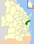 Location within Queensland | |||||||||||||||
| Population | 36,956 (2006 census)[1] | ||||||||||||||
| • Density | 12.4481/km2 (32.2405/sq mi) | ||||||||||||||
| Established | 1879 Shire of Widgee 1880 City of Gympie 1993 Shire of Cooloola (merged) | ||||||||||||||
| Area | 2,968.8 km2 (1,146.3 sq mi) | ||||||||||||||
| Council seat | Gympie | ||||||||||||||
| Website | Shire of Cooloola | ||||||||||||||
| |||||||||||||||
The Shire of Cooloola was a local government area located about 170 kilometres (106 mi) north of Brisbane – the state capital of Queensland, Australia. The shire covered an area of 2,968.8 square kilometres (1,146.3 sq mi), and was the product of a merger in 1993 between the City of Gympie and the Shire of Widgee, which had both existed since 1879–1880. It merged with several other LGAs to form the Gympie Region on 15 March 2008.
YouTube Encyclopedic
-
1/2Views:483405
-
Teewah Beach Oct 2014
-
Great Sandy National Park - Cooloola 3D
Transcription
History
The Cooloola area was originally settled for grazing purposes. The discovery of gold in 1867 lead to a gold rush and the development of the Mary River valley for closer agricultural pursuits.
The Widgee Division was incorporated on 11 November 1879 under the Divisional Boards Act 1879. On 3 July 1886, its western part separately incorporated as the Kilkivan Division. With the passage of the Local Authorities Act 1902, Widgee Division became the Shire of Widgee on 31 March 1903, and on 21 November 1940 moved into new premises, the former Bank of New South Wales building at 242 Mary Street, Gympie.
The Municipal Borough of Gympie was incorporated on 25 June 1880, having previously been the Gympie Division. It held, its first elections on 25 August 1880. A town hall was built in 1890. It became the Town of Gympie under the new Act on 31 March 1903, and on 7 January 1905 was proclaimed the City of Gympie by the Governor of Queensland.[2]
On 19 March 1992, the Electoral and Administrative Review Commission, created two years earlier, produced its report External Boundaries of Local Authorities, and recommended that the City of Gympie and the Shire of Widgee should be amalgamated.[3] The recommendation was implemented through the Local Government (Shire of Cooloola) Regulation 1993 creating the new Shire of Cooloola on 2 November 1993.[4] The first elections were held on 27 November 1993 and Adrian McClintock, the former Widgee chairman, was elected for a four-year term. The former Widgee Shire Council Chambers at 242 Mary Street, Gympie, were used as the Cooloola Shire Council Chambers.
On 15 March 2008, under the Local Government (Reform Implementation) Act 2007 passed by the Parliament of Queensland on 10 August 2007, Cooloola merged with the Shire of Kilkivan and Division 3 of the Shire of Tiaro (Theebine/Gunalda areas) to form the Gympie Region.[5] The former Cooloola Shire Council Chambers are used as the Gympie Regional Council Chambers.
Wards
On its creation, Cooloola was subdivided into four numbered divisions, containing 2, 4, 3 and 3 councillors respectively, plus an elected mayor. Before the 2000 local government elections, Division 2 was reduced to 3 councillors and a new one-councillor Division 5 was created.
Towns and localities
The Shire of Cooloola included the following settlements:
1 - split with Fraser Coast Region
Population
| Year | Population (Cooloola) |
Population (Gympie) |
Population (Widgee) |
|---|---|---|---|
| 1921 | 12,095 | 6,539 | 5,556 |
| 1933 | 16,435 | 7,749 | 8,686 |
| 1947 | 16,247 | 8,413 | 7,834 |
| 1954 | 18,103 | 9,964 | 8,139 |
| 1961 | 19,042 | 11,094 | 7,948 |
| 1966 | 18,769 | 11,279 | 7,490 |
| 1971 | 18,055 | 11,096 | 6,959 |
| 1976 | 19,520 | 11,280 | 8,240 |
| 1981 | 21,960 | 11,420 | 10,540 |
| 1986 | 24,400 | 11,430 | 12,970 |
| 1991 | 27,773 | 14,122 | 13,651 |
| 1996 | 31,736 | 15,099 | 16,637 |
| 2001 | 32,989 | 15,021 | 17,968 |
| 2006 | 36,070 | 16,454 | 19,616 |
* Numbers in italics relate to non-existing entities.
Mayors and Chairmen
Cooloola Shire Chairmen
Gympie City Mayors
- Joan Dodt (1988–1993)
- Mick Venardos (1976–1988)
- James Kidd (1970–1976)
- Ronald Witham (1941–1970)
- Luke Thomas (1937–1941)
- Dr Luther Morris (1931–1937)
- Alexander Glasgow (1930–1931)
- Luke Thomas (1927–1930)
- George Thomas (1924–1927)
- Luke Thomas (1920–1924)
- David Elder Reid (1903-1904)[6]
Widgee Shire Chairmen
- Adrian McClintock (1979–1993)
- Kevin De Vere (1976–1979), uncle of Australian Prime Minister Kevin Rudd[7]
- Michael MacDonnell (1973–1976)
- William Buchanan (1969–1973)
- William Hubbard Kidd (1924–1969)
- Joseph Tatnell (1921–1924)
References
- ^ Australian Bureau of Statistics (25 October 2007). "Cooloola (S) (Local Government Area)". 2006 Census QuickStats. Retrieved 18 March 2008.
- ^ Queensland Government Gazette, 7 January 1905, p.1905:31.
- ^ "External Boundaries of Local Authorities" (PDF). Electoral and Administrative Review Commission. Archived from the original (PDF) on 20 February 2014. Retrieved 3 February 2014.
- ^ Cooloola Shire Council (2001). "Cooloola Shire …a golden past" (PDF). Gympie Regional Council. Retrieved 3 February 2014.
- ^ "Agency ID 11054, Gympie Regional Council". Queensland State Archives. Retrieved 21 September 2013.
- ^ "Lieut.-Col. Reid Dead". The Mail. Adelaide: National Library of Australia. 25 October 1930. p. 4. Retrieved 6 April 2014.
- ^ "Kevin Rudd's Gympie link". Gympie Times. 5 December 2006. Archived from the original on 16 July 2011. Retrieved 18 March 2008.
Further reading
- Pedley, Ian (1979). Winds of change : one hundred years in the Widgee Shire. Widgee Shire Council. ISBN 0-9596220-0-4.
- Widgee Shire Centenary Supplement (1879-1979). 1979.
{{cite book}}:|work=ignored (help) (28 pages) - Cooloola Library (Local History Section) (2001). Cooloola Shire : a golden past. Cooloola Shire Council. ISBN 0-646-40011-8.
External links
- University of Queensland: Queensland Places: Cooloola Shire
- "External Boundaries of Local Authorities" (PDF). Electoral and Administrative Review Commission. 19 March 1992. Archived from the original (PDF) on 20 February 2014. Retrieved 3 February 2014.
- "Local Government (Shire of Cooloola) Regulation 1993" (PDF). Queensland Parliament. 1993.[permanent dead link]
- "Official website". Archived from the original on 18 February 2008. Retrieved 8 April 2016.
26°11′25.20″S 152°39′55.45″E / 26.1903333°S 152.6654028°E