
| Shire of Caboolture Queensland | |||||||||||||||
|---|---|---|---|---|---|---|---|---|---|---|---|---|---|---|---|
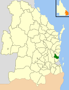 Location within Queensland | |||||||||||||||
| Population | 132,473 (2006 census)[1] | ||||||||||||||
| • Density | 108.194/km2 (280.222/sq mi) | ||||||||||||||
| Established | 1879 | ||||||||||||||
| Abolished | 2008 | ||||||||||||||
| Area | 1,224.4 km2 (472.7 sq mi) | ||||||||||||||
| Council seat | Caboolture | ||||||||||||||
| Region | South East Queensland | ||||||||||||||
 | |||||||||||||||
| Website | Shire of Caboolture | ||||||||||||||
| |||||||||||||||

The Shire of Caboolture was a local government area located in the Australian state of Queensland on the northern urban fringe of the capital, Brisbane, and south of the Sunshine Coast. The Shire covered an area of 1,224.4 square kilometres (472.7 sq mi), of which approximately one-quarter was urban, and existed as a local government entity from 1879 until 2008, when it amalgamated with the City of Redcliffe and Shire of Pine Rivers to form the Moreton Bay Region, which was renamed the City of Moreton Bay in July 2023.
YouTube Encyclopedic
-
1/2Views:11 452409
-
Best & Worst Suburbs in MORETON BAY Region (QUEENSLAND)
-
2014 JJ Caboolture Historical Village P1 15MIN x264
Transcription
History

Caboolture Division was created on 11 November 1879 as one of 74 divisions around Queensland under the Divisional Boards Act 1879.[2][3][4] It was centred on Caboolture, which was at that time a small logging town, and initially covered all of Moreton Bay and much of the Sunshine Coast, but by 1890 had shrunk considerably with the separate incorporation of the Pine Division (21 January 1888),[5] Redcliffe Division (5 April 1888) and Maroochy Division (5 July 1890).[6]
Caboolture Division became the Shire of Caboolture on 31 March 1903 after the Local Authorities Act 1902 was enacted.[3][7]
On 15 March 2008, under the Local Government (Reform Implementation) Act 2007 passed by the Parliament of Queensland on 10 August 2007, the Shire of Caboolture merged with the City of Redcliffe and the Shire of Pine Rivers to form the Moreton Bay Region,[7] which was renamed City of Moreton Bay in July 2023.[8]
Suburbs and towns
The Shire of Caboolture included the following suburbs:
|
Coastal Caboolture region: |
Inland Caboolture region: |
|
Population
| Year | Population | % Annual growth |
|---|---|---|
| 1933 | 5,316 | |
| 1947 | 5,716 | |
| 1954 | 7,101 | 3.15 |
| 1961 | 8,877 | 3.24 |
| 1966 | 10,149 | 2.71 |
| 1971 | 12,207 | 3.76 |
| 1976 | 19,404 | 9.71 |
| 1981 | 32,644 | 10.96 |
| 1986 | 47,494 | 7.79 |
| 1991 | 70,052 | 8.08 |
| 1996 | 98,859 | 7.13 |
| 2001 | 112,458 | 2.61 |
| 2006 | 132,473 | 3.33 |
Chairmen and mayors
- 1881: William Pettigrew[9]
- 1927: Anders Anderson Fredin[10]
- 1991-1994 Patricia Rhoda (Pat) Camilleri[11]
- 2000-2008: Joy Leishman
References
- ^ Australian Bureau of Statistics (25 October 2007). "Caboolture (S) (Local Government Area)". 2006 Census QuickStats. Retrieved 18 March 2008.
- ^ "Proclamation [Caboolture Division]". Queensland Government Gazette. 11 November 1879. p. 25:994.
- ^ a b "Agency ID 549, Caboolture Divisional Board". Queensland State Archives. Retrieved 20 September 2013.
- ^ "Caboolture Town History". Retrieved 6 May 2008.
- ^ "Agency ID 1483, Pine Divisional Board". Queensland State Archives. Retrieved 20 September 2013.
- ^ "Agency ID 1377, Maroochy Divisional Board". Queensland State Archives. Retrieved 20 September 2013.
- ^ a b "Agency ID 550, Caboolture Shire Council". Queensland State Archives. Retrieved 20 September 2013.
- ^ "New City, New Ambition, Renewed Brand". Moreton Bay City Council. Retrieved 5 August 2023.
- ^ Brown, Elaine. "Pettigrew, William (1825–1906)". Australian Dictionary of Biography. National Centre of Biography, Australian National University. ISSN 1833-7538. Retrieved 26 December 2013.
- ^ Pugh, Theophilus Parsons (1927). Pugh's Almanac for 1927. Retrieved 13 June 2014.
- ^ "Patricia Rhoda McLoughlin". Women's Museum of Australia. Retrieved 4 April 2020.
External links
- University of Queensland: Queensland Places: Caboolture Shire
- Official website at the Wayback Machine (archive index)
27°04′59″S 152°57′04″E / 27.08306°S 152.95111°E