
Shiogama
塩竈市 | |
|---|---|
 Urato islands Shiogama Port, Shiogama Shrine Aeon Town Shiogama, Shiogama Port Festival | |
 Flag  Seal | |
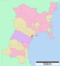 Location of Shiogama in Miyagi Prefecture | |
 Shiogama | |
| Coordinates: 38°18′51.7″N 141°01′19.1″E / 38.314361°N 141.021972°E | |
| Country | Japan |
| Region | Tōhoku |
| Prefecture | Miyagi |
| City Settled | November 23, 1941 |
| Government | |
| • Mayor | Kōki Satō (from September 2019) |
| Area | |
| • Total | 17.37 km2 (6.71 sq mi) |
| Population (June 1, 2019) | |
| • Total | 52,662 |
| • Density | 3,000/km2 (7,900/sq mi) |
| Time zone | UTC+9 (Japan Standard Time) |
| Phone number | 022-364-1111 |
| Address | 1-1 Asahimachi, Shiogama-shi, Miyagi-ken 985-8501 |
| Climate | Cfa |
| Website | http://www.city.shiogama.miyagi.jp/ |
| Symbols | |
| Flower | White Chrysanthemum |
| Tree | Shiogama Sakura |
Shiogama (塩竈市 or 塩釜市, Shiogama-shi) is a city located in Miyagi Prefecture, Japan. As of 1 June 2019[update], the city had an estimated population of 52,662, and a population density of 3,032 persons per km² in 23,270 households.[1] The total area of the city is 17.37 square kilometres (6.71 sq mi).
YouTube Encyclopedic
-
1/5Views:1 5962 2863571 232309
-
SHIOGAMA FISH MARKET TOUR
-
Cherry Blossoms at Shiogama Shrine in Japan
-
SHIOGAMA MINATO MATSURI FESTIVAL 2016
-
SHIOGAMA in JAPAN (Tourist information) 塩竈
-
Festival de la bahía de Matsushima - Shiogama Minato Matsuri
Transcription
Geography
Shiogama is in north-central Miyagi Prefecture, bordered by the Pacific Ocean to the east.
Neighboring municipalities
- Miyagi Prefecture
Climate
Shiogama has a humid climate (Köppen climate classification Cfa) characterized by mild summers and cold winters. The average annual temperature in Shiogama is 11.8 °C (53.2 °F). The average annual rainfall is 1,175.0 mm (46.26 in) with September as the wettest month. The temperatures are highest on average in August, at around 23.5 °C (74.3 °F), and lowest in January, at around 0.9 °C (33.6 °F).[2]
| Climate data for Shiogama (1991−2020 normals, extremes 1976−present) | |||||||||||||
|---|---|---|---|---|---|---|---|---|---|---|---|---|---|
| Month | Jan | Feb | Mar | Apr | May | Jun | Jul | Aug | Sep | Oct | Nov | Dec | Year |
| Record high °C (°F) | 14.4 (57.9) |
20.7 (69.3) |
21.3 (70.3) |
30.0 (86.0) |
30.9 (87.6) |
34.2 (93.6) |
35.5 (95.9) |
35.8 (96.4) |
35.7 (96.3) |
28.5 (83.3) |
23.5 (74.3) |
20.7 (69.3) |
35.8 (96.4) |
| Mean daily maximum °C (°F) | 4.4 (39.9) |
5.2 (41.4) |
8.9 (48.0) |
14.5 (58.1) |
19.3 (66.7) |
22.3 (72.1) |
25.7 (78.3) |
27.4 (81.3) |
24.1 (75.4) |
18.8 (65.8) |
13.0 (55.4) |
7.1 (44.8) |
15.9 (60.6) |
| Daily mean °C (°F) | 0.9 (33.6) |
1.3 (34.3) |
4.4 (39.9) |
9.6 (49.3) |
14.6 (58.3) |
18.3 (64.9) |
22.0 (71.6) |
23.5 (74.3) |
20.3 (68.5) |
14.8 (58.6) |
8.8 (47.8) |
3.4 (38.1) |
11.8 (53.3) |
| Mean daily minimum °C (°F) | −2.1 (28.2) |
−2.0 (28.4) |
0.5 (32.9) |
5.4 (41.7) |
10.8 (51.4) |
15.2 (59.4) |
19.3 (66.7) |
20.7 (69.3) |
17.2 (63.0) |
11.2 (52.2) |
5.0 (41.0) |
0.2 (32.4) |
8.5 (47.2) |
| Record low °C (°F) | −9.6 (14.7) |
−9.5 (14.9) |
−6.2 (20.8) |
−2.8 (27.0) |
0.5 (32.9) |
7.9 (46.2) |
11.1 (52.0) |
12.9 (55.2) |
6.9 (44.4) |
2.2 (36.0) |
−3.1 (26.4) |
−7.8 (18.0) |
−9.6 (14.7) |
| Average precipitation mm (inches) | 38.3 (1.51) |
31.8 (1.25) |
71.2 (2.80) |
87.9 (3.46) |
101.8 (4.01) |
130.0 (5.12) |
170.2 (6.70) |
130.5 (5.14) |
172.1 (6.78) |
140.2 (5.52) |
60.3 (2.37) |
40.6 (1.60) |
1,175 (46.26) |
| Average precipitation days (≥ 1.0 mm) | 6.0 | 5.8 | 7.5 | 8.4 | 9.4 | 11.0 | 13.8 | 11.1 | 11.2 | 8.5 | 6.5 | 6.5 | 105.7 |
| Mean monthly sunshine hours | 153.5 | 161.1 | 182.4 | 193.1 | 190.1 | 145.3 | 134.9 | 149.8 | 135.0 | 144.8 | 143.3 | 133.2 | 1,871.3 |
| Source: Japan Meteorological Agency[3][2] | |||||||||||||
Demographics
Per Japanese census data,[4] the population of Shiogama peaked around 1990 and has declined since.
| Year | Pop. | ±% |
|---|---|---|
| 1970 | 59,772 | — |
| 1980 | 61,040 | +2.1% |
| 1990 | 62,025 | +1.6% |
| 2000 | 61,547 | −0.8% |
| 2010 | 56,490 | −8.2% |
| 2020 | 52,203 | −7.6% |
Etymology
"Shiogama" means "salt furnace" and refers to a local Shinto ritual involving the making of salt from sea water, still performed every July. The name is sometimes written using the kanji 塩釜 rather than 塩竈 and both spellings are officially permitted. Both 釜 and 竈 are pronounced gama in compounds, but as lone words they are pronounced kama and kamado, respectively. A kamado (竈, "furnace") is what a kama (釜, "kettle") is placed upon, and so the two are not completely interchangeable. 塩竈 is the form officially used by the city, but for ease of writing, the 10-stroke 釜 is often used in place of the 21-stroke 竈, such as in Shiogama Station.[5]
Shiogama Jinja uses the rendering 鹽竈, with an archaic character for salt. This third form is rarely seen outside of this context.
History
The area of present-day Shiogama was part of ancient Mutsu Province, and has been settled since at least the Jōmon period by the Emishi people. During the Nara period, the area came under the control of colonists from the Yamato dynasty based at nearby Tagajō and was the most important seaport in Mutsu. The ruins of the provincial capital of Mutsu Province have been found within the city borders. During later portion of the Heian period, the area was ruled by the Northern Fujiwara. During the Sengoku period, the area was contested by various samurai clans before the area came under the control of the Date clan of Sendai Domain during the Edo period, under the Tokugawa shogunate.
The town of Shiogama was established with the post-Meiji restoration creation of the modern municipalities system on April 1, 1889. Parts of Tagajō and Shichigahama were incorporated into Shiogama of September 1, 1938. Shiogama was raised to city status on November 23, 1941 (187th, nationally; 3rd in Miyagi). The city annexed the Gyūchi area of neighboring Tagajō on December 1, 1949 and the village of Urato on April 1, 1950.
The city was affected by the tsunami caused by the 2011 Tōhoku earthquake,[6] although damage to its fishing industry turned out to be light.[7]
Government
Shiogama has a mayor-council form of government with a directly elected mayor and a unicameral city legislature of 18 members.
Economy
The economy of Shiogama is largely based on commercial fishing, especially of tuna, and fish processing. The city also boasts one of the highest density of sushi restaurants in Japan.
Education
Shiogama has six public elementary schools and four middle schools operated by the city government, and one public high school operated by the Miyagi Prefectural Board of Education.
Transportation
Railway
- East Japan Railway Company (JR East) – Tōhoku Main Line
- East Japan Railway Company (JR East) – Senseki Line
Highway
National highways
Miyagi Prefectural Highways
- Miyagi Prefectural Route 3 (Shiogama—Yoshioka)
- Miyagi Prefectural Route 10 (Shiogama—Watari)
- Miyagi Prefectural Route 11 (Shiogama—Shiogama-kō)
- Miyagi Prefectural Route 23 (Sendai—Shiogama)
- Miyagi Prefectural Route 35 (Izumi—Shiogama)
- Miyagi Prefectural Route 58 (Shiogama—Shichigahama—Tagajō)
Local attractions
Festivals
- Shiogama 'Hote' festival (10 March)
- Shiogama Flower festival and Shiogama Citizens Festival (late April)
- Shiogama Harbor festival (Eve: before Marine Day/festival: Marine Day July)
Specialties and crafts
|
Visitor attractions

|
|
Notable people from Shiogama
- Masao Maruyama (anime producer) [8]
- Masashi Nakano (politician)[9]
- Nobunaga Shimazaki (voice actor)
- Koichi Yamadera (voice actor)
References
- ^ Shiogama city official statistics(in Japanese)
- ^ a b 気象庁 / 平年値(年・月ごとの値). JMA. Retrieved March 22, 2022.
- ^ 観測史上1~10位の値(年間を通じての値). JMA. Retrieved March 22, 2022.
- ^ Shiogama population statistics
- ^ "塩竈市/「竈」の字について". www.city.shiogama.miyagi.jp. Archived from the original on 2012-10-19.
- ^ http://themes.thestar.com/photo/0eira3V9EGfFA a tsunami wave engulfing vehicles and houses in Shiogama
- ^ Aoki, Mizuho, "Fish processors rise to challenge", Japan Times, 9 April 2011, p. 3.
- ^ Entry at imdb.com
- ^ Official profile
External links
- Official Website (in Japanese)
| Sendai |
| ||
|---|---|---|---|
| Cities | |||
| Districts | |||
| International | |
|---|---|
| National | |
| Geographic | |