
Shenmu
神木市 | |
|---|---|
 Shenmu in Yulin | |
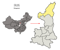 Yulin in Shaanxi | |
| Coordinates: 38°49′10″N 110°29′23″E / 38.81944°N 110.48972°E | |
| Country | People's Republic of China |
| Province | Shaanxi |
| Prefecture-level city | Yulin |
| Area | |
| • Total | 7,635 km2 (2,948 sq mi) |
| Population (2018) | |
| • Total | 485,000 |
| • Density | 64/km2 (160/sq mi) |
| Time zone | UTC+8 (China Standard) |
| Postal Code | 719300 |
| Website | www |
Shenmu (Chinese: 神木; pinyin: Shénmù; lit. 'Divine Trees') is a county-level city in the north of Shaanxi province, China, bordering Inner Mongolia to the northwest and Shanxi province, across the Yellow River, to the southeast. Under the administration of Yulin City, Shenmu is endowed with plentiful resources, especially coal, such as the three earth sovereigns coal fields of Huojitu, Yujialiang and Shagoupen which makes it the richest county in Shaanxi.[1] Shenmu county is also known for the Shimao archaeological site, the largest Neolithic settlement in China, and a city with evidence of trade networks stretching from the Eurasian Steppe to Southern China.[2]
YouTube Encyclopedic
-
1/1Views:1 033 274
-
"This guy is the god of languages!" - VRChat
Transcription
Etymology

The toponym of city can trace its history back to the Song dynasty. There were three giant pine trees, which were said to be planted since Tang dynasty, close to the fort located at Yangjiacheng. The fort was named Shenmu Zhai (神木寨; [Fort of Divine Trees]). Then the county administering the area around the fort was established in 1269, and the toponym stuck.[3][4]
Industrial zones
Shenmu has a large coalfield which should meet future demands for China's power growth.
Administrative divisions
As 2019, Shenmu City is divided to 6 subdistricts and 14 towns.[5]
- Subdistricts
|
|
- Towns
|
|
Climate
| Climate data for Shenmu (1991–2012 normals, extremes 1981–2010) | |||||||||||||
|---|---|---|---|---|---|---|---|---|---|---|---|---|---|
| Month | Jan | Feb | Mar | Apr | May | Jun | Jul | Aug | Sep | Oct | Nov | Dec | Year |
| Record high °C (°F) | 11.2 (52.2) |
18.8 (65.8) |
28.7 (83.7) |
35.7 (96.3) |
36.7 (98.1) |
41.2 (106.2) |
39.6 (103.3) |
37.0 (98.6) |
36.4 (97.5) |
29.1 (84.4) |
22.5 (72.5) |
14.2 (57.6) |
41.2 (106.2) |
| Average high °C (°F) | −0.7 (30.7) |
5.1 (41.2) |
11.7 (53.1) |
20.0 (68.0) |
25.7 (78.3) |
30.1 (86.2) |
31.3 (88.3) |
28.9 (84.0) |
24.0 (75.2) |
17.4 (63.3) |
8.9 (48.0) |
1.3 (34.3) |
17.0 (62.5) |
| Daily mean °C (°F) | −8.5 (16.7) |
−2.8 (27.0) |
4.0 (39.2) |
12.0 (53.6) |
18.2 (64.8) |
23 (73) |
24.7 (76.5) |
22.4 (72.3) |
16.9 (62.4) |
9.6 (49.3) |
1.4 (34.5) |
−5.9 (21.4) |
9.6 (49.2) |
| Average low °C (°F) | −14.4 (6.1) |
−8.9 (16.0) |
−2.2 (28.0) |
4.9 (40.8) |
10.9 (51.6) |
16.2 (61.2) |
19.0 (66.2) |
17.4 (63.3) |
11.5 (52.7) |
4.0 (39.2) |
−3.9 (25.0) |
−11.1 (12.0) |
3.6 (38.5) |
| Record low °C (°F) | −29.0 (−20.2) |
−23.1 (−9.6) |
−17.2 (1.0) |
−6.8 (19.8) |
−1.9 (28.6) |
5.2 (41.4) |
9.6 (49.3) |
8.1 (46.6) |
−2.1 (28.2) |
−8.2 (17.2) |
−18.9 (−2.0) |
−26.7 (−16.1) |
−29.0 (−20.2) |
| Average precipitation mm (inches) | 3.0 (0.12) |
3.5 (0.14) |
10.3 (0.41) |
16.8 (0.66) |
33.8 (1.33) |
43.1 (1.70) |
105.6 (4.16) |
98.8 (3.89) |
57.0 (2.24) |
21.4 (0.84) |
10.4 (0.41) |
2.5 (0.10) |
406.2 (16) |
| Average precipitation days (≥ 0.1 mm) | 2.1 | 2.5 | 3.8 | 4.1 | 7.1 | 8.9 | 11.0 | 10.9 | 8.9 | 5.4 | 3.0 | 1.9 | 69.6 |
| Average snowy days | 3.7 | 3.2 | 2.4 | 0.5 | 0 | 0 | 0 | 0 | 0 | 0.2 | 1.7 | 3.0 | 14.7 |
| Average relative humidity (%) | 54 | 47 | 42 | 37 | 41 | 47 | 58 | 66 | 65 | 61 | 56 | 53 | 52 |
| Mean monthly sunshine hours | 197.8 | 200.4 | 230.7 | 254.3 | 278.0 | 268.1 | 251.0 | 230.4 | 209.2 | 215.6 | 199.5 | 188.2 | 2,723.2 |
| Percent possible sunshine | 65 | 66 | 62 | 64 | 63 | 60 | 56 | 55 | 57 | 63 | 67 | 64 | 62 |
| Source: China Meteorological Administration[6][7] | |||||||||||||
References
- ^ "USGS Compilation of Geographic Information System Data Representing Coal Mines and Coal-Bearing Areas in China" (PDF).
- ^ Larmer, Brook (2020). "Mysterious carvings and evidence of human sacrifice uncovered in ancient city". National Geographic. Archived from the original on August 7, 2020.
- ^ 神木县志 [Shenmu County Gazetteer].
- ^ 陕西省志·行政建制志. 2010-12-16.
- ^ "统计用区划代码 www.stats.gov.cn" (in Chinese). XZQH. Retrieved 2021-01-02.
- ^ 中国气象数据网 – WeatherBk Data (in Simplified Chinese). China Meteorological Administration. Retrieved 26 August 2023.
- ^ 中国气象数据网 (in Simplified Chinese). China Meteorological Administration. Retrieved 26 August 2023.
External links
| |||||||||||||||||||||||||||||||||||||||||||||||||||||||||||||||


| International | |
|---|---|
| National | |
This Shaanxi location article is a stub. You can help Wikipedia by expanding it. |