
Shelby Township | |
|---|---|
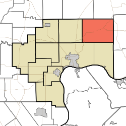 Location in Jefferson County | |
| Coordinates: 38°52′43″N 85°16′34″W / 38.87861°N 85.27611°W | |
| Country | United States |
| State | Indiana |
| County | Jefferson |
| Government | |
| • Type | Indiana township |
| Area | |
| • Total | 48.51 sq mi (125.6 km2) |
| • Land | 48.33 sq mi (125.2 km2) |
| • Water | 0.18 sq mi (0.5 km2) 0.37% |
| Elevation | 823 ft (251 m) |
| Population (2020) | |
| • Total | 1,151 |
| • Density | 24/sq mi (9.2/km2) |
| GNIS feature ID | 0453844 |
Shelby Township is one of ten townships in Jefferson County, Indiana, United States. As of the 2020 census, its population was 1,151 and it contained 458 housing units.[1]
| Census | Pop. | Note | %± |
|---|---|---|---|
| 1890 | 1,583 | — | |
| 1900 | 1,441 | −9.0% | |
| 1910 | 1,330 | −7.7% | |
| 1920 | 1,271 | −4.4% | |
| 1930 | 1,091 | −14.2% | |
| 1940 | 1,041 | −4.6% | |
| 1950 | 978 | −6.1% | |
| 1960 | 822 | −16.0% | |
| 1970 | 705 | −14.2% | |
| 1980 | 850 | 20.6% | |
| 1990 | 827 | −2.7% | |
| 2000 | 1,052 | 27.2% | |
| 2010 | 1,133 | 7.7% | |
| 2020 | 1,151 | 1.6% | |
| Source: US Decennial Census[2] | |||
YouTube Encyclopedic
-
1/3Views:3 425605454
-
The Old Stone School House Scenic Road Tour of Jefferson County, Indiana
-
Bad Drivers of Metro Detroit, Michigan Pt. 1
-
JellyStone Campground, Mt Gilead, Ohio Vacation Vlog Day 1
Transcription
History
The first land acquired by settlers was in 1809 on the northern border with Ripley County. Many early settlers were Scotch-Irish and were prominent in forming the Jefferson Presbyterian Church in 1818. Another early group was what was known as "Low Dutch", families primarily of Dutch origin who had lived in the New Amsterdam settlements in New York and New Jersey and who moved to Kentucky in the early 1780s. They were also involved in the formation of Jefferson Presbyterian, but joined the former Pleasant Presbyterian church in neighboring Switzerland County when it formed in 1829.
About 1817, families of Lowland Scots began arriving, and more continued to arrive through the early 1830s. Many were from towns such as Glasgow, Paisley, Kilmarnock and the Edinburgh area. They founded a predecessor to Caledonia Church in 1818, which lasted until 1825, and formed the bulk of that church's membership when it was organized. The Scottish settlement stretched in Pleasant and Craig Townships in Switzerland County on the east and Milton Township in Jefferson County to the South.
Shelby Township was created from the northern part of Milton Township and the remnant of Pittsburgh Township on February 12, 1823[3] by the Jefferson County commissioners. The action wiped out Pittsburgh Township. Shelby was named after Isaac Shelby, who commanded troops at the battle of King's Mountain during the Revolutionary War.
Geography
According to the 2010 census, the township has a total area of 48.51 square miles (125.6 km2), of which 48.33 square miles (125.2 km2) (or 99.63%) is land and 0.18 square miles (0.47 km2) (or 0.37%) is water.[4] The streams of Barbersville Creek, Black Branch, Bloody Run, Brushy Fork, Canaan Branch, Dry Fork, East Prong Indian-Kentuck, Hannibal Branch, Horton Branch, Little Brushy Fork, McCurry or McCrory's Branch, Miller Branch, Puncheon Camp Creek, Razor Fork, Salem Branch, Seals Fork, Shaw Branch, Spring Branch, Toddy's Branch, Vestal Branch, West Fork Indian-Kentuck, White Eye Branch, and Wilson's Fork, run through this township.
Unincorporated towns
Adjacent townships
- Brown Township, Ripley County (northeast)
- Pleasant Township, Switzerland County (east)
- Milton Township (south)
- Madison Township (southwest)
- Monroe Township (west)
- Shelby Township, Ripley County (northwest)
Cemeteries
The township contains these cemeteries: Canaan, Copeland, Etherton, Fry, Indian Kentuck, Jefferson Presbyterian, Lee, Lemen, Mathis, Means, Mermoud, Mount Pleasant Baptist, Pullum (or Pulliam), Riker, Risk, Rogers, Short (Blackhawk), Skeen, Spencer, Thornton, Vestal (Evans Farm) and Welch. Two cemeteries span the county line between Shelby Township and Pleasant Township, Switzerland county—Brushy Fork Baptist and Caledonia Presbyterian.
Major highways
References
- Notes
- ^ "Explore Census Data". data.census.gov. Retrieved April 10, 2024.
- ^ "Township Census Counts: STATS Indiana".
- ^ Biographical and Historical Souvenir for the Counties of Clark, Crawford, Harrison, Floyd, Jefferson, Jennings, Scott, and Washington, Indiana. Chicago Printing Company. 1889. pp. 150.
- ^ "Population, Housing Units, Area, and Density: 2010 - County -- County Subdivision and Place -- 2010 Census Summary File 1". United States Census. Archived from the original on February 12, 2020. Retrieved May 10, 2013.
- Sources
- U.S. Board on Geographic Names (GNIS)
- United States Census Bureau cartographic boundary files
- Baker, J. David, The Postal History of Indiana, 1976, Philatelic Bibliophile, P.O. Box 213971, Louisville, Ky. 1976.
- Gresham, John M. & Co., 1889. Biographical & Historical Souvenir for the Counties of Clark, Crawford, Harrison, Floyd, Jefferson, Jennings, Scott and Washington.
- John Paul Chapter DAR. Jefferson County Cemetery transcriptions, 1941
- Polk, R.L. Co. Indiana State Gazetteer & Business Directory. 1890. Volume V. S.E. Circle and Meridian Streets, Indianapolis, Ind. Reprinted 1978-9 by The Bookmark, P.O. Box 74 Knightstown, Ind. 46148.
- Scott, Robert W. The Indian-Kentuck in the Nineteenth Century, Windmill Publishing. 2002
External links
Municipalities and communities of Jefferson County, Indiana, United States | ||
|---|---|---|
| City |  | |
| Towns | ||
| Townships | ||
| CDPs | ||
| Other communities | ||
| Footnotes | ‡This populated place also has portions in an adjacent county or counties | |