
Shawneeland, Virginia | |
|---|---|
 Shawneeland  Shawneeland | |
| Coordinates: 39°11′29″N 78°20′44″W / 39.19139°N 78.34556°W | |
| Country | United States |
| State | Virginia |
| County | Frederick |
| Area | |
| • Total | 7.39 sq mi (19.15 km2) |
| • Land | 7.36 sq mi (19.06 km2) |
| • Water | 0.03 sq mi (0.09 km2) |
| Population (2010) | |
| • Total | 1,873 |
| • Density | 255/sq mi (98.3/km2) |
| Time zone | UTC−5 (Eastern (EST)) |
| • Summer (DST) | UTC−4 (EDT) |
| ZIP code | 22602 |
| FIPS code | 51-71625 |
| GNIS feature ID | 2630782 |
Shawnee Land is a residential community in Frederick County, Virginia, United States. Shawnee Land is located on the eastern slopes of Great North Mountain. The U.S. Census Bureau defines it as a census-designated place (listed as Shawneeland), with a population of 1,873 as of 2010.[1] In its past, Shawnee Land was a ski resort, with a number of slopes located on the eastern side of Great North Mountain. Shawnee Land thrived for a few years, but eventually the investors abandoned the project and the ski slopes were closed.
YouTube Encyclopedic
-
1/2Views:51 78712 840
-
Top 5 Haunted Places In West Virginia You Should Never Visit
-
Haunting LAKE SHAWNEE GHOST STORIES from Virginia
Transcription
Geography
The community is in western Frederick County, 10 miles (16 km) west of Winchester and 3 miles (5 km) east of the West Virginia border. The mountainside community rises from a base elevation of 850 feet (260 m) above sea level in the southeast, along Back Mountain Road, to the 2,300-foot (700 m) summit ridge of Great North Mountain in the northwest. The community drains east to the valley of Hogue Creek, which flows northeast to join Back Creek, a tributary of the Potomac River.
According to the U.S. Census Bureau, the Shawneeland CDP has a total area of 7.4 square miles (19.1 km2), of which 0.04 square miles (0.1 km2), or 0.48%, are water.[1]
References
- ^ a b "Geographic Identifiers: 2010 Demographic Profile Data (G001): Shawneeland CDP, Virginia". U.S. Census Bureau, American Factfinder. Retrieved January 2, 2019.[dead link]
Municipalities and communities of Frederick County, Virginia, United States | ||
|---|---|---|
| Towns | 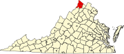 | |
| CDPs | ||
| Other communities |
| |
This Frederick County, Virginia state location article is a stub. You can help Wikipedia by expanding it. |