
Shōwa
昭和村 | |
|---|---|
 Shōwa village office | |
 Flag  Seal | |
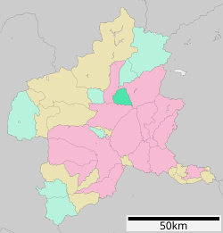 Location of Shōwa in Gunma Prefecture | |
 Shōwa | |
| Coordinates: 36°38′23.1″N 139°3′57.2″E / 36.639750°N 139.065889°E | |
| Country | Japan |
| Region | Kantō |
| Prefecture | Gunma |
| District | Tone |
| Area | |
| • Total | 64.14 km2 (24.76 sq mi) |
| Population (October 2020) | |
| • Total | 7,228 |
| • Density | 110/km2 (290/sq mi) |
| Time zone | UTC+9 (Japan Standard Time) |
| City symbols | |
| • Tree | Sakura |
| • Flower | Azalea |
| • Bird | Green pheasant |
| Phone number | 0278-24-5111 |
| Address | 388 Itoi, Shōwa-mura, Tone-gun, Gunma-ken 379-1298 |
| Website | Official website |

Shōwa (昭和村, Shōwa-mura) is a village located in Gunma Prefecture, Japan. As of 1 October 2020[update], the village had an estimated population of 7,228 in 2751 households,[1] and a population density of 110 persons per km2. The total area of the village is 64.14 square kilometres (24.76 sq mi).
YouTube Encyclopedic
-
1/3Views:3 7879682 240
-
ぐんまの臨床研修病院紹介「群馬大学医学部附属病院 ver.1」|健康福祉|医務課|群馬県
-
【役立つ医療情報】『重粒子線治療のナゾ』ブックレビュー:第3回「ロハス・メディカル」セレクト版
-
【役立つ医療情報】第3回「ロハス・メディカル」YouTubeテスト版〈オプジーボ特別編〉
Transcription
Geography
Located in central Gunma, Shōwa is on the northwestern slopes of Mt. Akagi, it is surrounded on the north, east, and west by the city of Numata and borders Shibukawa to the south. The Katashina River and the Tone River flow through the village.
Surrounding municipalities
Climate
Shōwa has a Humid continental climate (Köppen Cfa) characterized by warm summers and cold winters with heavy snowfall. The average annual temperature in Shōwa is 10.4 °C. The average annual rainfall is 1589 mm with September as the wettest month. The temperatures are highest on average in August, at around 23.0 °C, and lowest in January, at around -1.6 °C.[2]
Demographics
Per Japanese census data,[3] the population of Shōwa has been in decline over the past 60 years.
| Year | Pop. | ±% |
|---|---|---|
| 1960 | 10,266 | — |
| 1970 | 8,590 | −16.3% |
| 1980 | 8,263 | −3.8% |
| 1990 | 8,198 | −0.8% |
| 2000 | 7,878 | −3.9% |
| 2010 | 7,620 | −3.3% |
| 2020 | 6,953 | −8.8% |
History
The area of present-day Shōwa was part of the tenryō holdings in Kōzuke Province administered directly by the Tokugawa shogunate during the Edo period. On April 1, 1889 with the creation of the modern municipalities system after the Meiji Restoration, Kuroho and Itonose villages were established within Kitaseta District, Gunma. In 1896, Kitaseta District and a portion of Agatsuma District were transferred to Tone District, The two villages merged on November 1, 1958 to form Shōwa.
Government
Shōwa has a mayor-council form of government with a directly elected mayor and a unicameral village council of 12 members. Shōwa, together with the other municipalities in Tone District, contributes one member to the Gunma Prefectural Assembly. In terms of national politics, the town is part of Gunma 1st district of the lower house of the Diet of Japan.
Economy
Traditionally, the economy of Shōwa was heavily dependent on agriculture; primarily market gardening.
Education
Shōwa has three public elementary schools and one public middle school operated by the village government. The village does not have a high school.
Transportation
Railway
Shōwa does not have any passenger railway service. The nearest station is Numata in the neighboring city of Numata.
Highway
 Jōshin-etsu Expressway – Akagi-Kōgen SA, Shōwa IC
References
- ^ "Shōwa Village official statistics" (in Japanese). Japan.
- ^ Shōwa climate data
- ^ Shōwa population statistics
External links
![]() Media related to Shōwa, Gunma at Wikimedia Commons
Media related to Shōwa, Gunma at Wikimedia Commons
- Official Website (in Japanese)
| Core cities | ||
|---|---|---|
| Special cities | ||
| Cities | ||
| Districts | ||
| International | |
|---|---|
| National | |
| Geographic | |