| Sgurr Eilde Mor | |
|---|---|
| Sgùrr Èilde Mhòr | |
 Sgùrr Eilde Mòr and Coire an Lochan from Sgòr Eilde Beag | |
| Highest point | |
| Elevation | 1,010 m (3,310 ft)[1] |
| Prominence | 271 m (889 ft) |
| Parent peak | Binnein Mòr |
| Listing | Munro, Marilyn |
| Naming | |
| English translation | big peak of the hind |
| Language of name | Gaelic |
| Pronunciation | Scottish Gaelic: [ˈs̪kuːrˠ ˈeːltʲə moːɾ] English approximation: skoor-AYLT-yə-mor |
| Geography | |
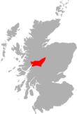
| Location | Highland, Scotland |
| Parent range | Mamores |
| OS grid | NN230657 |
| Topo map | OS Landranger 41, OS Explorer 392 |
Sgùrr Eilde Mòr or Sgùrr Èilde Mhòr (in Gaelic)[2] is a mountain in the Mamores range of the Grampian Mountains, Scotland. It is 6 kilometres north-east of Kinlochleven. It is a steep, conical peak of scree and quartzite boulders, capped with a layer of schist. With a height of 1010 m (3314 ft) it is classed as a Munro, so is popular with hillwalkers. It is most commonly climbed from Kinlochleven by way of a stalker's path which leads to a col at Coire an Lochan, and then by either the south or the west ridge - both routes involving an ascent of steep, bouldery terrain.
YouTube Encyclopedic
-
1/1Views:10 618
-
Solo Wild Camping in Scotland | Backpacking In The Eastern Mamore Mountains.
Transcription
References
- The Munros (SMC Guide), Donald Bennett et al., ISBN 0-907521-13-4
- ^ "walkhighlands Sgurr Eilde Mor". walkhighlands.co.uk. 2013. Retrieved 25 November 2013.
- ^ "Sgurr Eilde Mor". Ainmean-Àite na h-Alba: Gaelic Place-Names of Scotland.
56°45′00″N 4°53′39″W / 56.749863°N 4.89424°W


