
| Serra de Mariola Natural Park | |
|---|---|
| Parque Natural de la Sierra de Mariola (in Spanish) | |
IUCN category IV (habitat/species management area) | |
 Path to the Montcabrer 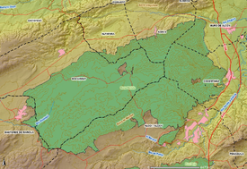 Map of the Serra Mariola Natural Park | |
| Location | Alcoy, Valencian Community, Spain |
| Nearest city | Valencian Community: Alcoy, Cocentaina, Muro de Alcoy, Agres, Alfafara, Bocairent and Banyeres de Mariola. |
| Coordinates | 38°44′1″N 0°35′30″W / 38.73361°N 0.59167°W |
| Area | 17.257 ha |
| Established | 2002 |
| Governing body | Generalitat Valenciana |
The Serra Mariola Natural Park[1] (Valencian pronunciation: [ˈsɛra ðe maɾiˈɔla], Spanish: Parque Natural de la Sierra de Mariola) is a mountain range in the Valencian Community, Spain, one of the most peripheral offsprings of the Baetic System. Most of its territory is included in a natural park founded in 2002, covering an area of 17,257 ha. The park is surrounded by the towns of Cocentaina and Bocairent and the cities of Ontinyent and Alcoy. [2]
It has a rectangular shape and altitudes higher than 1,000 metres, the highest peak being the Montcabrer, at 1,389 metres high. To the north the Benicadell Mountain Range has a peak bearing the same name and is 1,104 metres high. The Serra is predominantly composed of limestone. The climate is largely Mediterranean.
Covering these mountain ranges are some 200 or more different aromatic and medicinal plants with hundreds of different trees, which include a variety of yew unique to this area.
YouTube Encyclopedic
-
1/3Views:2 5393 8924 600
-
Escapada a Banyeres de Mariola
-
Circular del Vinalopó, Toll Blau y Molí de L'ombría
-
La Sierra Calderona - Valencia
Transcription
See also
References
- ^ Juan Picó & Enrique A. Moltó. (2006). "Geografia física" in Història d'Alcoi. (p. 35). Alcoi: Ajuntament d'Alcoi, Editorial Marfil, S.A., Centre Alcoià d'estudis Històrics i Arqueològics. ISBN 84-89136-50-5
- ^ "Routes and Travel Ideas in the Serra Mariola | Serra Mariola Tourism". Serra Mariola Turismo. Retrieved 2022-03-30.
External links
- Serra Mariola Natural Park (Spanish, Valencian)
This article about a location in the Valencian Community, Spain, is a stub. You can help Wikipedia by expanding it. |
This protected areas-related article is a stub. You can help Wikipedia by expanding it. |