
| Semo La | |
|---|---|
 Tibet S206 at Semo La | |
| Elevation | 5,565.1 m (18,258 ft)[1][2] |
| Traversed by | Tibet Provincial Road S206 |
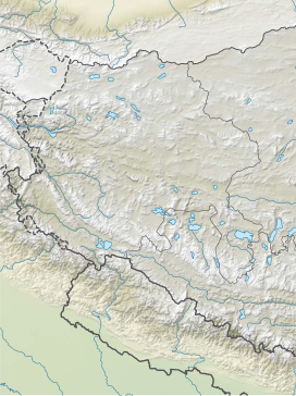
| Location | Coqen, Ngari, Tibet, China |
| Range | Gangdise Shan, Transhimalaya, Tibetan Plateau |
| Coordinates | 30°06′36″N 85°25′54″E / 30.11000°N 85.43167°E |
 Semo La | |
| Semo La | |||||||
|---|---|---|---|---|---|---|---|
| Chinese name | |||||||
| Traditional Chinese | 桑木拉大坂 | ||||||
| Simplified Chinese | 桑木拉大坂 | ||||||
| Literal meaning | Semo La pass (dàbǎn is a Uyghur loanword for pass) | ||||||
| |||||||
| Tibetan name | |||||||
| Tibetan | བཟར་མོ་ལ | ||||||
| |||||||
Semo La[3] (Chinese: 桑木拉大坂; Standard Tibetan: བཟར་མོ་ལ) is a mountain pass situated in Coqên County, Ngari Prefecture in the central part of Tibet and gives access to the Changtang region. It is found on the so-called Northern Route, north of Raka and south of Town of Coqên in Central Tibet. Travellers use this route as an alternative access route to western Tibet and Mount Kailash, especially when mud makes access by the more southern route difficult.[citation needed]
The road crossing the pass was once an old unsurfaced track travelled only by a weekly bus and trucks heading west to avoid the boggy parts of the south of the country.[4][2] The construction of paved road through the pass, Tibet Provincial Road S206, was finished in late 2015.[5]
YouTube Encyclopedic
-
1/3Views:3951 2602 588
-
Marc Semo : "la reprise de la guerre a été voulue surtout et d'abord par le PKK"
-
La Turquie et la question syrienne : mise au point de Marc Semo
-
VOY#004 COL & CIME DE LA BONETTE (F)
Transcription
Elevation
The height according to the Tibet Department of Transportation is 5,565 m (18,258 ft);[1] however, the signage at the road rounded it up to 5,566 m (18,261 ft). In 2005, a Catalan cartographic expedition certified the height to be 5,565.1 m (18,258 ft).[4][2]
At 5,565 metres (18,258 ft), Semo La may be the highest asphalted road in the world. Khardung La was once thought to be the world record holder at 5,602 metres (18,379 ft); in reality, according to modern surveys, it measures 5,359 m (17,582 ft), 243 m (797 ft) less than previously thought.[4][2]
See also
References
- ^ a b Tibet Department of Transportation (2011-12-27). "西藏省道206线措勤至国杰(22道班)段公路改建工程环境影响评价二次公示-公路管理-中华人民共和国交通运输部". Ministry of Transportation of the People's Republic of China (in Chinese). Retrieved 2017-07-22.
桑木拉大坂最高点(海拔5565m)
- ^ a b c d Assumpció Térmens (2006-03-20). "ICC - Semo Khardung" (PDF). viewfinderpanoramas.org. Institut Cartogràfic de Catalunya. Retrieved 2017-02-05.
- ^ La means "pass" in Tibetan
- ^ a b c Jordi Pons (2005). "Summary of Catalan expedition to Semo La and Khardung La". viewfinderpanoramas.org. Archived from the original on 2014-11-29. Retrieved 2017-02-05.
- ^ 郭翠雯 (2015-03-06). "省道206线措勤至国杰公路改建工程今年8月底完工". xzxw.com (in Chinese). China Tibet News Web. Retrieved 2017-02-05.
自治区省道206...预计将于2015年8月30日交工
| On the border | |||||||||||||||||||
|---|---|---|---|---|---|---|---|---|---|---|---|---|---|---|---|---|---|---|---|
| In the interior |
| ||||||||||||||||||
This Tibet location article is a stub. You can help Wikipedia by expanding it. |
This Chinese location article is a stub. You can help Wikipedia by expanding it. |