
Seelingstädt | |
|---|---|
 Coat of arms | |
Location of Seelingstädt within Greiz district 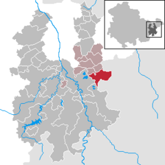 | |
 Seelingstädt  Seelingstädt | |
| Coordinates: 50°47′28″N 12°14′33″E / 50.79111°N 12.24250°E | |
| Country | Germany |
| State | Thuringia |
| District | Greiz |
| Municipal assoc. | Ländereck |
| Subdivisions | 5 |
| Government | |
| • Mayor (2022–28) | Regina Hilbert[1] |
| Area | |
| • Total | 17.97 km2 (6.94 sq mi) |
| Highest elevation | 345 m (1,132 ft) |
| Lowest elevation | 295 m (968 ft) |
| Population (2022-12-31)[2] | |
| • Total | 1,282 |
| • Density | 71/km2 (180/sq mi) |
| Time zone | UTC+01:00 (CET) |
| • Summer (DST) | UTC+02:00 (CEST) |
| Postal codes | 07580 |
| Dialling codes | 036608 |
| Vehicle registration | GRZ |
Seelingstädt is a municipality in the district of Greiz, in Thuringia, Germany. It is the seat of the municipal association of Ländereck.[3]
YouTube Encyclopedic
-
1/1Views:2 010
-
Зигмар 1993. WISMUT
Transcription
References
- ^ Gewählte Bürgermeister - aktuelle Landesübersicht, Freistaat Thüringen, accessed 10 November 2022.
- ^ "Bevölkerung der Gemeinden, erfüllenden Gemeinden und Verwaltungsgemeinschaften in Thüringen Gebietsstand: 31.12.2022" (in German). Thüringer Landesamt für Statistik. June 2023.
- ^ Thüringer Gesetz zur freiwilligen Neugliederung kreisangehöriger Gemeinden im Jahr 2024, Gesetz- und Verordnungsblatt für den Freistaat Thüringen, 2023 Nr. 15, p. 349
| Authority control databases: National |
|---|
This Greiz district location article is a stub. You can help Wikipedia by expanding it. |