

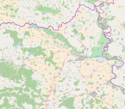


Sarvaš (German: Sarwasch-Hirschfeld, Hungarian: Drávaszarvas) is a village in eastern Slavonia, Croatia, east of Osijek. It has a population of 1,658 (census 2021). It is administratively within the area of the city of Osijek. Szarvas means "deer" in Hungarian.
YouTube Encyclopedic
-
1/3Views:3855312 442
-
Sarvaš - PANORAMA
-
Lidé na fakultě - Adrián Sarvaš
-
Dravski pješački put: Sarvaš - Aljmaš - Bijelo Brdo by DragoKarlo
Transcription
History
One Scordisci archaeological site in Sarvaš dating back to late La Tène culture was excavated in the 1970s and 1980s as a part of rescue excavations in eastern Croatia.[3] Archaeological site was a part of the settlement network of Scordisci in the area of Vinkovci.[3]
According to the 1931 census in the Kingdom of Yugoslavia, the town's population included 1157 Danube Swabian Germans (the majority).[4] These folk were almost all expelled by the Communist regime of Josip Broz Tito after 1945.[5]
The local Catholic church was completely destroyed in the country's War of Independence.[5] By 2006 the church was restored.[6]
References
- ^ Register of spatial units of the State Geodetic Administration of the Republic of Croatia. Wikidata Q119585703.
- ^ "Population by Age and Sex, by Settlements, 2021 Census". Census of Population, Households and Dwellings in 2021. Zagreb: Croatian Bureau of Statistics. 2022.
- ^ a b Dizdar, Marko (2016). "Late La Tène Settlements in the Vinkovci Region (Eastern Slavonia, Croatia): Centres of Trade and Exchange" (PDF). Boii - Taurisci: Proceedings of the International Seminar, Oberleis-Klement, June 14th-15th, 2012. Austrian Academy of Sciences Press: 31–48. Retrieved 22 January 2019.
- ^ Slavonia census of 1931 Archived 2008-06-04 at the Wayback Machine
- ^ a b Sakralna baština Podunavskih Švaba u Hrvatskoj
- ^ Day of Sarvaš celebrated Archived 2007-10-28 at the Wayback Machine
| History |  | |
|---|---|---|
| Districts | ||
| Suburbs | ||
| Buildings and landmarks | ||
| Churches |
| |
| Culture | ||
| Galleries and museums |
| |
| Education |
| |
| Sports venues | ||
| Transport | ||
| Festivals | ||
| Neighboring municipalities | ||
| International | |
|---|---|
| National | |
| Other | |
This Osijek-Baranja County geography article is a stub. You can help Wikipedia by expanding it. |