
Sarnaghbyur
Սառնաղբյուր | |
|---|---|
 Hokevank Monastery or the Red Monastery | |
 Sarnaghbyur 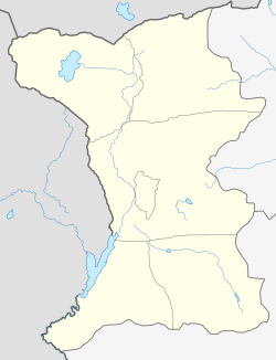 Sarnaghbyur | |
| Coordinates: 40°31′26.67″N 43°54′35.55″E / 40.5240750°N 43.9098750°E | |
| Country | Armenia |
| Province | Shirak |
| Municipality | Ani |
| Population (2008) | |
| • Total | 3,604 |
| Time zone | UTC+4 |
Sarnaghbyur (Armenian: Սառնաղբյուր) is a village in the Ani Municipality of the Shirak Province of Armenia. It was renamed Sarnaghbyur in 1940.
The village has an artificial reservoir that irrigates 1,000 hectares of land in Ani.
YouTube Encyclopedic
-
1/2Views:5 091665
-
Սառնաղբյուր՝ տեսարժան վայրերով և պատմություններով հարուստ գյուղ՝ Շիրակի մարզում։
-
Vahē & Lucie 2019 - Film - 2nd Place - ClayMan
Transcription
Demographics
| Year | Pop. | ±% p.a. |
|---|---|---|
| 1831 | 262 | — |
| 1897 | 2,385 | +3.40% |
| 1939 | 2,851 | +0.43% |
| 1959 | 2,012 | −1.73% |
| 1970 | 2,394 | +1.59% |
| 1979 | 2,460 | +0.30% |
| 1989 | 2,928 | +1.76% |
| 2001 | 3,034 | +0.30% |
| 2004 | 2,159 | −10.72% |
| Source: [1] | ||
History
There is also an archeological site in the village. There are numerous evidences on the hill called Kalachi or Ghalachi, but no archaeological studies have been conducted so far. Village names can be listed as Gyodikendi and Syogutli or Sogtlu names that have been given by the Turks in 1918. In May battles in the way it should be stated that the village is quite serious resistance to the Turkish 1918 on May 18-23 or 24 within the period. There are many accounts of these events. The village has a large area.
Economy
The population is engaged in cattle breeding, cultivation of grain and fodder crops.
Historical and cultural sights
The village has a number of historical monuments that probably indicate that the area was formerly inhabited.
In the center of the village are the churches of St. Tadevos (1883), St. Jacob (V-VI centuries) and St. Karapet ( 1205 ). Near the village are the Vogheni Monastery of the X-XIII centuries, St. Gregory the Illuminator pilgrimage site, and 6 km east - St. Lazar Church (V-VI centuries), "Gndakar" (1st millennium BC) and "Berdik" ( 2nd-1st millennium BCE) castles. In 1883, the Tadevos Apostolic Church was built, which is now in operation.
Gallery
-
 Hokevank monastery
 -
 Saint Thadeus the Apostle church
 -
 Saint Hakob church
 -
 Water reservoir
References
- ^ Հայաստանի Հանրապետության բնակավայրերի բառարան [Republic of Armenia settlements dictionary] (PDF) (in Armenian). Yerevan: Cadastre Committee of the Republic of Armenia. 2008. Archived from the original (PDF) on 11 March 2018.
- Sarnaghbyur at GEOnet Names Server
- World Gazeteer: Armenia[dead link] – World-Gazetteer.com
- Report of the results of the 2001 Armenian Census, Statistical Committee of Armenia
Capital: Gyumri | ||
| Urban settlements |  | |
| Akhuryan Municipality | ||
| Amasia Municipality | ||
| Ani Municipality | ||
| Artik Municipality | ||
| Ashotsk Municipality | ||
This article about a location in Shirak Province, Armenia is a stub. You can help Wikipedia by expanding it. |