
Sant'Angelo Le Fratte | |
|---|---|
| Comune di Sant'Angelo Le Fratte | |
 | |
 Sant'Angelo Le Fratte within the Province of Potenza | |
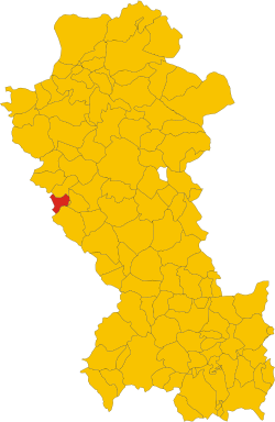
Location of Sant'Angelo Le Fratte  | |
 Sant'Angelo Le Fratte Location of Sant'Angelo Le Fratte in Italy  Sant'Angelo Le Fratte Sant'Angelo Le Fratte (Basilicata) | |
| Coordinates: 40°32′49″N 15°33′27″E / 40.54694°N 15.55750°E | |
| Country | Italy |
| Region | Basilicata |
| Province | Potenza (PZ) |
| Frazioni | Farisi, Isca, Santa Maria Fellana, San Vito |
| Area | |
| • Total | 23 km2 (9 sq mi) |
| Elevation | 560 m (1,840 ft) |
| Population (2011)[2] | |
| • Total | 1,457 |
| • Density | 63/km2 (160/sq mi) |
| Demonym | Santangiolesi |
| Time zone | UTC+1 (CET) |
| • Summer (DST) | UTC+2 (CEST) |
| Postal code | 85050 |
| Dialing code | 0975 |
| ISTAT code | 076079 |
| Patron saint | San Michele Arcangelo |
| Saint day | 29 September |
| Website | Official website |
Sant'Angelo Le Fratte is a town and comune in the province of Potenza, in the Southern Italian region of Basilicata. As of 2011 its population was of 1,457.[2]
YouTube Encyclopedic
-
1/3Views:1 0447 600576
-
Sant'Angelo Le Fratte il paese più dipinto d'Italia Potenza Basilicata Cinematic drone & gimbal 4k
-
Sant'Angelo Le Fratte - Piccola Grande Italia
-
Sant'Angelo Le Fratte in 4k
Transcription
Geography
Located near the borders with Campania, Sant'Angelo is bounded by the comuni of Brienza, Caggiano (SA), Polla (SA), Satriano di Lucania, Savoia di Lucania, and Tito.[3] It counts the hamlets (frazioni) of Farisi, Isca, Santa Maria Fellana, and San Vito.
Demographics

References
- ^ "Superficie di Comuni Province e Regioni italiane al 9 ottobre 2011". Italian National Institute of Statistics. Retrieved 16 March 2019.
- ^ a b (in Italian) Source: Istat 2011
- ^ 40577 Sant'Angelo Le Fratte on OpenStreetMap
External links
![]() Media related to Sant'Angelo Le Fratte at Wikimedia Commons
Media related to Sant'Angelo Le Fratte at Wikimedia Commons
- (in Italian) Sant'Angelo Le Fratte official website
This Basilicata location article is a stub. You can help Wikipedia by expanding it. |