
San Vicente Pacaya | |
|---|---|
Municipality | |
 San Vicente Pacaya Location in Guatemala | |
| Coordinates: 14°24′58″N 90°38′21″W / 14.41611°N 90.63917°W | |
| Country | |
| Department | |
| Municipality | Escuintla |
| Government | |
| • Type | Municipal |
| Area | |
| • Municipality | 131 km2 (51 sq mi) |
| Population (census 2018)[1] | |
| • Municipality | 16,705 |
| • Density | 130/km2 (330/sq mi) |
| • Urban | 8,942 |
| • Religions | Roman Catholicism Evangelicalism |
| Climate | Cwb |
San Vicente Pacaya (Spanish pronunciation: [sam biˈsente paˈkaʝa]) is a town and municipality in the Escuintla department of Guatemala.
YouTube Encyclopedic
-
1/3Views:10 39410 1633 186
-
San Vicente Pacaya
-
Parque Ecologico Calderas en San Vicente Pacaya
-
Pobreza Extrema en San Vicente Pacaya
Transcription
Climate
San Vicente Pacaya has a subtropical highland climate (Köppen: Cwb).
| Climate data for San Vicente Pacaya | |||||||||||||
|---|---|---|---|---|---|---|---|---|---|---|---|---|---|
| Month | Jan | Feb | Mar | Apr | May | Jun | Jul | Aug | Sep | Oct | Nov | Dec | Year |
| Mean daily maximum °C (°F) | 23.3 (73.9) |
24.3 (75.7) |
25.6 (78.1) |
26.0 (78.8) |
25.5 (77.9) |
24.1 (75.4) |
24.2 (75.6) |
24.4 (75.9) |
23.7 (74.7) |
23.5 (74.3) |
23.3 (73.9) |
23.0 (73.4) |
24.2 (75.6) |
| Daily mean °C (°F) | 17.6 (63.7) |
18.3 (64.9) |
19.3 (66.7) |
20.2 (68.4) |
20.3 (68.5) |
19.9 (67.8) |
19.7 (67.5) |
19.7 (67.5) |
19.4 (66.9) |
19.2 (66.6) |
18.5 (65.3) |
17.7 (63.9) |
19.1 (66.5) |
| Mean daily minimum °C (°F) | 12.0 (53.6) |
12.3 (54.1) |
13.0 (55.4) |
14.4 (57.9) |
15.2 (59.4) |
15.8 (60.4) |
15.3 (59.5) |
15.1 (59.2) |
15.2 (59.4) |
14.9 (58.8) |
13.7 (56.7) |
12.4 (54.3) |
14.1 (57.4) |
| Average precipitation mm (inches) | 4 (0.2) |
4 (0.2) |
8 (0.3) |
29 (1.1) |
157 (6.2) |
303 (11.9) |
235 (9.3) |
210 (8.3) |
313 (12.3) |
180 (7.1) |
29 (1.1) |
10 (0.4) |
1,482 (58.4) |
| Source: Climate-Data.org[2] | |||||||||||||
Geographic location
Places adjacent to San Vicente Pacaya | ||||||||||||||||
|---|---|---|---|---|---|---|---|---|---|---|---|---|---|---|---|---|
| ||||||||||||||||
Films
The municipality was the filming location for the Guatemalan movie Ixcanul, from director Jayro Bustamante, a film that had earn international praise and 17 international awards, including several major European circuits. Based on a true story, Ixcanul tells the story of María, a young girl that goes from a peaceful arranged married while working at a coffee plantation near Ixcanul Volcano to dealing with the harsh reality of children traffic and machismo in her society after she unwillingly gets pregnant after a night with her childhood sweetheart.[4]
See also
Notes and references
References
- ^ Citypopulation.de Population of departments and municipalities in Guatemala
- ^ "Climate: San Vicente Pacaya". Climate-Data.org. Retrieved 21 August 2015.
- ^ a b SEGEPLAN. "Municipios de Escuintla, Guatemala". Secretaría General de Planificación y Programación de la Presidencia de la República (in Spanish). Guatemala. Archived from the original on 14 July 2015. Retrieved 13 July 2015.
- ^ "Ixcanul está en casa". ElPeriódico (in Spanish). Guatemala. 24 August 2015. Archived from the original on August 24, 2015. Retrieved 24 August 2015.
Capital: Escuintla | ||
| Municipalities | 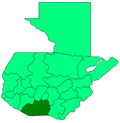 | |