To install click the Add extension button. That's it.

The source code for the WIKI 2 extension is being checked by specialists of the Mozilla Foundation, Google, and Apple. You could also do it yourself at any point in time.

4,5
Kelly Slayton
Congratulations on this excellent venture… what a great idea!
Alexander Grigorievskiy
I use WIKI 2 every day and almost forgot how the original Wikipedia looks like.
What we do. Every page goes through several hundred of perfecting techniques; in live mode. Quite the same Wikipedia. Just better.
.
Leo
Newton
Brights
Milds

San José Iturbide

From Wikipedia, the free encyclopedia

San José Parish

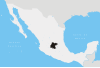
San José Iturbide is a Mexican city (and municipality) located in the Northeast region of the state of Guanajuato, within the Sierra Gorda range. It is named in honor of Saint Joseph and the first Emperor of Mexico, Agustín de Iturbide. The municipality has an area of 534.11 square kilometres (1.76% of the surface of the state) and is bordered to the north by San Luis de la Paz and Doctor Mora, to the east by Tierra Blanca, to the south by the state of Querétaro, and to the west by San Miguel de Allende. The municipality had a population of 54,661 inhabitants according to the 2005 census.[1][2]

The municipal president of San José Iturbide is Arq. Jose Geronimo Robles Gutierrez[3]

YouTube Encyclopedic

  • 1/3
    Views:
    4 455
    17 520
    2 691
  • San Jose Iturbide, Guanajuato, Mexico
  • San Jose Iturbide, Guanajuato, Mexico
  • Leyenda del Juego de Barras San josé Iturbide

Transcription

Geography

Climate

San José Iturbide
Climate chart (explanation)
J
F
M
A
M
J
J
A
S
O
N
D
 
 
14
 
 
5
22
 
 
6.8
 
 
6
24
 
 
7.4
 
 
9
27
 
 
25
 
 
11
29
 
 
48
 
 
13
30
 
 
81
 
 
13
27
 
 
109
 
 
12
25
 
 
83
 
 
12
25
 
 
72
 
 
12
25
 
 
31
 
 
9
24
 
 
10
 
 
7
24
 
 
6.1
 
 
6
22
Average max. and min. temperatures in °C
Precipitation totals in mm
Source: [1]
Imperial conversion
JFMAMJJASOND
 
 
0.6
 
 
41
72
 
 
0.3
 
 
43
75
 
 
0.3
 
 
47
80
 
 
1
 
 
51
84
 
 
1.9
 
 
55
86
 
 
3.2
 
 
55
80
 
 
4.3
 
 
54
77
 
 
3.3
 
 
54
77
 
 
2.8
 
 
53
76
 
 
1.2
 
 
49
75
 
 
0.4
 
 
45
75
 
 
0.2
 
 
42
72
Average max. and min. temperatures in °F
Precipitation totals in inches

References

  1. ^ "2005 Census". INEGI: Instituto Nacional de Estadística, Geografía e Informática. Archived from the original on 2013-04-06. Retrieved 2007-03-22.
  2. ^ "Mexican Municipality Encyclopedia". Enciclopedia de los Municipios de México. Retrieved 2007-03-22.
  3. ^ Administración Municipal 2009-2012 Archived 2007-09-29 at the Wayback Machine

External links

21°00′N 100°23′W / 21.000°N 100.383°W / 21.000; -100.383

This page was last edited on 11 April 2023, at 08:03
Basis of this page is in Wikipedia. Text is available under the CC BY-SA 3.0 Unported License. Non-text media are available under their specified licenses. Wikipedia® is a registered trademark of the Wikimedia Foundation, Inc. WIKI 2 is an independent company and has no affiliation with Wikimedia Foundation.