
San Carlos | |
|---|---|
City | |
| San Carlos del Apa | |
 San Carlos | |
| Coordinates: 22°16′0″S 57°20′0″W / 22.26667°S 57.33333°W | |
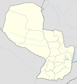
| Country | Paraguay |
| Department | Concepción |
| Government | |
| • Intendente municipal | Luis Aníbal Schupp |
| Area | |
| • Total | 2,036 km2 (786 sq mi) |
| Elevation | 123 m (404 ft) |
| Population | |
| • Total | 2,742 |
| • Density | 0.33/km2 (0.9/sq mi) |
| Time zone | -4 Gmt |
| Postal code | 8930 |
| Climate | Aw |
San Carlos del Apa is a city of Paraguay in the Concepción Department, and a historical site located between River Apa and Stream Blandengues.
YouTube Encyclopedic
-
1/3Views:319632858
-
Testimonio Alumna de la Universidad San Carlos
-
Turismo Paraguay: San Carlos del Apa
-
Vuelo al Fuerte San Carlos del Apa
Transcription
Geography
San Carlos is far from Asunción at 589 km, 90 km from the Brazilian port of the same name "San Carlos do Apa" and 200 km from Concepción. It is located on the border with Brazil.
Climate
The maximum temperature reaches 40 degrees in summer, while the minimum in winter is up to minus 2 degrees. The average is 24 degrees Celsius.
The rainfall times are plentiful from November to January, and the driest months are from June to September. Winds are from the north, east and southeast.
Demographics
San Carlos has a total of 690 inhabitants, of which 438 are men and 252 women. In urban areas there are 444 people and in rural areas 246.
Economy
Residents of San Carlos are principally engaged in livestock and agriculture. The city is a reserve of clover plantation.
San Carlos has a landing field for light aircraft.
Getting there
You reach the city by the west through farms, and by the east, passing through agricultural settlements, such as Colony Jose Felix Lopez, "Puentesiño" and Paso Bravo National Park. It has runways for air transport.
It is located 680 km north of Asunción.
History
The Fortress of San Carlos was built in 1796 by order of Governor of Paraguay, Don Joaquin de Alos y Bru, years after the founding of the Villa Real de la Concepcion, on a small hill a few metres from the Apa River, with the aim of defending the region against the advance of bandits and Mbayaés Indians allied with the conquerors from Brazil. There, several battles were fought. The Governor sent the commander of Villa Real de Concepción, Don Luis Bernardo Ramirez on an expedition to establish a fort on the banks of River Apa. It also had barracks, housing, oratory, storage and cooking places for the soldiers guarding it. It is a sign of the presence of Spaniards since late 1700 and the government of José Gaspar Rodríguez de Francia. During the Paraguayan War there were fought several battles at the site, in 1867, Cnel. Urbieta defeated Brazilian troops and thus regained control of the fort.
Tourist attractions
San Carlos is considered historic and touristic, because the ruins of Fort San Carlos del Apa are located there, scenario of numerous battles. The fort has high walls surrounding it and nowadays it receives many tourists.
Another attraction of San Carlos is its exuberant nature. The Caxoeira hills, Brazil, and the Cerro Paiva, Paraguay, complement the beautiful landscape next to River Apa. In the river it is possible to navigate and fish.
The Fortress of San Carlos is a historical heritage of both Paraguay, and Brazil. It is very close to the Mato Grosso.
References
- Illustrated Geography of Paraguay, Distributed Arami SRL, 2007. ISBN 99925-68-04-6
- Geography of Paraguay, First Edition 1999, Publisher Hispanic Paraguay SRL