
Saint John Plantation, Maine | |
|---|---|
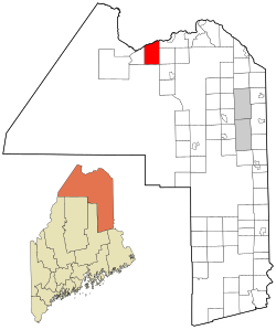 Location of Saint John Plantation, Maine | |
| Coordinates: 47°10′N 68°46′W / 47.167°N 68.767°W | |
| Country | United States |
| State | Maine |
| County | Aroostook |
| Area | |
| • Total | 51.5 sq mi (133.5 km2) |
| • Land | 50.3 sq mi (130.2 km2) |
| • Water | 1.3 sq mi (3.3 km2) |
| Elevation | 1,188 ft (362 m) |
| Population (2020) | |
| • Total | 263 |
| • Density | 5.1/sq mi (2.0/km2) |
| Time zone | UTC-5 (Eastern (EST)) |
| • Summer (DST) | UTC-4 (EDT) |
| ZIP code | 04743 |
| Area code | 207 |
| FIPS code | 23-65200 |
| GNIS feature ID | 0582710[1] |
Saint John Plantation is a plantation in Aroostook County, Maine, United States, on the banks of the Saint John River. The population was 263 at the 2020 census.[2]
YouTube Encyclopedic
-
1/3Views:1 1477 3462 462
-
Ice Jam
-
A 10-minute drive on Route 1 in Madawaska, Maine, United States
-
kingdrop 2017 | Ameri-Khan Holocaust, "The Dog-Headed Beast Who Became St. Christopher" | Roll Call
Transcription
Geography
According to the United States Census Bureau, the plantation has a total area of 51.5 square miles (133.5 km2), of which 50.3 square miles (130.2 km2) is land and 1.3 square miles (3.3 km2), or 2.45%, is water.[3]
Demographics
| Census | Pop. | Note | %± |
|---|---|---|---|
| 1870 | 127 | — | |
| 1880 | 166 | 30.7% | |
| 1890 | 226 | 36.1% | |
| 1900 | 371 | 64.2% | |
| 1910 | 571 | 53.9% | |
| 1920 | 549 | −3.9% | |
| 1930 | 569 | 3.6% | |
| 1940 | 628 | 10.4% | |
| 1950 | 569 | −9.4% | |
| 1960 | 407 | −28.5% | |
| 1970 | 377 | −7.4% | |
| 1980 | 322 | −14.6% | |
| 1990 | 274 | −14.9% | |
| 2000 | 282 | 2.9% | |
| 2010 | 267 | −5.3% | |
| 2020 | 263 | −1.5% | |
| U.S. Decennial Census[4] | |||
At the 2000 census there were 282 people in 110 households, including 78 families, in the plantation. The population density was 5.6 inhabitants per square mile (2.2/km2). There were 147 housing units at an average density of 2.9 per square mile (1.1/km2). The racial makeup of the plantation was 100.00% White.[5] Of the 110 households 33.6% had children under the age of 18 living with them, 62.7% were married couples living together, 6.4% had a female householder with no husband present, and 28.2% were non-families. 24.5% of households were one person and 16.4% were one person aged 65 or older. The average household size was 2.56 and the average family size was 3.04.
The age distribution was 27.7% under the age of 18, 5.3% from 18 to 24, 24.5% from 25 to 44, 27.7% from 45 to 64, and 14.9% 65 or older. The median age was 40 years. For every 100 females, there were 91.8 males. For every 100 females age 18 and over, there were 96.2 males.
The median household income was $27,250 and the median family income was $37,500. Males had a median income of $29,375 versus $13,750 for females. The per capita income for the plantation was $13,212. About 6.6% of families and 8.1% of the population were below the poverty line, including 3.2% of those under the age of 18 and 20.9% of those 65 or over.
References
- ^ "Plantation of Saint John". Geographic Names Information System. United States Geological Survey, United States Department of the Interior. 1 September 1995. Retrieved 2010-03-10.
- ^ "Census - Geography Profile: St. John plantation, Aroostook County, Maine". United States Census Bureau. Retrieved January 9, 2022.
- ^ "Geographic Identifiers: 2010 Demographic Profile Data (G001): St. John plantation, Aroostook County, Maine". U.S. Census Bureau, American Factfinder. Archived from the original on February 12, 2020. Retrieved May 21, 2013.
- ^ "Census of Population and Housing". Census.gov. Retrieved June 4, 2015.
- ^ "U.S. Census website". United States Census Bureau. Retrieved 2008-01-31.

This Maine state location article is a stub. You can help Wikipedia by expanding it. |