
Saint-Germé | |
|---|---|
 The church of Saint-Germé | |
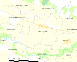
Location of Saint-Germé  | |
 Saint-Germé  Saint-Germé | |
| Coordinates: 43°40′52″N 0°08′43″W / 43.6811°N 0.1453°W | |
| Country | France |
| Region | Occitania |
| Department | Gers |
| Arrondissement | Mirande |
| Canton | Adour-Gersoise |
| Government | |
| • Mayor (2020–2026) | Philippe Poitreau[1] |
| Area 1 | 9.55 km2 (3.69 sq mi) |
| Population (2021)[2] | 504 |
| • Density | 53/km2 (140/sq mi) |
| Time zone | UTC+01:00 (CET) |
| • Summer (DST) | UTC+02:00 (CEST) |
| INSEE/Postal code | 32378 /32400 |
| Elevation | 89–110 m (292–361 ft) (avg. 102 m or 335 ft) |
| 1 French Land Register data, which excludes lakes, ponds, glaciers > 1 km2 (0.386 sq mi or 247 acres) and river estuaries. | |
Saint-Germé (French pronunciation: [sɛ̃ ʒɛʁme]; Occitan: Sent Germer) is a commune in the Gers department in southwestern France.
YouTube Encyclopedic
-
1/4Views:132 1687231 0119 253
-
Toutes les graines germées ! www.regenere.org
-
Le moulin de Saint-Ondras
-
Olivier Frérot à propos de son ouvrage "Solidarités émergentes institutions en germe"
-
Paté de tournesol germé à la wakamé et aux carottes - www.biovie.fr
Transcription
Geography
Population
| Year | Pop. | ±% |
|---|---|---|
| 1962 | 511 | — |
| 1968 | 508 | −0.6% |
| 1975 | 523 | +3.0% |
| 1982 | 488 | −6.7% |
| 1990 | 471 | −3.5% |
| 1999 | 443 | −5.9% |
| 2008 | 501 | +13.1% |
See also
References
- ^ "Répertoire national des élus: les maires". data.gouv.fr, Plateforme ouverte des données publiques françaises (in French). 9 August 2021.
- ^ "Populations légales 2021". The National Institute of Statistics and Economic Studies. 28 December 2023.
Wikimedia Commons has media related to Saint-Germé.
| Authority control databases: National |
|---|
This Gers geographical article is a stub. You can help Wikipedia by expanding it. |